Country:
 Singapore
Region:
City:
Latitude and Longitude:
Time Zone:
Postal Code:
IP information under different IP Channel
ip-api
Country
Region
City
ASN
Time Zone
ISP
Blacklist
Proxy
Latitude
Longitude
Postal
Route
IPinfo
Country
Region
City
ASN
Time Zone
ISP
Blacklist
Proxy
Latitude
Longitude
Postal
Route
MaxMind
Country
Region
City
ASN
Time Zone
ISP
Blacklist
Proxy
Latitude
Longitude
Postal
Route
Luminati
Country
SGASN
Time Zone
Asia/Singapore
ISP
NTT-LTD-2914
Latitude
Longitude
Postal
db-ip
Country
Region
City
ASN
Time Zone
ISP
Blacklist
Proxy
Latitude
Longitude
Postal
Route
ipdata
Country
Region
City
ASN
Time Zone
ISP
Blacklist
Proxy
Latitude
Longitude
Postal
Route
Popular places and events near this IP address

Kallang
Planning Area and HDB Town in Central Region ----, Singapore
Distance: Approx. 176 meters
Latitude and longitude: 1.31083333,103.86555556
Kallang is a planning area and residential zone located in the Central Region of Singapore. Development of the town is centered around the Kallang River, the longest river in Singapore. Kallang Planning Area is bounded by Toa Payoh in the north, Geylang in the east, Marine Parade in the southeast, Marina East in the south, the Downtown Core in the southwest, Rochor, Newton in the west, and Novena in the northwest.

CNA938
Radio station
Distance: Approx. 329 meters
Latitude and longitude: 1.312751,103.862
CNA938 is an English-language radio station in Singapore. Owned by the state-owned broadcaster Mediacorp and launched on 2 October 1998, it broadcasts a news/talk radio format. The station is marketed as a radio extension of Mediacorp's television channel CNA, broadcasting news and lifestyle programmes from 7 a.m.
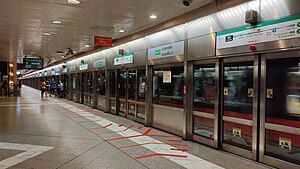
Lavender MRT station
Mass Rapid Transit station in Singapore
Distance: Approx. 395 meters
Latitude and longitude: 1.30716667,103.86300833
Lavender MRT station is an underground Mass Rapid Transit (MRT) station on the East West line in Kallang, Singapore. Located under Kallang Road, the station is close to the Immigration and Checkpoints Authority (ICA) Building, the former Golden Mile Complex and Jalan Besar Stadium. Planned and built as part of Phase Two of the initial system.
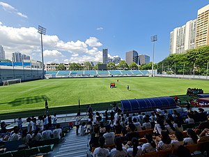
Jalan Besar Stadium
Stadium in Singapore
Distance: Approx. 411 meters
Latitude and longitude: 1.310016,103.860347
Jalan Besar Stadium, officially the Jalan Besar ActiveSG Stadium, is a football stadium located in Kallang, Singapore. The stadium is part of the Jalan Besar Sports and Recreation Centre, a community sports facility that includes the stadium as well as a swimming complex. It is the home ground of the Singapore Premier League club Young Lions.

Sri Manmatha Karuneshvarar Temple
Hindu temple in Singapore
Distance: Approx. 282 meters
Latitude and longitude: 1.30893333,103.86593611
Sri Manmatha Karuneshvarar Temple (Tamil: ஸ்ரீ மன்மத காருணீஸ்வரர் கோவில்) or Sivan Temple is a Hindu temple for Sri Manmatha Karuneshvarar Sivan or Shiva as the presiding deity located on Kallang Road in Singapore.
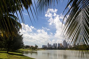
Kallang Riverside Park
Park in Kallang, Singapore
Distance: Approx. 455 meters
Latitude and longitude: 1.307,103.866
Kallang Riverside Park (Chinese: 加冷河畔公园) is a riverine park in Kallang, Singapore. It sits on the confluence of the Kallang River and Rochor River, north of the Kallang Basin.
Bendemeer MRT station
Mass Rapid Transit station in Singapore
Distance: Approx. 353 meters
Latitude and longitude: 1.3135953,103.8630402
Bendemeer MRT station is an underground Mass Rapid Transit (MRT) station on the Downtown line in Kallang, Singapore. Despite its name, the station is not located under Bendemeer Road, but under Kallang Bahru. This station serves the commercial developments around Lavender Street and the industrial estates along Kallang Avenue.

National Football Academy (Singapore)
Distance: Approx. 411 meters
Latitude and longitude: 1.310016,103.860347
The National Football Academy, commonly referred to as NFA, is a football academy based in Jalan Besar, Singapore. It was launched by the Football Association of Singapore on 13 August 2000 with the aim of developing Singapore's most promising young footballers. Trainees are scouted through a systematic talent identification process before being given the chance to develop their skills under some of the best youth coaches in the country.

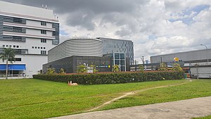
HackerspaceSG
Singaporean organisation
Distance: Approx. 197 meters
Latitude and longitude: 1.31008796,103.86229645
HackerspaceSG is a 1,202-square-foot (111.7 m2) technology community center and hackerspace in Singapore. While predominantly an open working space for software projects, HackerspaceSG is also a landmark of the Singapore DIY movement, and also hosts a range of events from technology classes to biology, computer hardware, and manufacturing. The space is open to all types of hackers.
Kallang Gasworks
Distance: Approx. 279 meters
Latitude and longitude: 1.30830556,103.86508333
Kallang Gasworks (Chinese: 加冷煤气厂 Pinyin: Jiā lěng méi qì chǎng) was the first site dedicated to gas manufacturing from coal in Singapore. It operated from 1862 to 23 March 1998. In 1862, it was constructed by the Singapore Gas Company and occupied an area of about 3.14ha.

Hill Street Tai Hwa Pork Noodle
Street food stall in Singapore
Distance: Approx. 615 meters
Latitude and longitude: 1.30528,103.86241
Hill Street Tai Hwa Pork Noodle (Chinese: 大华猪肉粿条面) is a street food stall in Kallang, Singapore. It is owned and run by Tang Chay Seng. In 2016, it became one of the first two street food locations in the world to be awarded a star in the Michelin Guide.
161 Lavender Street
Shophouses in Kallang, Singapore
Distance: Approx. 428 meters
Latitude and longitude: 1.31287,103.86092
161 Lavender Street is a row of shophouses on Lavender Street in the Lavender subzone of Kallang, Singapore. Completed by philanthropist Lee Kong Chian in the 1930s, it was gazetted for conservation as part of the Jalan Besar Secondary Settlement conservation area.
Weather in this IP's area
scattered clouds
28 Celsius
31 Celsius
26 Celsius
28 Celsius
1008 hPa
80 %
1008 hPa
1006 hPa
10000 meters
3.09 m/s
190 degree
40 %
06:55:37
19:02:40