Country:
 Japan
JapanRegion:
City:
Latitude and Longitude:
Time Zone:
Postal Code:
IP information under different IP Channel
ip-api
Country
Region
City
ASN
Time Zone
ISP
Blacklist
Proxy
Latitude
Longitude
Postal
Route
IPinfo
Country
Region
City
ASN
Time Zone
ISP
Blacklist
Proxy
Latitude
Longitude
Postal
Route
MaxMind
Country
Region
City
ASN
Time Zone
ISP
Blacklist
Proxy
Latitude
Longitude
Postal
Route
Luminati
Country
JPRegion
22
City
inatori
ASN
Time Zone
Asia/Tokyo
ISP
TOKAI Communications Corporation
Latitude
Longitude
Postal
db-ip
Country
Region
City
ASN
Time Zone
ISP
Blacklist
Proxy
Latitude
Longitude
Postal
Route
ipdata
Country
Region
City
ASN
Time Zone
ISP
Blacklist
Proxy
Latitude
Longitude
Postal
Route
Popular places and events near this IP address

Higashiizu
Town in Japan
Distance: Approx. 2557 meters
Latitude and longitude: 34.76666667,139.03333333
Higashiizu (東伊豆町, Higashiizu-chō) is a town located in Kamo District, Shizuoka Prefecture, Japan. As of 30 June 2019, the town had an estimated population of 12,155 in 6264 households, and a population density of 160 persons per km2. The total area of the town is 77.83 square kilometres (30.05 sq mi).

Kawazu, Shizuoka
Town in Japan
Distance: Approx. 6462 meters
Latitude and longitude: 34.75,138.98333333
Kawazu (河津町, Kawazu-chō) is a town located on the east coast of Izu Peninsula in Kamo District, Shizuoka Prefecture, Japan. As of 1 August 2019, the town had an estimated population of 7,203 in 3334 households, and a population density of 71 persons per km². The total area of the town is 100.79 square kilometres (38.92 sq mi).

Atagawa Tropical & Alligator Garden
Distance: Approx. 4252 meters
Latitude and longitude: 34.816602,139.067895
The Atagawa Tropical & Alligator Garden (熱川バナナワニ園, Atagawa Banana Wani En) is a botanical garden with alligators located in the Fuji-Hakone-Izu National Park at 971-9 Naramoto, Higashiizu-cho, Kamo, Shizuoka Prefecture, Japan. It is open daily. An admission fee is charged.

Izu-Ōkawa Station
Railway station in Higashiizu, Shizuoka Prefecture, Japan
Distance: Approx. 7011 meters
Latitude and longitude: 34.84388889,139.07388889
Izu-Ōkawa Station (伊豆大川駅, Izu-Ōkawa-eki) is a railway station in the town of Higashiizu, Shizuoka Prefecture, Japan, operated by the privately owned Izu Kyūkō Line .
Izu-Hokkawa Station
Railway station in Higashiizu, Shizuoka Prefecture, Japan
Distance: Approx. 5587 meters
Latitude and longitude: 34.82694444,139.07583333
Izu-Hokkawa Station (伊豆北川駅, Izu-Hokkawa-eki) is a railway station in the town of Higashiizu, Shizuoka Prefecture, Japan, operated by the privately owned Izu Kyūkō Line.
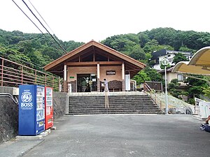
Izu-Atagawa Station
Railway station in Higashiizu, Shizuoka Prefecture, Japan
Distance: Approx. 4340 meters
Latitude and longitude: 34.81666667,139.06916667
Izu-Atagawa Station (伊豆熱川駅, Izu-Atagawa-eki) is a railway station in the town of Higashiizu, Shizuoka Prefecture, Japan, operated by the privately owned Izu Kyūkō Line .
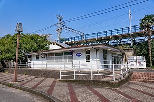
Katase-Shirata Station
Railway station in Higashiizu, Shizuoka Prefecture, Japan
Distance: Approx. 2770 meters
Latitude and longitude: 34.80222222,139.06111111
Katase-Shirata Station (片瀬白田駅, Katase-Shirata-eki) is a railway station in the town of Higashiizu, Shizuoka Prefecture, Japan, operated by the privately owned Izu Kyūkō Line .

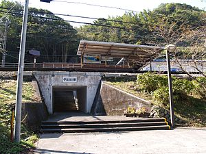
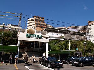
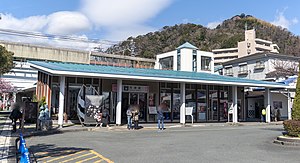
Izu-Inatori Station
Railway station in Higashiizu, Shizuoka Prefecture, Japan
Distance: Approx. 1710 meters
Latitude and longitude: 34.774333,139.037097
Izu-Inatori Station (伊豆稲取駅, Izu-Inatori-eki) is a railway station in the town of Higashiizu, Shizuoka Prefecture, Japan, operated by the privately owned Izu Kyūkō Line .
Imaihama-Kaigan Station
Railway station in Kawazu, Shizuoka Prefecture, Japan
Distance: Approx. 4844 meters
Latitude and longitude: 34.75388889,139.00472222
Imaihama-Kaigan Station (今井浜海岸駅, Imaihama-Kaigan-eki) is a railway station in the town of Kawazu, Shizuoka Prefecture, Japan, operated by the privately owned Izu Kyūkō Line .
Kawazu Station
Railway station in Kawazu, Shizuoka Prefecture, Japan
Distance: Approx. 5883 meters
Latitude and longitude: 34.7475,138.99611111
Kawazu Station (河津駅, Kawazu-eki) is a railway station in the town of Kawazu, Shizuoka Prefecture, Japan, operated by the privately owned Izu Kyūkō Line .

Mine Onsen
Thermal spring
Distance: Approx. 6024 meters
Latitude and longitude: 34.75695,138.98246
Mine Onsen, also known by the name of the public bathhouse facility, Odoriko Onsen, is a geothermal hot spring located in Daifunto park, Kawazu, Shizuoka Prefecture, Japan. The hot springs are accessible from Tokyo on the Odoriko or the Super View Odoriko train lines.

Kawazu-Nanadaru Loop Bridge
Bridge in Shizuoka Prefecture, Japan
Distance: Approx. 8685 meters
Latitude and longitude: 34.79,138.94
The Kawazu-Nanadaru Loop Bridge (河津七滝ループ橋, Kawazu-Nanadaru Rūpu-kyō) is a bridge located in Kawazu, Shizuoka on Japan National Route 414 connecting Numazu to Shimoda, in Japan's Izu Peninsula southwest of Tokyo.
Weather in this IP's area
broken clouds
24 Celsius
24 Celsius
24 Celsius
25 Celsius
1010 hPa
79 %
1010 hPa
971 hPa
10000 meters
7.87 m/s
13.09 m/s
241 degree
56 %
05:52:40
17:04:41