116.250.236.232 - IP Lookup: Free IP Address Lookup, Postal Code Lookup, IP Location Lookup, IP ASN, Public IP
Country:
Region:
City:
Location:
Time Zone:
Postal Code:
ISP:
ASN:
language:
User-Agent:
Proxy IP:
Blacklist:
IP information under different IP Channel
ip-api
Country
Region
City
ASN
Time Zone
ISP
Blacklist
Proxy
Latitude
Longitude
Postal
Route
db-ip
Country
Region
City
ASN
Time Zone
ISP
Blacklist
Proxy
Latitude
Longitude
Postal
Route
IPinfo
Country
Region
City
ASN
Time Zone
ISP
Blacklist
Proxy
Latitude
Longitude
Postal
Route
IP2Location
116.250.236.232Country
Region
queensland
City
glen aplin
Time Zone
Australia/Brisbane
ISP
Language
User-Agent
Latitude
Longitude
Postal
ipdata
Country
Region
City
ASN
Time Zone
ISP
Blacklist
Proxy
Latitude
Longitude
Postal
Route
Popular places and events near this IP address
Girraween National Park
Protected area in Queensland, Australia
Distance: Approx. 5086 meters
Latitude and longitude: -28.77416667,151.91194444
Girraween National Park is an area of the Granite Belt in the Darling Downs region of Queensland, Australia reserved as a national park. Girraween is known for its spectacular flowers, dramatic landscapes and unique wildlife. Bushwalking and rock climbing are the most popular activities in the park.

Ballandean Pyramid
Stone pyramid near Ballandean, Queensland, Australia
Distance: Approx. 9031 meters
Latitude and longitude: -28.81478889,151.851225
The Ballandean Pyramid is a man-made stone pyramid near the small village of Ballandean, Queensland, Australia. The pyramid is approximately 15 metres in height and built from blocks of the local granite. (It should not be confused with the nearby natural rock formations known as the Pyramids in the Girraween National Park.) It is on private property belonging to a local vineyard (Henty Estate) and is approximately 25 metres from the nearest road.

Ballandean, Queensland
Town in Queensland, Australia
Distance: Approx. 7919 meters
Latitude and longitude: -28.8008,151.8427
Ballandean is a rural town and locality in the Southern Downs Region, Queensland, Australia. The town has a number of nearby vineyards which attracted tourists to the area. In the 2021 census, the locality of Ballandean had a population of 316 people.
Somme, Queensland
Suburb of Southern Downs Region, Queensland, Australia
Distance: Approx. 8605 meters
Latitude and longitude: -28.773,151.8019
Somme is a rural locality in the Southern Downs Region, Queensland, Australia. In the 2021 census, Somme had a population of 39 people.
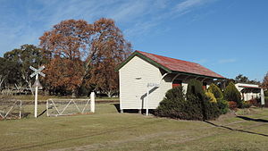
Ballandean railway station
Former railway station in Queensland, Australia
Distance: Approx. 7822 meters
Latitude and longitude: -28.7999,151.8429
Ballandean railway station is located on the Southern line in Queensland, Australia. It services the town of Ballandean, a rural district in the Granite Belt.
Broadwater, Queensland
Suburb of Southern Downs Region, Queensland, Australia
Distance: Approx. 8540 meters
Latitude and longitude: -28.6611,151.8788
Broadwater is a rural locality in the Southern Downs Region, Queensland, Australia. In the 2021 census, Broadwater had a population of 321 people.

Severnlea, Queensland
Suburb of Southern Downs Region, Queensland, Australia
Distance: Approx. 5101 meters
Latitude and longitude: -28.7041,151.9158
Severnlea is a semi-rural locality in the Southern Downs Region, Queensland, Australia. In the 2021 census, Severnlea had a population of 382 people.
Glen Aplin, Queensland
Suburb of Southern Downs Region, Queensland, Australia
Distance: Approx. 148 meters
Latitude and longitude: -28.7388,151.8794
Glen Aplin is a rural locality in the Southern Downs Region, Queensland, Australia. In the 2021 census, Glen Aplin had a population of 566 people.

Thorndale, Queensland
Suburb of Southern Downs Region, Queensland, Australia
Distance: Approx. 4455 meters
Latitude and longitude: -28.7025,151.8589
Thorndale is a rural locality in the Southern Downs Region, Queensland, Australia. In the 2021 census, Thorndale had a population of 134 people.
Fletcher, Queensland
Suburb of Southern Downs Region, Queensland, Australia
Distance: Approx. 3584 meters
Latitude and longitude: -28.7686,151.8697
Fletcher is a rural locality in the Southern Downs Region, Queensland, Australia. In the 2021 census, Fletcher had a population of 128 people.
Mount Tully, Queensland
Suburb of Southern Downs Region, Queensland, Australia
Distance: Approx. 6390 meters
Latitude and longitude: -28.7352,151.9458
Mount Tully is a rural locality in the Southern Downs Region, Queensland, Australia. In the 2021 census, Mount Tully had a population of 117 people.

Storm King, Queensland
Suburb of Southern Downs Region, Queensland, Australia
Distance: Approx. 9780 meters
Latitude and longitude: -28.7261,151.9797
Storm King is a rural locality in the Southern Downs Region, Queensland, Australia. In the 2021 census, Storm King had a population of 106 people.
Weather in this IP's area
broken clouds
18 Celsius
19 Celsius
18 Celsius
18 Celsius
1015 hPa
97 %
1015 hPa
914 hPa
10000 meters
1.28 m/s
1.1 m/s
79 degree
74 %


