116.103.61.77 - IP Lookup: Free IP Address Lookup, Postal Code Lookup, IP Location Lookup, IP ASN, Public IP
Country:
Region:
City:
Location:
Time Zone:
Postal Code:
ISP:
ASN:
language:
User-Agent:
Proxy IP:
Blacklist:
IP information under different IP Channel
ip-api
Country
Region
City
ASN
Time Zone
ISP
Blacklist
Proxy
Latitude
Longitude
Postal
Route
db-ip
Country
Region
City
ASN
Time Zone
ISP
Blacklist
Proxy
Latitude
Longitude
Postal
Route
IPinfo
Country
Region
City
ASN
Time Zone
ISP
Blacklist
Proxy
Latitude
Longitude
Postal
Route
IP2Location
116.103.61.77Country
Region
ninh thuan
City
phan rang-thap cham
Time Zone
Asia/Ho_Chi_Minh
ISP
Language
User-Agent
Latitude
Longitude
Postal
ipdata
Country
Region
City
ASN
Time Zone
ISP
Blacklist
Proxy
Latitude
Longitude
Postal
Route
Popular places and events near this IP address

Air Vietnam Flight 706
1974 aircraft hijacking
Distance: Approx. 8259 meters
Latitude and longitude: 11.63333333,108.95
Air Vietnam Flight 706 was a Boeing 727 that crashed on September 15, 1974 after three hijackers detonated hand grenades as it was approaching Phan Rang Air Base in South Vietnam for an emergency landing. All 67 passengers and 8 crew members aboard the aircraft were killed in the crash.

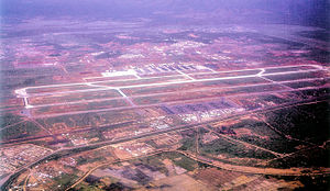
Phan Rang Air Base
Airport in Vietnam
Distance: Approx. 8196 meters
Latitude and longitude: 11.63361111,108.95194444
Phan Rang Air Base (also called Thành Sơn Air Base) is a Vietnam People's Air Force (VPAF) (Khong Quan Nhan Dan Viet Nam) military airfield in Vietnam. It is located 5.2 miles (4.5 nmi; 8.4 km) north-northwest of Phan Rang – Tháp Chàm in Ninh Thuận Province. Initially built by the Imperial Japanese Army about 1942, the airfield was also used by the French Air Force (French: Armée de l'Air) during the First Indochina War then abandoned in 1954.

Phan Rang–Tháp Chàm
Provincial city in Ninh Thuận, Vietnam
Distance: Approx. 5 meters
Latitude and longitude: 11.56666667,108.98333333
Phan Rang–Tháp Chàm, commonly known as Phan Rang, is a city in Vietnam and the capital of Ninh Thuận Province. The community has a population of 207,998 (2023), of which 196,459 (2023) live in the main city.

Po Klong Garai Temple
Religious building in Vietnam
Distance: Approx. 5513 meters
Latitude and longitude: 11.60111111,108.94694444
Po Klong Garai Temple is a Hindu Cham religious complex located in the Cham principality of Panduranga, in what is now Phan Rang in southern Vietnam.

Ninh Phước district
District in Southeast Vietnam
Distance: Approx. 7671 meters
Latitude and longitude: 11.52583333,108.92666667
Ninh Phước is a district (huyện) of Ninh Thuận province in the Southeast region of Vietnam, south of Phan Rang. It is also known as "Phu Quy". The city is growing at a fairly fast rate compared to other cities in Vietnam.

Khánh Hải, Cà Mau
Commune and village in Cà Mau, Vietnam
Distance: Approx. 5762 meters
Latitude and longitude: 11.58333333,109.03333333
Khánh Hải is a commune (xã) and village in Trần Văn Thời district, Cà Mau province, in Vietnam.

Tháp Chàm station
Railway station in Vietnam
Distance: Approx. 4973 meters
Latitude and longitude: 11.59722222,108.95
Tháp Chàm station is a railway station on the North–South railway (Reunification Express) line in Vietnam. It serves the city of Phan Rang–Tháp Chàm in Ninh Thuận Province. A branch line to Da Lat once started here.
Weather in this IP's area
overcast clouds
24 Celsius
24 Celsius
24 Celsius
24 Celsius
1013 hPa
61 %
1013 hPa
1003 hPa
10000 meters
7.12 m/s
10.91 m/s
41 degree
100 %