116.101.248.8 - IP Lookup: Free IP Address Lookup, Postal Code Lookup, IP Location Lookup, IP ASN, Public IP
Country:
Region:
City:
Location:
Time Zone:
Postal Code:
ISP:
ASN:
language:
User-Agent:
Proxy IP:
Blacklist:
IP information under different IP Channel
ip-api
Country
Region
City
ASN
Time Zone
ISP
Blacklist
Proxy
Latitude
Longitude
Postal
Route
db-ip
Country
Region
City
ASN
Time Zone
ISP
Blacklist
Proxy
Latitude
Longitude
Postal
Route
IPinfo
Country
Region
City
ASN
Time Zone
ISP
Blacklist
Proxy
Latitude
Longitude
Postal
Route
IP2Location
116.101.248.8Country
Region
lang son
City
lang son
Time Zone
Asia/Ho_Chi_Minh
ISP
Language
User-Agent
Latitude
Longitude
Postal
ipdata
Country
Region
City
ASN
Time Zone
ISP
Blacklist
Proxy
Latitude
Longitude
Postal
Route
Popular places and events near this IP address

Lạng Sơn
Provincial city in Lạng Sơn Province, Vietnam
Distance: Approx. 2999 meters
Latitude and longitude: 21.84777778,106.75777778
Lạng Sơn () is a city in far Northern Vietnam, and the capital of Lạng Sơn Province. It is accessible by road and rail from Hanoi, the Vietnamese capital, and it is the northernmost point on National Route 1.

Roman Catholic Diocese of Lạng Sơn and Cao Bằng
Diocese of the Catholic Church in northern Vietnam
Distance: Approx. 1726 meters
Latitude and longitude: 21.83333333,106.75
The diocese of Lạng Sơn and Cao Bằng (Latin: Dioecesis Langsonensis et Caobangensis) is a Roman Catholic diocese in northern Vietnam's Lạng Sơn and Cao Bằng provinces. Joseph Chau Ngoc Tri (vn) was appointed in 2016 as the diocese's bishop. The creation of the diocese in its present form was declared on 24 November 1960.

Battle of Núi Bop
Part of the Sino-French War
Distance: Approx. 3032 meters
Latitude and longitude: 21.848,106.758
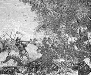
The Battle of Núi Bop (3–4 January 1885) was a French victory during the Sino-French War. The battle was fought to clear Chinese forces away from the French forward base at Chu, and was an essential preliminary to the Lạng Sơn Campaign in February 1885.
Cao Lộc
Township in Northeast, Vietnam
Distance: Approx. 5189 meters
Latitude and longitude: 21.86694444,106.76805556
Cao Lộc is a township (thị trấn) and capital of Cao Lộc District, Lạng Sơn Province, Vietnam.

Lạng Sơn station
Railway station in Lạng Sơn, Vietnam
Distance: Approx. 4435 meters
Latitude and longitude: 21.8557,106.7688
Lạng Sơn station is a railway station in Vietnam. It serves the town of Lạng Sơn, in Lạng Sơn Province.
Weather in this IP's area
light rain
14 Celsius
13 Celsius
14 Celsius
14 Celsius
1025 hPa
81 %
1025 hPa
979 hPa
10000 meters
2.64 m/s
10.42 m/s
29 degree
100 %