115.84.180.97 - IP Lookup: Free IP Address Lookup, Postal Code Lookup, IP Location Lookup, IP ASN, Public IP
Country:
Region:
City:
Location:
Time Zone:
Postal Code:
ISP:
ASN:
language:
User-Agent:
Proxy IP:
Blacklist:
IP information under different IP Channel
ip-api
Country
Region
City
ASN
Time Zone
ISP
Blacklist
Proxy
Latitude
Longitude
Postal
Route
db-ip
Country
Region
City
ASN
Time Zone
ISP
Blacklist
Proxy
Latitude
Longitude
Postal
Route
IPinfo
Country
Region
City
ASN
Time Zone
ISP
Blacklist
Proxy
Latitude
Longitude
Postal
Route
IP2Location
115.84.180.97Country
Region
ha tinh
City
hoa lac
Time Zone
Asia/Ho_Chi_Minh
ISP
Language
User-Agent
Latitude
Longitude
Postal
ipdata
Country
Region
City
ASN
Time Zone
ISP
Blacklist
Proxy
Latitude
Longitude
Postal
Route
Popular places and events near this IP address

Hà Tĩnh province
Province of Vietnam
Distance: Approx. 5574 meters
Latitude and longitude: 18.33333333,105.9
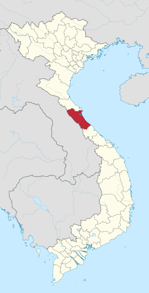
Hà Tĩnh is a northern coastal province in the North Central Coast region, the Central of Vietnam. It borders Nghệ An to the north, Quảng Bình to the south, Bolikhamsai and Khammouane of Laos to the west and the South China Sea (Gulf of Tonkin) to the east. Hà Tĩnh together with neighbouring Nghệ An province the two provinces are together called "Nghệ Tĩnh", and the locals are known for speaking Vietnamese with a very noticeable regional accent.

Hà Tĩnh
Provincial city in Vietnam
Distance: Approx. 5574 meters
Latitude and longitude: 18.33333333,105.9
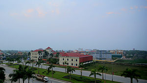
Hà Tĩnh (Vietnamese: [hâː tǐŋ̟ˀ] ) is a city in Vietnam. It is the capital of Hà Tĩnh Province, and lies in the North Central Coast region. It is located on National Highway 1A. The Vietnamese capital Hanoi is located 340 km north of Hà Tĩnh, Vinh is located 50 km to the north, and Huế is located 314 km to the south.

Thạch Hà district
District in North Central Coast, Vietnam
Distance: Approx. 6915 meters
Latitude and longitude: 18.388,105.89
Thạch Hà is a rural district of Hà Tĩnh province in the North Central Coast region of Vietnam. As of 2003 the district had a population of 182,120. The district covers an area of 399 km².

Mai Thủy
Commune in Quảng Bình, Vietnam
Distance: Approx. 7376 meters
Latitude and longitude: 18.41666667,105.91666667
Mai Thuy is a commune in the Lệ Thủy District, Quảng Bình Province, Vietnam. The local economy is mainly agricultural, rice production and cattle breeding. This commune borders: Mỹ Thủy opposite to the other bank of Kiến Giang River, Xuân Thủy, Phú Thủy and Trường Thủy.
Hóa Hợp
Commune and village in Quảng Bình, Vietnam
Distance: Approx. 5474 meters
Latitude and longitude: 18.31666667,105.91666667
Hóa Hợp [hoa˦ həp˧] is a commune and village in Minh Hóa District, Quảng Bình Province, in Vietnam.
Đại Nài
Ward in Ha Tinh, Vietnam
Distance: Approx. 5574 meters
Latitude and longitude: 18.33333333,105.9
Đại Nài is a ward of the city of Ha Tinh in Ha Tinh Province, Vietnam. It has an area of 4.26 kilometers and 5,748 people as of 2004, when the quarter was established, and the population density is 1,349 per square kilometer.

Hà Tĩnh Stadium
Multi-use stadium in Ha Tinh, Vietnam
Distance: Approx. 4888 meters
Latitude and longitude: 18.33333333,105.9075
Sân vận động Hà Tĩnh is a football stadium located in Nam Hà Ward, Hà Tĩnh City, Vietnam.
Weather in this IP's area
overcast clouds
18 Celsius
18 Celsius
18 Celsius
18 Celsius
1023 hPa
93 %
1023 hPa
1021 hPa
10000 meters
5.72 m/s
9.03 m/s
354 degree
100 %