115.70.238.211 - IP Lookup: Free IP Address Lookup, Postal Code Lookup, IP Location Lookup, IP ASN, Public IP
Country:
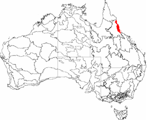
 Australia
Region:
City:
Location:
Time Zone:
Postal Code:
ISP:
ASN:
language:
User-Agent:
Proxy IP:
Blacklist:
IP information under different IP Channel
ip-api
Country
Region
City
ASN
Time Zone
ISP
Blacklist
Proxy
Latitude
Longitude
Postal
Route
db-ip
Country
Region
City
ASN
Time Zone
ISP
Blacklist
Proxy
Latitude
Longitude
Postal
Route
IPinfo
Country
Region
City
ASN
Time Zone
ISP
Blacklist
Proxy
Latitude
Longitude
Postal
Route
IP2Location
115.70.238.211Country
auRegion
queensland
City
clifton beach
Time Zone
Australia/Brisbane
ISP
Language
User-Agent
Latitude
Longitude
Postal
ipdata
Country
Region
City
ASN
Time Zone
ISP
Blacklist
Proxy
Latitude
Longitude
Postal
Route
Popular places and events near this IP address
Yirrganydji
Indigenous Australian people
Distance: Approx. 1554 meters
Latitude and longitude: -16.75,145.66666667
The Yirrganydji (Irrukandji) people are an Indigenous Australian people of Queensland who trace their descent from the Irukandji and, as such, are the original custodians of a narrow coastal strip within Djabugay country that runs northwards from Cairns, Queensland to Port Douglas. Their traditional lifestyle was that of fishers along this coastal strip and around the river mouths, islands and seas between the Barron River and Port Douglas.

Ellis Beach, Queensland
Suburb of Cairns Region, Queensland, Australia
Distance: Approx. 4120 meters
Latitude and longitude: -16.7261,145.6725
Ellis Beach is a coastal locality in the Cairns Region, Queensland, Australia. In the 2021 census, Ellis Beach had a population of 5 people.

Clifton Beach, Queensland
Suburb of Cairns, Queensland, Australia
Distance: Approx. 1044 meters
Latitude and longitude: -16.7719,145.6683
Clifton Beach is a coastal suburb in the Cairns Region, Queensland, Australia. In the 2021 census, Clifton Beach had a population of 3,192 people.

Haycock Island
Island in Queensland
Distance: Approx. 4292 meters
Latitude and longitude: -16.731,145.694
Haycock Island is an island in Far North Queensland northeast of Palm Cove and about 20 kilometres (12 mi) north of Cairns, Queensland in Trinity Bay. Haycock Island is a few hundred metres southeast of Double Island. The island was formed by a huge earthquake that caused a massive upheaval of the earth's tectonic plates.
Smithfield State High School
Public state, secondary school in Cairns, Queensland, Australia
Distance: Approx. 6115 meters
Latitude and longitude: -16.81305556,145.69555556
Smithfield State High School is a secondary school located in Smithfield, Cairns, Queensland, Australia. Smithfield State High School operates as an independent public secondary school and is known for its unique partnership with Trinity Beach State School and James Cook University, through the Tropical North Learning Academy. The school attracts students primarily from the Cairns and tableland area.

Palm Cove, Queensland
Suburb of Cairns, Queensland, Australia
Distance: Approx. 1910 meters
Latitude and longitude: -16.7469,145.6658
Palm Cove is a suburb of Cairns in the Cairns Region, Queensland, Australia. In the 2021 census, Palm Cove had a population of 2,450 people. It is named after the palm trees that line the beach.
Cairns Tropical Zoo
Zoo in Queensland, Australia
Distance: Approx. 1109 meters
Latitude and longitude: -16.7581,145.6627
Cairns Tropical Zoo was a 6-hectare (15-acre) tropical zoo in Cairns, Queensland, Australia. It had a small collection of native and introduced species, and was a member of the Zoo and Aquarium Association. It was owned by the Freeman family.

Trinity Beach, Queensland
Suburb of Cairns, Queensland, Australia
Distance: Approx. 4283 meters
Latitude and longitude: -16.7933,145.6966
Trinity Beach is a coastal suburb of Cairns in the Cairns Region, Queensland, Australia. In the 2021 census, Trinity Beach had a population of 6,594 people.

Kewarra Beach
Suburb of Cairns, Queensland, Australia
Distance: Approx. 2760 meters
Latitude and longitude: -16.7875,145.6763
Kewarra Beach is a coastal suburb of Cairns in the Cairns Region, Queensland, Australia. In the 2021 census, Kewarra Beach had a population of 6,133 people.

Trinity Park, Queensland
Suburb of Cairns, Queensland, Australia
Distance: Approx. 5803 meters
Latitude and longitude: -16.805,145.7041
Trinity Park is a coastal suburb of Cairns in the Cairns Region, Queensland, Australia. In the 2021 census, Trinity Park had a population of 3,536 people.

Buchan, Queensland
Town in Queensland, Australia
Distance: Approx. 2234 meters
Latitude and longitude: -16.7433,145.6683
Buchan is a coastal town in the locality of Palm Cove in the Cairns Region, Queensland, Australia.

Macalister Range, Queensland
Suburb of Cairns Region, Queensland, Australia
Distance: Approx. 2200 meters
Latitude and longitude: -16.7586,145.6516
Macalister Range is a coastal locality in the Cairns Region, Queensland, Australia. In the 2021 census, Macalister Range had "no people or a very low population".
Weather in this IP's area
overcast clouds
30 Celsius
37 Celsius
30 Celsius
30 Celsius
1007 hPa
79 %
1007 hPa
992 hPa
10000 meters
4.63 m/s
20 degree
98 %