115.249.100.11 - IP Lookup: Free IP Address Lookup, Postal Code Lookup, IP Location Lookup, IP ASN, Public IP
Country:
Region:
City:
Location:
Time Zone:
Postal Code:
IP information under different IP Channel
ip-api
Country
Region
City
ASN
Time Zone
ISP
Blacklist
Proxy
Latitude
Longitude
Postal
Route
Luminati
Country
ASN
Time Zone
Asia/Kolkata
ISP
Reliance Communications Ltd.DAKC MUMBAI
Latitude
Longitude
Postal
IPinfo
Country
Region
City
ASN
Time Zone
ISP
Blacklist
Proxy
Latitude
Longitude
Postal
Route
IP2Location
115.249.100.11Country
Region
maharashtra
City
mumbai
Time Zone
Asia/Kolkata
ISP
Language
User-Agent
Latitude
Longitude
Postal
db-ip
Country
Region
City
ASN
Time Zone
ISP
Blacklist
Proxy
Latitude
Longitude
Postal
Route
ipdata
Country
Region
City
ASN
Time Zone
ISP
Blacklist
Proxy
Latitude
Longitude
Postal
Route
Popular places and events near this IP address

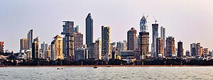
Mumbai
Capital of Maharashtra, India
Distance: Approx. 16 meters
Latitude and longitude: 19.07611111,72.8775
Mumbai ( muum-BY; ISO: Muṁbaī, Marathi: [ˈmumbəi] ), also known as Bombay ( bom-BAY), is the capital city of the Indian state of Maharashtra. Mumbai is the financial capital and the most populous city proper of India with an estimated population of 12.5 million (1.25 crore). Mumbai is the centre of the Mumbai Metropolitan Region, the sixth-most populous metropolitan area in the world with a population of over 23 million (2.3 crore).

Kurla
Suburb in Mumbai Suburban, Maharashtra, India
Distance: Approx. 837 meters
Latitude and longitude: 19.07261111,72.8845
Kurla (Pronunciation: [kuɾlaː]) is a suburb of East Mumbai, India. It is the headquarters of the Kurla taluka of Mumbai Suburban district. The neighbourhood is named after the eponymous East Indian village that it grew out of.
Dhirubhai Ambani International School
Private dayschool in Mumbai, Maharashtra, India
Distance: Approx. 1264 meters
Latitude and longitude: 19.066725,72.870464
The Dhirubhai Ambani International School (DAIS) is a private co-educational LKG-15 day school in Mumbai, Maharashtra, India, built by Reliance Industries, named after the late patriarch of the conglomerate, Dhirubhai Ambani. The school was established in 2003 and has been an IB World School since January 2003. It offers the International Baccalaureate Program in its Diploma form.

Our Lady of Egypt Church
Church in Mumbai, India
Distance: Approx. 904 meters
Latitude and longitude: 19.07833333,72.86916667
Our Lady of Egypt is a Roman Catholic church in Kalina, Mumbai under the Archdiocese of Bombay. The church was founded in 1606 and celebrated its 400th anniversary in mid-2006. Father John Lopes is the parish priest as of 2024.
Holy Cross High School (Kurla)
Government school in Mumbai
Distance: Approx. 1191 meters
Latitude and longitude: 19.08295,72.886004
Holy Cross High School is a school located in Kurla, a suburb of Mumbai, India. It prepares students for the Secondary School Leaving Certificate examinations conducted by the Maharashtra State Board of Secondary and Higher Secondary Education.
American School of Bombay
Private school in Mumbai, Maharashtra, India
Distance: Approx. 1156 meters
Latitude and longitude: 19.067777,72.870692
The American School of Bombay is a coeducational, independent day school in Mumbai, India that serves children from Pre-K through Grade 12.

Kurla Assembly constituency
Constituency of the Maharashtra legislative assembly in India
Distance: Approx. 588 meters
Latitude and longitude: 19.073,72.882
Kurla Assembly constituency is one of the 288 Vidhan Sabha constituencies of Maharashtra state in western India. This constituency presently, after delimitation of Legislative Assembly constituencies in 2008, is reserved for the candidates belonging to the Scheduled Castes.
Gem and Jewellery Export Promotion Council
Distance: Approx. 756 meters
Latitude and longitude: 19.072635,72.871157
Gem & Jewellery Export Promotion Council (GJEPC) is an organisation set up by the Government of India (GOI) with aim to promote the Indian gem and jewellery industry and its products.
Directorate of Technical Education, Maharashtra
Distance: Approx. 32 meters
Latitude and longitude: 19.076,72.8777
The Directorate of Technical Education Maharashtra has more than 2000 educational institutions in the state use DTE Maharashtra exams. The Directorate conducts entrance test including MH-CET, the state entrance test for admission in technical institute degree courses, including Diploma courses for Bachelor of Architecture and Bachelor of Hotel Management and catering technology.

Michael High School, Kurla
Private school, catholic, co-ed school in Mumbai, Maharashtra, India
Distance: Approx. 1054 meters
Latitude and longitude: 19.083485,72.883535
Michael High School is located in Kurla, a suburb of Mumbai, India. It prepares students for the Secondary School Leaving Certificate examinations conducted by the Maharashtra State Board of Secondary and Higher Secondary Education.
Parsi–Muslim riots
Riots which occurred in 1851 in Bombay
Distance: Approx. 32 meters
Latitude and longitude: 19.076,72.8777
The Parsi–Muslim riots occurred in 1851 in Bombay, and were reprised in 1874 in parts of Gujarat. These marked the beginning of a period of tension in the two communities. The first riot took place over the blurred depiction of the Islamic prophet, Muhammad, and his appearance in a public print by a Parsi newspaper, Chitra Gyan Darpan, in October 1851.
Consulate General of Sweden, Mumbai
Diplomatic mission of Sweden in Mumbai
Distance: Approx. 1182 meters
Latitude and longitude: 19.06888,72.86906
The Consulate General of Sweden, Mumbai is the diplomatic mission of Sweden in Mumbai, India. Its focusing on promoting trade and investment, enhancing Sweden's image, and providing consular services to Swedish citizens. Reestablished in 2012, the consulate collaborates with the Swedish embassy in New Delhi, Business Sweden, and the Swedish-Indian Chamber of Commerce to promote strategic industries such as energy, environmental technology, healthcare, and IT. The district covered by the consulate includes Maharashtra, Gujarat, Goa, and the union territory of Dadra and Nagar Haveli and Daman and Diu, with a population of approximately 180 million people.
Weather in this IP's area
smoke
28 Celsius
29 Celsius
28 Celsius
28 Celsius
1010 hPa
51 %
1010 hPa
1009 hPa
2100 meters
3.09 m/s
250 degree
100 %
