Country:
 India
IndiaRegion:
City:
Latitude and Longitude:
Time Zone:
Postal Code:
IP information under different IP Channel
ip-api
Country
Region
City
ASN
Time Zone
ISP
Blacklist
Proxy
Latitude
Longitude
Postal
Route
IPinfo
Country
Region
City
ASN
Time Zone
ISP
Blacklist
Proxy
Latitude
Longitude
Postal
Route
MaxMind
Country
Region
City
ASN
Time Zone
ISP
Blacklist
Proxy
Latitude
Longitude
Postal
Route
Luminati
Country
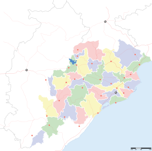
INRegion
od
City
khandagiri
ASN
Time Zone
Asia/Kolkata
ISP
Reliance Jio Infocomm Limited
Latitude
Longitude
Postal
db-ip
Country
Region
City
ASN
Time Zone
ISP
Blacklist
Proxy
Latitude
Longitude
Postal
Route
ipdata
Country
Region
City
ASN
Time Zone
ISP
Blacklist
Proxy
Latitude
Longitude
Postal
Route
Popular places and events near this IP address

Bhubaneswar
City in Odisha, India
Distance: Approx. 692 meters
Latitude and longitude: 20.27,85.84
Bhubaneswar (Odia: [ˈbʱubɔneswɔɾɔ] ) is the capital and second largest city of the Indian state of Odisha. It is located in the Khordha district. The region, especially the old town, was historically often depicted as Chakra Khetra and Ekamra Khetra (Area adorned with a mango tree).
Jajpur derailment
Distance: Approx. 692 meters
Latitude and longitude: 20.27,85.84
On 13 February 2009, a passenger train derailment occurred at 19:45 local time (14:15 UTC) near Jajpur in the eastern state of Odisha, India. Nine people were killed and 150 people were injured in the incident. Twelve carriages belonging to the Howrah–Chennai Coromandel Express are believed to have derailed following the train's departure from Jajapur Keonjhar Road station near Jajapur.
State Council for Technical Education & Vocational Training
Educational institution in Odisha, India
Distance: Approx. 692 meters
Latitude and longitude: 20.27,85.84
State Council for Technical Education & Vocational Training (SCTE & VT) is located in the city of Bhubaneswar, Odisha, India. The board is managing the Diploma & ITI education in Orissa, which is affiliated to AICTE, New Delhi, recognized by Government of Odisha. According to SCTE & VT, there are almost 124 private and 35 state government diploma colleges in the Odisha state which include polytechnic, Diploma institutes & 637 ITI institutes, prevailing under this board, which produces skilled laborers & techno-entrepreneurial workforces for State SMEs industry.
Bhubaneswar railway station
Railway station in Odisha, India
Distance: Approx. 1156 meters
Latitude and longitude: 20.2656,85.8431
Bhubaneswar Railway Station (BBS) serves Bhubaneswar, the capital of the Indian state of Odisha and it is the headquarters of the East Coast Railway zone of the Indian Railways. It comes under (NSG2) railway stations category of India.

Utkal University of Culture
Public cultural university in Bhubaneswar, Odisha
Distance: Approx. 425 meters
Latitude and longitude: 20.2667949,85.833028
Utkal University of Culture is a Public university in Bhubaneswar, Odisha dedicated for research, teaching and education in the field of culture.

Ekamra-Bhubaneswar Assembly constituency
Constituency of the Odisha legislative assembly in India
Distance: Approx. 1066 meters
Latitude and longitude: 20.277,85.841
Ekamra-Bhubaneswar is a Vidhan Sabha constituency of Khordha district, Odisha, India. This constituency includes 5 Gram panchayats (Basuaghai, Itipur, Tikarapada, Dhauli and Sisupal) of Bhubaneswar block and Ward No.12, 14, 15 and 30 to 34 and Ward No. 38 to 47 of BMC. The constituency was formed in 2008 Delimitation and went for polls in 2009 election.
Odisha State Child Protection Society
Government Organisation in Odisha, India
Distance: Approx. 692 meters
Latitude and longitude: 20.27,85.84
Odisha State Child Protection Society (OSCPS) is the technical, fundamental and functional unit of Women & Child Development Department, Government of Odisha, for implementation of Integrated Child Protection Scheme (ICPS). OSCPS has been registered in the year 2009 under Society Registration Act. District Child Protection Units (DCPUs) as the extended bodies of OSCPS, have been constituted to carry out the activities of ICPS at district and sub-district level.

Harekrushna Mahtab State Library
Library in Bhubaneswar, Odisha, India
Distance: Approx. 566 meters
Latitude and longitude: 20.275666,85.833818
The Harekrushna Mahtab State Library is a library in the city of Bhubaneswar, Odisha, India. This is situated on the Sachivalay Marg, next to State Secretariat. Completed in 1959, it houses the State Library of Odisha and the Public Library for the city of Bhubaneswar.
Forum Mart
Shopping mall in Odisha, India
Distance: Approx. 692 meters
Latitude and longitude: 20.27,85.84
Forum Mart is a shopping mall located at Janpath, Bhubaneswar in the state of Odisha, India. The shopping destination is spread over a floor area of two hundred thousand square feet. Publicly opened in 2004, the mall is one of the largest and oldest malls in Odisha.
Pal Heights
Shopping mall in Odisha, India
Distance: Approx. 692 meters
Latitude and longitude: 20.27,85.84
Pal Heights is a shopping mall located at Jayadev Vihar, Bhubaneswar in the state of Odisha, India. It has a floor area of two hundred thousand square feet. Opened in 2008, the mall is one of the largest malls in Odisha.

Bhawani Mall
Shopping mall in Odisha, India
Distance: Approx. 692 meters
Latitude and longitude: 20.27,85.84
BMC Bhawani Mall is a five storied shopping mall complex located at Saheed Nagar, Bhubaneswar in the state of Odisha, India. The shopping destination is spread over a floor area of six hundred thousand square feet. Publicly opened in 2012, the mall is the second largest mall in Bhubaneswar, following the Esplanade One.
City Centre Mall, Sambalpur
Shopping mall in Odisha, India
Distance: Approx. 692 meters
Latitude and longitude: 20.27,85.84
City Centre Mall is a five-storied shopping mall complex located at Sambalpur in the state of Odisha, India.
Weather in this IP's area
haze
30 Celsius
37 Celsius
30 Celsius
30 Celsius
998 hPa
84 %
998 hPa
992 hPa
4000 meters
3.09 m/s
20 degree
75 %
05:32:37
17:56:24