115.231.232.122 - IP Lookup: Free IP Address Lookup, Postal Code Lookup, IP Location Lookup, IP ASN, Public IP
Country:
Region:
City:
Location:
Time Zone:
Postal Code:
IP information under different IP Channel
ip-api
Country
Region
City
ASN
Time Zone
ISP
Blacklist
Proxy
Latitude
Longitude
Postal
Route
Luminati
Country
ASN
Time Zone
Asia/Shanghai
ISP
CT-HangZhou-IDC
Latitude
Longitude
Postal
IPinfo
Country
Region
City
ASN
Time Zone
ISP
Blacklist
Proxy
Latitude
Longitude
Postal
Route
IP2Location
115.231.232.122Country
Region
zhejiang
City
jiaxing
Time Zone
Asia/Shanghai
ISP
Language
User-Agent
Latitude
Longitude
Postal
db-ip
Country
Region
City
ASN
Time Zone
ISP
Blacklist
Proxy
Latitude
Longitude
Postal
Route
ipdata
Country
Region
City
ASN
Time Zone
ISP
Blacklist
Proxy
Latitude
Longitude
Postal
Route
Popular places and events near this IP address

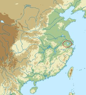
Jiaxing
Prefecture-level city in Zhejiang, People's Republic of China
Distance: Approx. 815 meters
Latitude and longitude: 30.747,120.756
Jiaxing (simplified Chinese: 嘉兴; traditional Chinese: 嘉興; pinyin: Jiāxīng; Wade–Giles: Chia-hsing), alternately romanized as Kashing, is a prefecture-level city in northern Zhejiang province, China. Lying on the Grand Canal of China, Jiaxing borders Hangzhou to the southwest, Huzhou to the west, Shanghai to the northeast, and the province of Jiangsu to the north. As of the 2020 census, its population was 5,400,868 and its built-up (or metro) area made of 2 urban districts was home to 1,518,654 inhabitants.

Majiabang culture
Chinese Neolithic culture
Distance: Approx. 3812 meters
Latitude and longitude: 30.73583333,120.715
The Majiabang culture, formerly also written Ma-chia-pang, was a Neolithic culture that occupied the Yangtze River Delta, primarily around Lake Tai west of modern Shanghai and north of Hangzhou Bay. The culture spread throughout southern Jiangsu and Zhejiang north of Hangzhou Bay from around 5000 BC to 3300 BC, coexisting with the Hemudu culture in Zhejiang south of the bay. The later part of the period is now considered a separate cultural phase, referred to as the Songze culture.

South Lake (Jiaxing)
Lake in Jiaxing, Zhejiang, China
Distance: Approx. 784 meters
Latitude and longitude: 30.757,120.756
South Lake (Chinese: 南湖; pinyin: Nán Hú; Wu: Noe平Wu平) is a lake in the South of Jiaxing, Zhejiang, China, and covers an area of 0.54 km2. It is also known as "Mandarin Duck Lake" due to its shape. Alongside the lake are the ruins of the Misty Rain Tower, which was first built in the 10th century AD. In the year 1548, during the Ming Dynasty, the local government dredged the waterways and piled up the mud into the center of South Lake, forming an islet.

Xiuzhou, Jiaxing
District in Zhejiang, People's Republic of China
Distance: Approx. 5047 meters
Latitude and longitude: 30.76666667,120.7
Xiuzhou District (Chinese: 秀洲区; pinyin: Xiùzhōu Qū) is a district in Jiaxing, Zhejiang, China, bordering Jiangsu province to the north. There is 90 km (56 mi) to central Shanghai in the northeast, 80 km (50 mi) to Hangzhou in the southwest and 70 km (43 mi) to Suzhou in the north. It is an important urban district of Jiaxing city.

Nanhu, Jiaxing
District in Zhejiang, People's Republic of China
Distance: Approx. 1613 meters
Latitude and longitude: 30.75,120.76666667
Nanhu District (Chinese: 南湖区; pinyin: Nánhú Qū) is a district in Jiaxing, Zhejiang Province of China. Its former name was Xiucheng District (秀城区), and it changed to current name on 17 May 2005. Total area is 425.83 km2 (164.41 sq mi), and total population is 450,000 in 2001.
Jiaxing Stadium
Sports venue in Jiaxing, China
Distance: Approx. 1176 meters
Latitude and longitude: 30.743226,120.75648
The Jiaxing Sports Centre Stadium is a multi-purpose stadium in Jiaxing, China. It is currently used mostly for football matches. The stadium holds 35,000 spectators.
Jiaxing Airport
Airport in Zhejiang, China
Distance: Approx. 8358 meters
Latitude and longitude: 30.70666667,120.68055556
Jiaxing Airport (Chinese: 嘉兴机场), or Jiaxing Air Base, is a military air base in the city of Jiaxing in Zhejiang province, China. It is being converted to a dual-use military and civilian airport. The airport is located 8 kilometers from the city center in Xiuzhou District.

Xiu Prefecture
Historical administrative division in Zhejiang, China
Distance: Approx. 3126 meters
Latitude and longitude: 30.73,120.73
Xiuzhou or Xiu Prefecture was a zhou (prefecture) in imperial China, centering on modern Jiaxing, Zhejiang, China. Its administrative area contained most of modern Shanghai. It was created by the Wuyue kingdom in 938; in 1195, the Song dynasty renamed it Jiaxing Prefecture.

Jiaxing Catholic Church
Church in Zhejiang, China
Distance: Approx. 1850 meters
Latitude and longitude: 30.767368,120.757913
Jiaxing Catholic Church (simplified Chinese: 嘉兴天主堂; traditional Chinese: 嘉興天主堂; pinyin: Jiāxīng Tiānzhǔtáng) is a Roman Catholic Church in downtown Jiaxing, Zhejiang, China.
Jiaxing Vincent Abbey
Church in Zhejiang, China
Distance: Approx. 3686 meters
Latitude and longitude: 30.783066,120.763953
Jiaxing Vincent Abbey (simplified Chinese: 嘉兴文生修道院; traditional Chinese: 嘉興文生修道院; pinyin: Jiāxīng Wensheng Xiūdàoyuàn) is a Roman Catholic Church in Nanhu District, Jiaxing, Zhejiang, China.
Juehai Temple
Buddhist temple in Jiaxing, China
Distance: Approx. 1406 meters
Latitude and longitude: 30.764716,120.751977
Juehai Temple (simplified Chinese: 觉海寺; traditional Chinese: 覺海寺; pinyin: Juéhǎi Sì) is a Buddhist temple located in Nanhu District of Jiaxing, Zhejiang, China.
Weather in this IP's area
overcast clouds
7 Celsius
7 Celsius
7 Celsius
7 Celsius
1030 hPa
77 %
1030 hPa
1029 hPa
10000 meters
1.35 m/s
2.81 m/s
5 degree
100 %

