115.188.24.224 - IP Lookup: Free IP Address Lookup, Postal Code Lookup, IP Location Lookup, IP ASN, Public IP
Country:
 New Zealand
Region:
City:
Location:
Time Zone:
Postal Code:
ISP:
ASN:
language:
User-Agent:
Proxy IP:
Blacklist:
IP information under different IP Channel
ip-api
Country
Region
City
ASN
Time Zone
ISP
Blacklist
Proxy
Latitude
Longitude
Postal
Route
db-ip
Country
Region
City
ASN
Time Zone
ISP
Blacklist
Proxy
Latitude
Longitude
Postal
Route
IPinfo
Country
Region
City
ASN
Time Zone
ISP
Blacklist
Proxy
Latitude
Longitude
Postal
Route
IP2Location
115.188.24.224Country
nzRegion
northland
City
whangarei
Time Zone
Pacific/Auckland
ISP
Language
User-Agent
Latitude
Longitude
Postal
ipdata
Country
Region
City
ASN
Time Zone
ISP
Blacklist
Proxy
Latitude
Longitude
Postal
Route
Popular places and events near this IP address

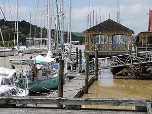
Whangārei
City in Northland, New Zealand
Distance: Approx. 746 meters
Latitude and longitude: -35.725,174.32361111
Whangārei (Māori: [faŋaːˈɾɛi]) is the northernmost city in New Zealand and the largest settlement of the Northland region. It is part of the Whangarei District, created in 1989 from the former Whangarei City, Whangarei County and Hikurangi Town councils to administer both the city and its hinterland. The city population was estimated to be 56,800 in June 2024, an increase from 47,000 in 2001.

Radio Northland
Radio station in Whangārei
Distance: Approx. 1230 meters
Latitude and longitude: -35.7209301,174.320869
Radio Northland was a radio station based in Whangārei, New Zealand. The station was started by Radio New Zealand (which at the time was known as the National Broadcasting Service) in 1949. The original callsign was 1XN and the station was originally known by this name, the callsign was later changed to 1ZN. The station originally broadcast on 970AM in Whangārei (callsign 1ZN), Kaikohe on 1220AM (callsign 1ZE) and Kaitaia on 1440AM (callsign 1ZK).
Horahora, Whangārei
Suburb in Whangārei, New Zealand
Distance: Approx. 1710 meters
Latitude and longitude: -35.7359,174.3057
Horahora is a suburb on the southwestern side of Whangārei, in Northland, New Zealand. According to the 2013 New Zealand census, Horahora has a population of 1,053, an increase of 27 people since the 2006 census.
Morningside, Whangārei
Suburb in Whangārei, New Zealand
Distance: Approx. 781 meters
Latitude and longitude: -35.738107,174.320385
Morningside (Māori: Porowini) is a suburb to the south of Whangārei in Northland, New Zealand. Morningside railway housing settlement still substantially exists. Many of the houses have been considerably modified, but one 1939 house is protected by NZHPT Category II listing, number 7745.
Okara Park
Stadium in Whangārei, New Zealand
Distance: Approx. 571 meters
Latitude and longitude: -35.73416667,174.32944444
Okara Park, currently known commercially as Semenoff Stadium (previously known as Toll Stadium due to a sponsorship agreement) is a multi-purpose stadium in Whangārei, New Zealand. It is currently used mostly for rugby union matches and is the home stadium of Northland Rugby Union. The stadium is able to hold 18,500 people and was built in 1965.

Hātea River
River in New Zealand
Distance: Approx. 1055 meters
Latitude and longitude: -35.72222222,174.32388889
The Hātea River is a river of New Zealand. It flows from the north-east of Whangārei southwards and into the northern head of Whangārei Harbour. Its lower length forms the eastern boundary of the city.
Cobham Oval
New Zealand Cricket ground
Distance: Approx. 770 meters
Latitude and longitude: -35.735,174.33138889
Cobham Oval is a cricket ground in Whangārei, New Zealand, next to the Okara Park rugby stadium. It stages daytime-only first-class and List A matches. It is the home ground and headquarters of the Northland cricket team and one of the home grounds for the Northern Districts cricket team.
Whangarei County
County in New Zealand
Distance: Approx. 746 meters
Latitude and longitude: -35.725,174.32361111
Whangarei County was one of the counties of New Zealand in the North Island.

Hundertwasser Art Centre
Art and cultural centre in New Zealand
Distance: Approx. 830 meters
Latitude and longitude: -35.7243,174.325
The Hundertwasser Art Centre with Wairau Māori Art Gallery is an art and cultural centre in Whangārei, New Zealand. It is the conception of artist and architect Friedensreich Hundertwasser, who lived near Kawakawa for 30 years, and was first designed in 1993. The project proved controversial and was considered and rejected a number of times until it was approved by a binding referendum in June 2015.
Whangārei Central
Suburb in Whangārei, New Zealand
Distance: Approx. 687 meters
Latitude and longitude: -35.725543,174.323327
Whangārei Central is the central business district of Whangārei, in the Northland Region of New Zealand's North Island. It includes the Whangārei Town Basin. It has traditionally been the main commercial centre of Northland.
Woodhill, Whangārei
Suburb in Whangārei, New Zealand
Distance: Approx. 1168 meters
Latitude and longitude: -35.731,174.311
Woodhill (Māori: Kauika) is a suburb of Whangārei, in Northland Region, New Zealand. It is about 1.5 kilometres southwest of the city centre. State Highway 1 runs through Woodhill, bypassing the CBD, and State Highway 14 ends at an intersection with SH1.

Riverside, Whangārei
Suburb in Whangārei, New Zealand
Distance: Approx. 1168 meters
Latitude and longitude: -35.728,174.336
Riverside (Māori: Ōruku) is a suburb of Whangārei, in Northland Region, New Zealand. It is east of the city centre, across the Hātea River. Pohe Island is a 54 square kilometre open space which is adjacent to the mouth of the Hātea River and Whangārei Harbour.
Weather in this IP's area
clear sky
22 Celsius
22 Celsius
22 Celsius
22 Celsius
1017 hPa
73 %
1017 hPa
1006 hPa
10000 meters
2.59 m/s
5.98 m/s
202 degree
8 %