Country:
 New Zealand
Region:
City:
Latitude and Longitude:
Time Zone:
Postal Code:
IP information under different IP Channel
ip-api
Country
Region
City
ASN
Time Zone
ISP
Blacklist
Proxy
Latitude
Longitude
Postal
Route
IPinfo
Country
Region
City
ASN
Time Zone
ISP
Blacklist
Proxy
Latitude
Longitude
Postal
Route
MaxMind
Country
Region
City
ASN
Time Zone
ISP
Blacklist
Proxy
Latitude
Longitude
Postal
Route
Luminati
Country
NZRegion
auk
City
auckland
ASN
Time Zone
Pacific/Auckland
ISP
Spark New Zealand Trading Ltd.
Latitude
Longitude
Postal
db-ip
Country
Region
City
ASN
Time Zone
ISP
Blacklist
Proxy
Latitude
Longitude
Postal
Route
ipdata
Country
Region
City
ASN
Time Zone
ISP
Blacklist
Proxy
Latitude
Longitude
Postal
Route
Popular places and events near this IP address
Unitec Institute of Technology
University in New Zealand
Distance: Approx. 1504 meters
Latitude and longitude: -36.87777778,174.70777778
Unitec Institute of Technology (Māori: Te Whare Wānanga o Wairaka) is the largest institute of technology in Auckland, New Zealand. 16,844 students study programmes from certificate to postgraduate degree level (levels 1 to 9) across a range of subjects. The main campus is situated in Mt Albert while a secondary Waitākere campus is situated in Henderson and there are various pop-ups throughout the North Shore.

Point Chevalier
Suburb in Auckland, New Zealand
Distance: Approx. 220 meters
Latitude and longitude: -36.86388889,174.70527778
Point Chevalier (; commonly known as Point Chev and an original colonial name of Point Bunbury after Thomas Bunbury) is a residential suburb and peninsula in the city of Auckland in the north of New Zealand. It is located five kilometres to the west of the city centre on the southern shore of the Waitematā Harbour. The suburb was originally a working-class area, with some state houses in the area, but over the past several decades the suburb has seen growth into becoming a middle-class suburb, with several redevelopment projects either completed or underway.

Western Springs (Auckland suburb)
Suburb in Auckland, New Zealand
Distance: Approx. 1790 meters
Latitude and longitude: -36.867,174.723
Western Springs is a residential suburb in the city of Auckland in the north of New Zealand. It is located four kilometres to the west of the city centre, Auckland CBD. The park is situated to the north of State Highway 16 and the residential suburb is located southeast of the park on the opposite side of State Highway 16. The suburb is dominated by Western Springs Reserve, also known as Western Springs Lakeside Te Wai Ōrea, which features a lake with a variety of birdlife.

Waterview, New Zealand
Suburb in Auckland, New Zealand
Distance: Approx. 1714 meters
Latitude and longitude: -36.88,174.7
Waterview is a suburb of Auckland, New Zealand, located along the western side of Auckland's isthmus. Its boundaries are Oakley Creek in the east, Heron Park in the south, the Waitematā Harbour (and Motu Manawa (Pollen Island) Marine Reserve) in the west, and the Northwestern Motorway and the Oakley Creek inlet in the north. Waterview is primarily a residential area, with its residents commuting to work.

Auckland Zoo
Zoo in Auckland, New Zealand
Distance: Approx. 1440 meters
Latitude and longitude: -36.86218,174.718924
Auckland Zoo (Māori: Rawhi Whakaaturanga o Tāmaki Makaurau) is a 16.35-hectare (40-acre) zoological garden in Auckland, New Zealand, situated next to Western Springs Park not far from Auckland's central business district. It is run by Auckland Council with the Zoological Society of Auckland as a supporting organisation. Auckland Zoo opened in 1922, experiencing early difficulties mainly due to animal health issues.

Meola Creek
Creek in Auckland, New Zealand
Distance: Approx. 1409 meters
Latitude and longitude: -36.852778,174.708056
Meola Creek is a waterway in Auckland, New Zealand. It is situated in Integrated Catchment Area #1 within Auckland City's drainage network. The catchment consists largely of a natural valley that runs down from the north-east slopes of Mt Albert (Owairaka), north of Mt Albert Road.
Western Springs College
School in New Zealand
Distance: Approx. 1284 meters
Latitude and longitude: -36.8625,174.71722222
Western Springs College is a state co-educational secondary school located in Western Springs, an inner suburb of Auckland, New Zealand. Western Springs College and Ngā Puna o Waiōrea teach collaboratively on one campus. The school educates approximately 1848 students, from Years 9 to 13 (ages 13 to 18).

Northwestern Cycleway
Cycle route in Auckland, New Zealand
Distance: Approx. 901 meters
Latitude and longitude: -36.8721883,174.7072291
The Northwestern Cycleway (Māori: Ara Paihikara i te Raki-mā-Uru), sometimes also referred to as the North West or Northwestern Cycle Route, is a 12 km mostly off-road cycle route in New Zealand that connects the Auckland CBD with the suburb of Westgate. For most of its length, it runs alongside the Northwestern Motorway (State Highway 16). The cycleway is used (as of March 2013) by approximately 800 users daily at the St Lukes Road intersection, approximately 750 daily at the Great North Road intersection, and approximately 650 daily at the Te Atatū intersection (some but not all users would have been counted at all three locations).
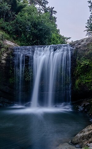
Oakley Creek
Creek in New Zealand
Distance: Approx. 1099 meters
Latitude and longitude: -36.87263,174.69558
Oakley Creek (Māori: Te Auaunga) is a creek in Auckland, New Zealand. While heavily human-modified (being surrounded for most of its length by suburban development, especially in the upper reaches), it has a number of important ecological features, such as having the only natural waterfall on the Auckland isthmus (which is also the largest in urban Auckland).

Carrington Hospital
Carrington Hospital (Former) in Auckland, New Zealand
Distance: Approx. 1169 meters
Latitude and longitude: -36.874975,174.706332
Carrington Hospital is a former lunatic asylum and psychiatric hospital listed as a Category I by Heritage New Zealand located in Point Chevalier, Auckland. Serving as the main asylum for Auckland for over a century the asylum was closed down with the land and building sold to Carrington Technical Institute (later Unitec). Most of the former site was sold to the Crown in 2018–2021 to be used for a large residential development.

Westpoint Performing Arts Centre
Performing arts venue in Auckland, New Zealand
Distance: Approx. 1324 meters
Latitude and longitude: -36.8595,174.7164
The Westpoint Performing Arts Centre is a venue located in Point Chevalier, Auckland, New Zealand used for theatrical performances and rehearsals.

Western Springs Reserve
Public park in Auckland, New Zealand
Distance: Approx. 1775 meters
Latitude and longitude: -36.864,174.723
Western Springs Reserve, also known as Western Springs Lakeside Te Wai Ōrea, consists of a sanctuary for wildlife, surrounding a lake fed by the natural springs. There are walking paths surrounding the lake with bridges going across sections of it. Auckland Zoo, Museum of Transport & Technology and Western Springs Stadium are all situated around the park.
Weather in this IP's area
light rain
13 Celsius
12 Celsius
12 Celsius
13 Celsius
1006 hPa
88 %
1006 hPa
1002 hPa
10000 meters
2.57 m/s
250 degree
75 %
06:13:56
18:15:33