115.188.127.172 - IP Lookup: Free IP Address Lookup, Postal Code Lookup, IP Location Lookup, IP ASN, Public IP
Country:
Region:
City:
Location:
Time Zone:
Postal Code:
ISP:
ASN:
language:
User-Agent:
Proxy IP:
Blacklist:
IP information under different IP Channel
ip-api
Country
Region
City
ASN
Time Zone
ISP
Blacklist
Proxy
Latitude
Longitude
Postal
Route
db-ip
Country
Region
City
ASN
Time Zone
ISP
Blacklist
Proxy
Latitude
Longitude
Postal
Route
IPinfo
Country
Region
City
ASN
Time Zone
ISP
Blacklist
Proxy
Latitude
Longitude
Postal
Route
IP2Location
115.188.127.172Country
Region
auckland
City
mount albert
Time Zone
Pacific/Auckland
ISP
Language
User-Agent
Latitude
Longitude
Postal
ipdata
Country
Region
City
ASN
Time Zone
ISP
Blacklist
Proxy
Latitude
Longitude
Postal
Route
Popular places and events near this IP address
Unitec Institute of Technology
University in New Zealand
Distance: Approx. 1107 meters
Latitude and longitude: -36.87777778,174.70777778
Unitec (Māori: Te Whare Wānanga o Wairaka) is the largest institute of technology in Auckland, New Zealand. 16,844 students study programmes from certificate to postgraduate degree level (levels 1 to 9) across a range of subjects. The main campus is situated in Mt Albert while a secondary Waitākere campus is situated in Henderson and there are various pop-ups throughout the North Shore.

Mount Albert, New Zealand
Suburb in Auckland, New Zealand
Distance: Approx. 746 meters
Latitude and longitude: -36.884,174.716
Mount Albert (Māori: Ōwairaka) is an inner suburb of Auckland, New Zealand, which is centred on Ōwairaka / Mount Albert, a local volcanic peak which dominates the landscape. By 1911, growth in the area had increased to the point where Mount Albert was declared an independent borough, which was later absorbed into Auckland. The suburb is located 7 kilometres (4.3 mi) to the southwest of the Auckland City Centre.

Baldwin Avenue railway station
Railway station in New Zealand
Distance: Approx. 41 meters
Latitude and longitude: -36.87786667,174.72
Baldwin Avenue railway station, in the suburb of Mount Albert, is on the Western Line of the Auckland railway network. The station has offset side platforms connected by a level crossing.

Morningside, Auckland
Suburb in Auckland, New Zealand
Distance: Approx. 1118 meters
Latitude and longitude: -36.87883,174.732731
Morningside is a suburb of Auckland, New Zealand. It lies four kilometres south-west of the city centre, close to Eden Park and Western Springs Reserve.

Mount Albert Grammar School
State secondary, day and boarding school in Auckland, New Zealand
Distance: Approx. 845 meters
Latitude and longitude: -36.88458889,174.72533333
Mount Albert Grammar School, commonly known as MAGS, is a co-educational state secondary school in Mount Albert in Auckland, New Zealand. It teaches students in year levels 9 to 13. As of August 2021, Mount Albert Grammar School is the second largest school in New Zealand, behind Rangitoto College.

Fowlds Park
Distance: Approx. 897 meters
Latitude and longitude: -36.873991,174.728794
Fowlds Park is a small public reserve in the northern part of Mount Albert, in Auckland City.
Marist College, Auckland
State integrated school in Auckland, New Zealand
Distance: Approx. 626 meters
Latitude and longitude: -36.8817,174.7257
Marist College (originally called Marist Sisters College) is an integrated Catholic girls high school located in Mount Albert, Auckland, New Zealand. It teaches from year 7 through to year 13 with an education "founded on the Catholic faith", and as of 2019 had a student roll of 760.
Auckland Institute of Studies
Private university in Auckland, New Zealand
Distance: Approx. 519 meters
Latitude and longitude: -36.87357222,174.72089167
Auckland Institute of Studies (AIS) (formerly AIS St Helens; Māori: Te Whare Wānanga ki Hato Herena) is the leading privately owned tertiary institute in Auckland, New Zealand. AIS was established in 1990, in Auckland's Downtown shopping centre. It moved into the former St Helens Maternity Hospital in Mt Albert, Auckland in 1993, after converting it into a tertiary residential campus.
Mount Albert School
State co-educational primary (year 1-6) school
Distance: Approx. 962 meters
Latitude and longitude: -36.878,174.731
Mount Albert School is a primary school in the suburb of Mount Albert, Auckland, New Zealand that caters for boys and girls from Year 1 to Year 6. it currently has a roll of 495 and its current principal is Marian Caulfield.

Ferndale House
Historic house in Auckland, New Zealand
Distance: Approx. 483 meters
Latitude and longitude: -36.882496,174.719463
Ferndale House is a 19th-century house in Mount Albert, Auckland, New Zealand, which is listed by Heritage New Zealand as a Category II structure. The house was built in the 1860s for the Garlick family, major figures in the Methodist community in Mount Albert, later becoming a hub for the Plunket Society in the 1940s and a community centre.

St Lukes, New Zealand
Suburb in Auckland, New Zealand
Distance: Approx. 1148 meters
Latitude and longitude: -36.88313,174.73152
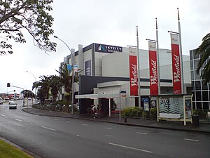
St Lukes is a suburb of New Zealand's largest city, Auckland. It is under the local governance of the Auckland Council. After Westfield St Lukes opened in 1972, the area developed into a major commercial area of the Auckland isthmus.

Ōwairaka, Statue of a Cloaked Woman
Statue in Auckland, New Zealand
Distance: Approx. 371 meters
Latitude and longitude: -36.88072222,174.72291667
The Ōwairaka, Statue of a Cloaked Woman by Christine Hellyar is a suffrage memorial to commemorate the women of Mount Albert. It is located in Alice Wylie Reserve, Mount Albert, Auckland. It was initially erected in 1995.
Weather in this IP's area
broken clouds
25 Celsius
26 Celsius
24 Celsius
26 Celsius
1002 hPa
64 %
1002 hPa
998 hPa
10000 meters
4.12 m/s
240 degree
75 %