Country:
 Malaysia
Region:
City:
Latitude and Longitude:
Time Zone:
Postal Code:
IP information under different IP Channel
ip-api
Country
Region
City
ASN
Time Zone
ISP
Blacklist
Proxy
Latitude
Longitude
Postal
Route
IPinfo
Country
Region
City
ASN
Time Zone
ISP
Blacklist
Proxy
Latitude
Longitude
Postal
Route
MaxMind
Country
Region
City
ASN
Time Zone
ISP
Blacklist
Proxy
Latitude
Longitude
Postal
Route
Luminati
Country
MYRegion
12
City
kotakinabalu
ASN
Time Zone
Asia/Kuching
ISP
TM TECHNOLOGY SERVICES SDN. BHD.
Latitude
Longitude
Postal
db-ip
Country
Region
City
ASN
Time Zone
ISP
Blacklist
Proxy
Latitude
Longitude
Postal
Route
ipdata
Country
Region
City
ASN
Time Zone
ISP
Blacklist
Proxy
Latitude
Longitude
Postal
Route
Popular places and events near this IP address
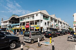
Penampang
Big Town and district capital in Sabah, Malaysia
Distance: Approx. 3408 meters
Latitude and longitude: 5.91666667,116.11666667
Penampang (Malay: Pekan Penampang) is the capital of the Penampang District in the West Coast Division of Sabah, Malaysia. Its population was estimated to be around 93,616 in 2010, with ethnic Kadazan as the majority. It contains, or is synonymous with, Donggongon, which as of 2007, it has a population of 78,086.
Putatan
Town and district capital in Sabah, Malaysia
Distance: Approx. 6126 meters
Latitude and longitude: 5.88333333,116.05
Putatan (Malay: Pekan Putatan) is a municipality in the capital of the Putatan district in the West Coast Division of Sabah, Malaysia. Its population was estimated to be around 100,000 in 2021. It is one of the satellite town of Kota Kinabalu metropolitan area together with neighbouring Petagas town.

Lok Kawi
Distance: Approx. 7444 meters
Latitude and longitude: 5.85,116.05
Lok Kawi is a township in the West Coast Division of Sabah, Malaysia. Located around the border of the districts of Penampang and Papar, and about 15 kilometres south of the state capital Kota Kinabalu, it has become part of the urban expanse of Kota Kinabalu. Nearby towns include Putatan in the north, and Kinarut in the south.
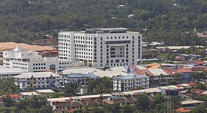
Kepayan
Neighbourhood in Kota Kinabalu, Sabah, Malaysia
Distance: Approx. 5920 meters
Latitude and longitude: 5.924,116.06547222
Kepayan is a sub-district, or a neighbourhood, within the city of Kota Kinabalu in Sabah, Malaysia. It is located within Kota Kinabalu city district, and borders with the district of Penampang (which certain parts of this neighbourhood are jurisdictionally located under the Penampang District Council since most of it is administered by the Kota Kinabalu City Hall). The Kota Kinabalu International Airport, Sabah Contingent Police Headquarters as well as the Kota Kinabalu Central Prison, are located in Kepayan.
Petagas War Memorial
Park dedicated to victims of World War II
Distance: Approx. 6655 meters
Latitude and longitude: 5.92103889,116.05481389
The Petagas War Memorial or Petagas War Memorial Garden (Malay: Taman Peringatan Petagas/Perang Petagas) is a memorial park dedicated to the Second World War victims in Sabah particularly to 324 resistance movement members, who were executed on 21 January 1944 at the site by the Japanese occupying forces of North Borneo for their involvement in the Jesselton Revolt. The park memorial plate lists the names of men of various ethnic groups in North Borneo and from various islands in the Sulu Archipelago including the main resistance leader Albert Kwok and those who assisted or died in Labuan Military Prison. The park was built exactly on the site where the massacre took place and where the victims were initially buried.

Kota Kinabalu High School
Private school (1949-1971) school in Kota Kinabalu, Sabah, West Coast Division, Malaysia
Distance: Approx. 7446 meters
Latitude and longitude: 5.9458845,116.070886
Kota Kinabalu High School, KKHS (Malay: Sekolah Tinggi Kota Kinabalu, STKK; Chinese: 亚庇中学, 庇中 ) is a high school in Kota Kinabalu, Sabah, Malaysia.

St. Michael's Church, Penampang
Church in Sabah, Malaysia
Distance: Approx. 2282 meters
Latitude and longitude: 5.90817778,116.11015278
St. Michael’s Church is a Roman Catholic church in Donggongon, Penampang District, Sabah, Malaysia. It is the oldest church in the district of Penampang and the second oldest stone church in Sabah, after St.
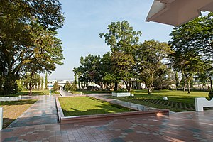
Tun Fuad Stephens Park
Park in Kota Kinabalu, Sabah, Malaysia
Distance: Approx. 6719 meters
Latitude and longitude: 5.94833333,116.11138889
Tun Fuad Stephens Park is a recreational park in Bukit Padang, Kota Kinabalu, Sabah, Malaysia. It is built in honour of the late Chief Minister of Sabah Fuad Stephens who perished in the Double Six Tragedy in 1976.

Putatan railway station
Distance: Approx. 6268 meters
Latitude and longitude: 5.89354722,116.04874444
Putatan railway station (Malay: Stesen Keretapi Putatan) is one of eleven minor railway station on the Western Sabah Railway Line located in Putatan, Penampang, Sabah, Malaysia.

Penampang District
District of Malaysia in Sabah
Distance: Approx. 3408 meters
Latitude and longitude: 5.91666667,116.11666667
The Penampang District (Malay: Daerah Penampang) is an administrative district in the Malaysian state of Sabah, part of the West Coast Division which includes the districts of Kota Belud, Kota Kinabalu, Papar, Penampang, Putatan, Ranau and Tuaran. The capital of the district is in Penampang Town.

Putatan District
District of Malaysia in Sabah
Distance: Approx. 3408 meters
Latitude and longitude: 5.91666667,116.11666667
The Putatan district (Malay: Daerah Putatan) is an administrative district in the Malaysian state of Sabah, part of the West Coast Division which includes the districts of Kota Belud, Kota Kinabalu, Papar, Penampang, Ranau and Tuaran. The capital of the district is in Putatan Town. All matters in this town are under the district jurisdiction except for matters such as education and security are still under the supervision of the Penampang District.

Pogunon Community Museum
Museum in Sabah, Malaysia
Distance: Approx. 5224 meters
Latitude and longitude: 5.91333333,116.145
Pogunon Community Museum (Malay: Muzium Komuniti Pogunon) is a museum located at Pogunon Village in Penampang District of Sabah, Malaysia.
Weather in this IP's area
few clouds
34 Celsius
41 Celsius
33 Celsius
34 Celsius
1010 hPa
66 %
1010 hPa
1008 hPa
10000 meters
2.57 m/s
20 %
06:07:46
18:19:09