Country:
 Malaysia
Region:
City:
Latitude and Longitude:
Time Zone:
Postal Code:
IP information under different IP Channel
ip-api
Country
Region
City
ASN
Time Zone
ISP
Blacklist
Proxy
Latitude
Longitude
Postal
Route
IPinfo
Country
Region
City
ASN
Time Zone
ISP
Blacklist
Proxy
Latitude
Longitude
Postal
Route
MaxMind
Country
Region
City
ASN
Time Zone
ISP
Blacklist
Proxy
Latitude
Longitude
Postal
Route
Luminati
Country
MYRegion
14
City
kualalumpur
ASN
Time Zone
Asia/Kuala_Lumpur
ISP
TM TECHNOLOGY SERVICES SDN. BHD.
Latitude
Longitude
Postal
db-ip
Country
Region
City
ASN
Time Zone
ISP
Blacklist
Proxy
Latitude
Longitude
Postal
Route
ipdata
Country
Region
City
ASN
Time Zone
ISP
Blacklist
Proxy
Latitude
Longitude
Postal
Route
Popular places and events near this IP address
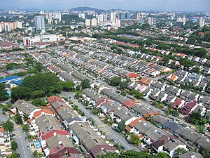
Bangsar
Place in Federal Territory of Kuala Lumpur, Malaysia
Distance: Approx. 376 meters
Latitude and longitude: 3.13083333,101.66944444
Bangsar is a residential suburb on the outskirts of Kuala Lumpur, lying about 4 kilometres (2.5 mi) south-west of the city centre. It is part of the Lembah Pantai parliamentary constituency. Bangsar is administered by Dewan Bandaraya Kuala Lumpur (DBKL), unlike other townships in the Klang Valley such as Petaling Jaya and Subang Jaya which have their municipal councils.

Damansara Town Centre
Township in Federal Territory of Kuala Lumpur
Distance: Approx. 1604 meters
Latitude and longitude: 3.1469615,101.6621025
Pusat Bandar Damansara (English: Damansara Town Centre) is a township in the Segambut constituency of Kuala Lumpur, Malaysia. The original buildings making up the township were constructed between 1981 and 1984, and were demolished in 2016 for new development.
Saidina Abu Bakar As Siddiq Mosque
Mosque in Bangsar, Kuala Lumpur, Malaysia
Distance: Approx. 655 meters
Latitude and longitude: 3.12958333,101.67180556
The Saidina Abu Bakar As Siddiq Mosque (MSABA) (Malay: Masjid Saidina Abu Bakar As-Siddiq) is a prominent mosque in Bangsar, Kuala Lumpur, Malaysia. The mosque was named after Muhammad's successor (Caliph) Abu Bakr.

Bangsar Park
Distance: Approx. 521 meters
Latitude and longitude: 3.1327,101.6721
Bangsar Park was the first residential area to be developed within the area which is now known as Bangsar in Kuala Lumpur, Malaysia. It is a much sought-after residential and commercial address in the Klang Valley. It lies about four kilometres southwest of the city centre and is a ten minutes drive by car from the city centre.

Federal Hill, Kuala Lumpur
Distance: Approx. 1415 meters
Latitude and longitude: 3.139423,101.678819
Federal Hill (Malay: Bukit Persekutuan) is a low-density and affluent residential area in Kuala Lumpur, Malaysia. This residential area was developed during the British colonial era. Federal Hill is covered by an 18-acre (0.073 km2) secondary forest.

Rimba Ilmu Botanical Gardens
Distance: Approx. 1097 meters
Latitude and longitude: 3.13106944,101.65796389
Rimba Ilmu (literally forest of knowledge) is a tropical botanical garden set up by the late Professor W.R. Stanton in 1974 on the campus of the University of Malaya in Kuala Lumpur, Malaysia. The garden has over 1,600 species of plants occupying over 80 hectares. It is populated mainly with indigenous plants species but include many from tropical Asia, the Pacific islands, Australia, South America, Africa and Madagascar.
2008 Bukit Antarabangsa landslide
Distance: Approx. 1446 meters
Latitude and longitude: 3.13,101.68
The 2008 Bukit Antarabangsa landslide was a landslide that occurred on the early morning of 6 December 2008, at the town of Bukit Antarabangsa of Selangor, Malaysia. 4 people were killed while 15 others were injured from the incident. 14 houses were destroyed during the process.
2011 Hulu Langat landslide
Landslide in Malaysia
Distance: Approx. 1446 meters
Latitude and longitude: 3.13,101.68
The 2011 Hulu Langat landslide was a landslide attributed to heavy rain that occurred on the afternoon of 21 May 2011, at Kampung Gahal in the district of Hulu Langat at Selangor, Malaysia. The landslide struck an orphanage nearby, killing 16 people, including 13 children.
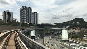
Pusat Bandar Damansara MRT station
Railway station in Damansara Town Centre, Malaysia
Distance: Approx. 1239 meters
Latitude and longitude: 3.14341111,101.66224167
The Pusat Bandar Damansara MRT Station, otherwise known as Pavilion Damansara Heights–Pusat Bandar Damansara MRT Station for sponsorship purposes, is a mass rapid transit (MRT) station serving the areas of Damansara Town Centre, Damansara Heights and Bangsar in Kuala Lumpur, Malaysia. It is one of the stations of the Kajang Line and was opened on 16 December 2016 when Phase One of the line became operational.

Al-Rahman Mosque, Kuala Lumpur
Mosque in Kuala Lumpur, Malaysia
Distance: Approx. 1754 meters
Latitude and longitude: 3.11858333,101.66272222
The Al-Rahman Mosque (Malay: Masjid Al-Rahman) is a mosque in Kuala Lumpur, Malaysia. The mosque is located at University of Malaya in Jalan Pantai Baharu and was named after the first Malaysian Prime Minister, Tunku Abdul Rahman Putra Al-Haj. Today, the mosque is joint managed by University of Malaya and the Department of Federal Territory Islamic Affairs (JAWI).
UM Arena Stadium
Stadium in Kuala Lumpur, Malaysia
Distance: Approx. 954 meters
Latitude and longitude: 3.13097222,101.65933333
The UM Arena Stadium (Malay: Stadium Sains Sukan UM Arena, literally UM Arena Sports Science Stadium) is a stadium located inside the University of Malaya in Kuala Lumpur, Malaysia. It holds 1,000 people. The stadium was used in the 2017 SEA Games football tournament and the 2018 AFC U-16 Championship.

Pavilion Damansara Heights
Shopping mall in Kuala Lumpur, Malaysia
Distance: Approx. 1502 meters
Latitude and longitude: 3.14635,101.66309
Pavilion Damansara Heights, also known as Pavilion DH, is a shopping mall located within the Pusat Bandar Damansara commercial area in Bukit Damansara, Kuala Lumpur, Malaysia.
Weather in this IP's area
few clouds
31 Celsius
36 Celsius
29 Celsius
31 Celsius
1013 hPa
70 %
1013 hPa
1004 hPa
10000 meters
2.06 m/s
160 degree
20 %
07:06:37
19:15:46