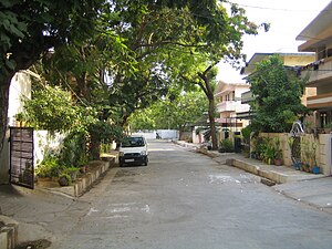
Country:
Region:
City:
Latitude and Longitude:
Time Zone:
Postal Code:
IP information under different IP Channel
ip-api
Country
Region
City
ASN
Time Zone
ISP
Blacklist
Proxy
Latitude
Longitude
Postal
Route
Luminati
Country
Region
ka
City
bengaluru
ASN
Time Zone
Asia/Kolkata
ISP
TATA Communications formerly VSNL is Leading ISP
Latitude
Longitude
Postal
IPinfo
Country
Region
City
ASN
Time Zone
ISP
Blacklist
Proxy
Latitude
Longitude
Postal
Route
db-ip
Country
Region
City
ASN
Time Zone
ISP
Blacklist
Proxy
Latitude
Longitude
Postal
Route
ipdata
Country
Region
City
ASN
Time Zone
ISP
Blacklist
Proxy
Latitude
Longitude
Postal
Route
Popular places and events near this IP address
Langar Houz
Suburb in Hyderabad District, Telangana, India
Distance: Approx. 1918 meters
Latitude and longitude: 17.3782,78.4208
Langar Houz is a suburb of Hyderabad, near Golconda, in the Indian state of Telangana. It is a major commercial centre for the city's cantonment area. Langar Houz was once considered to be the gateway to the city and Golkonda Palace.

Laxminagar Colony, Mehdipatnam
Neighbourhood in Hyderabad, Telangana, India
Distance: Approx. 1891 meters
Latitude and longitude: 17.387081,78.428843
Laxminagar Colony is a gated community in Hyderabad, India. It is near the Gudimalkapur crossroads, near Mehdipatnam, on the Ring Road that leads to Bangalore from Hyderabad. This colony consists of 30–40 independent bungalow/houses.
Mir Alam Tank
Reservoir in Hyderabad, Telangana, India
Distance: Approx. 2538 meters
Latitude and longitude: 17.35,78.43333333
Mir Alam Tank is a reservoir in Hyderabad, Telangana, India. It is located to the south of Musi river. It was the primary source of drinking water to Hyderabad before Osman Sagar and Himayat Sagar were built.
Tolichowki
Neighbourhood in Hyderabad, Telangana, India
Distance: Approx. 470 meters
Latitude and longitude: 17.37444444,78.44166667
Toli chowki is a neighbourhood in Hyderabad, Telangana, India. The name Tolichowki comes from the Urdu word 'Toli', meaning 'troupe', and 'Chowki', meaning 'post'. It is close to the IT corridor like Gachibowli, Madhapur, Manikonda and Kondapur, hence making it a preferred residential for people working in the IT industry.
Karwan
Neighbourhood in Hyderabad, Telangana, India
Distance: Approx. 470 meters
Latitude and longitude: 17.37444444,78.44166667
Karwan is one of the major neighbourhoods in Hyderabad, Telangana, India. It is a part of the old city of Hyderabad. It is 10 km from the IT hubs like Gachibowli, HITECH City, etc.
Gudimalkapur
Neighbourhood in Hyderabad, Telangana, India
Distance: Approx. 841 meters
Latitude and longitude: 17.37972222,78.43583333
Gudimalkapur is a major suburban neighbourhood of Hyderabad, India. It is one of the oldest parts of the city, 2 km from Mehdipatnam, another famous suburb. The area has a small-town environment, as it has seen very little development being an interior location away from the mainstream city.
Asif Nagar
Mandal in Telangana, India
Distance: Approx. 2467 meters
Latitude and longitude: 17.3894,78.4527
Asif Nagar is a major neighbourhood in the western part of Hyderabad, India. It is located north of the Musi River near Mehdipatnam. It is a mandal in the Hyderabad District and one of the oldest neighbourhoods that have existed for a long while.
Dhoolpet
Inner city in Telangana, India
Distance: Approx. 2458 meters
Latitude and longitude: 17.37444444,78.46083333
Dhoolpet is a neighbourhoods in the Old City of Hyderabad India, partly inhabited by people who migrated from Uttar Pradesh during the Nizam rule. Dhoolpet is part of Goshamahal Assembly constituency in old city. Dhoolpet has a sizeable Hindu migrant population, drawn from north India and Gujarat, among which Lodha community is dominant.

Toli Masjid
Mosque in Hyderabad, India
Distance: Approx. 276 meters
Latitude and longitude: 17.37461,78.43897
Toli Masjid, also known as Damri Masjid, is a mosque in Hyderabad, in the Indian state of Telangana. It was constructed during the Qutb Shahi period and completed in 1671. Built in the distinctive Qutb Shahi style, the mosque displays considerable Hindu influences in its style.
Karwan Assembly constituency
Constituency of the Telangana legislative assembly in India
Distance: Approx. 629 meters
Latitude and longitude: 17.378,78.437
Karwan Assembly constituency is a constituency of Telangana Legislative Assembly, India. It is one of 15 constituencies in the capital city of Hyderabad. It is part of Hyderabad Lok Sabha constituency.

Kulsum Begum Masjid
Mosque in Hyderabad, India
Distance: Approx. 664 meters
Latitude and longitude: 17.375204,78.443318
Kulsum Begum Masjid (also known as Kulsumpura Masjid or Jama Masjid Karwan) is a mosque in the Karwan locality of Hyderabad, India. It was built in the 17th century by Kulsum Begum, daughter of Sultan Muhammad Qutb Shah.
Masjid E Qutub Shahi Langer Houz
16th-century mosque in Telangana, India
Distance: Approx. 2225 meters
Latitude and longitude: 17.378758,78.417941
Masjid e Qutb Shahi (arabic مسجد قطب شاه) is a historic mosque located in Langar Houz, Hyderabad. It is associated with the Qutb Shahi dynasty, a ruling dynasty of the region during 1518–1687.
Weather in this IP's area
haze
27 Celsius
28 Celsius
27 Celsius
27 Celsius
1013 hPa
57 %
1013 hPa
957 hPa
5000 meters
2.57 m/s
90 degree
40 %
06:16:26
17:43:13