Country:
Region:
City:
Latitude and Longitude:
Time Zone:
Postal Code:
IP information under different IP Channel
ip-api
Country
Region
City
ASN
Time Zone
ISP
Blacklist
Proxy
Latitude
Longitude
Postal
Route
Luminati
Country
Region
jk
City
jakarta
ASN
Time Zone
Asia/Jakarta
ISP
PT WIRELESS INDONESIA WIN
Latitude
Longitude
Postal
IPinfo
Country
Region
City
ASN
Time Zone
ISP
Blacklist
Proxy
Latitude
Longitude
Postal
Route
db-ip
Country
Region
City
ASN
Time Zone
ISP
Blacklist
Proxy
Latitude
Longitude
Postal
Route
ipdata
Country
Region
City
ASN
Time Zone
ISP
Blacklist
Proxy
Latitude
Longitude
Postal
Route
Popular places and events near this IP address

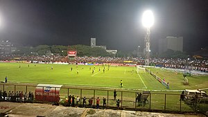
Andi Mattalatta Stadium
Multi-purpose stadium in South Sulawesi, Indonesia
Distance: Approx. 5834 meters
Latitude and longitude: -5.15844444,119.41547222
Andi Mattalatta Stadium was a multi-purpose stadium in Makassar, South Sulawesi, Indonesia. It was used mostly for football matches. The stadium held 15,000 people and was the home stadium of PSM Makassar.

Japanese destroyer Natsushio
Kagerō-class destroyer
Distance: Approx. 6591 meters
Latitude and longitude: -5.16666667,119.4
Natsushio (夏潮, lit. “Summer Tide”) was the sixth vessel to be commissioned in the 19-vessel Kagerō-class destroyers built for the Imperial Japanese Navy in the late-1930s under the Circle Three Supplementary Naval Expansion Program (Maru San Keikaku).
Roman Catholic Archdiocese of Makassar
Roman Catholic archdiocese on Sulawesi, Indonesia
Distance: Approx. 8041 meters
Latitude and longitude: -5.1333,119.417
The Roman Catholic Metropolitan Archdiocese of Makassar (Latin: Archidioecesis Metropolitae Makassarensis) is an archdiocese located in the city of Makassar in South Sulawesi in Indonesia. It covers parishes located in the administrative provinces of South Sulawesi, West Sulawesi and Southeast Sulawesi.
Trans Studio Makassar
Indoor theme park in South Sulawesi, Indonesia
Distance: Approx. 7547 meters
Latitude and longitude: -5.159676,119.394243
Trans Studio is the world's third-largest indoor theme park (as of 2009), located in Makassar, South Sulawesi, Indonesia. The 20,000-square-metre (220,000 sq ft), 20-metre (66 ft) high building houses the indoor theme park. Trans Studio is built on 12.7 ha (31 acres) with investment up to IDR 1 trillion (approximately USD 104 million).
Jeneberang River
River in South Sulawesi, Indonesia
Distance: Approx. 7730 meters
Latitude and longitude: -5.19305556,119.38138889
The Jeneberang (Indonesian: Sungai Jeneberang) (Historical Name : Garassi River) is a river of approximately 75 km in length in the south-western half of the island of Sulawesi, Indonesia. The catchment has an area of 760 square kilometers.
Kalegowa Stadium
Distance: Approx. 3033 meters
Latitude and longitude: -5.22358,119.44454
Kalegowa Stadium is a multi-use stadium in Pallangga, Gowa Regency, South Sulawesi, Indonesia.
Alauddin Islamic State University
Distance: Approx. 2944 meters
Latitude and longitude: -5.1767,119.4341
Universitas Islam Negeri Alauddin (Alauddin State Islamic University) is a university located in Makasar, South Sulawesi. The name Alauddin originates from the name of the first king of the Gowa Sultanate who converted to Islam, changed his name to Alauddin and made Islam as the sultanate's official religion.

Sungguminasa
Village in Gowa, South Sulawesi Province, Indonesia
Distance: Approx. 341 meters
Latitude and longitude: -5.2,119.45
Sungguminasa is a town and Gowa Regency's administrative capital in South Sulawesi Province, Indonesia. It is home to the Balla' Lompoa Museum, a reconstruction of the Gowa royal palace. The building is constructed on stilts and made of ironwood.

Fort Somba Opu
Ruins of a former citadel in Makassar, South Sulawesi
Distance: Approx. 5504 meters
Latitude and longitude: -5.18934722,119.40196944
Fort Somba Opu (Makassarese Baruga Somba Opu, Indonesian Benteng Somba Opu) was a fortified commercial center of the Gowa Sultanate. Its ruins are located in Makassar, South Sulawesi, Indonesia. The fort was the center of the Gowa Sultanate in the 16th-century until its destruction by the Dutch East India Company in 1669.

Al-Markaz Al-Islami Mosque
Mosque in Makassar, South Sulawesi, Indonesia
Distance: Approx. 7956 meters
Latitude and longitude: -5.1299887,119.4263232
Al-Markaz Al-Islami Mosque (Indonesian: Masjid Al-Markaz Al-Islami) is a mosque located in Makassar, South Sulawesi, Indonesia. The construction begun in 1994 and the mosque was completed in 1996. With maximum capacity of 10,000 pilgrims, building area of 6,932 m2, and site area of 10,000 m2, it serves as one of the biggest centers of Islamic religious activity in Southeast Asia.
Barombong Stadium
Stadium in Makassar, Indonesia
Distance: Approx. 7532 meters
Latitude and longitude: -5.20185833,119.38323056
Barombong Stadium is a stadium in Makassar, South Sulawesi, Indonesia. It is mostly used for football matches and is the new home stadium of PSM Makassar. The stadium was built in late January 2011.
2021 Makassar cathedral bombing
Distance: Approx. 8150 meters
Latitude and longitude: -5.13605556,119.41041667
The Makassar cathedral bombing was an attack occurred on 28 March 2021, around 10:28 Central Indonesia Time (UTC+8) at the Sacred Heart Cathedral (Indonesian: Gereja Katolik Hati Yesus yang Mahakudus) in Makassar, South Sulawesi, Indonesia, during a Palm Sunday service. It was the first church bombing in Indonesia since the 13 May 2018 bombings of three churches in Surabaya.
Weather in this IP's area
light rain
28 Celsius
34 Celsius
28 Celsius
28 Celsius
1007 hPa
89 %
1007 hPa
1006 hPa
8000 meters
1.03 m/s
20 %
05:36:42
17:58:19