Country:
Region:
City:
Latitude and Longitude:
Time Zone:
Postal Code:
IP information under different IP Channel
ip-api
Country
Region
City
ASN
Time Zone
ISP
Blacklist
Proxy
Latitude
Longitude
Postal
Route
Luminati
Country
ASN
Time Zone
Asia/Bangkok
ISP
TOT Public Company Limited
Latitude
Longitude
Postal
IPinfo
Country
Region
City
ASN
Time Zone
ISP
Blacklist
Proxy
Latitude
Longitude
Postal
Route
db-ip
Country
Region
City
ASN
Time Zone
ISP
Blacklist
Proxy
Latitude
Longitude
Postal
Route
ipdata
Country
Region
City
ASN
Time Zone
ISP
Blacklist
Proxy
Latitude
Longitude
Postal
Route
Popular places and events near this IP address

Buriram province
Province in Thailand
Distance: Approx. 1057 meters
Latitude and longitude: 14.99416667,103.10222222
Buriram province (Thai: จังหวัดบุรีรัมย์, RTGS: Changwat Buri Ram, pronounced [tɕāŋ.wàt bū.rīː.rām]) is one of Thailand's seventy-seven Provinces (changwat) and lies in lower northeastern Thailand, also called Isan. Neighboring provinces are (from south clockwise) Sa Kaeo, Nakhon Ratchasima, Khon Kaen, Maha Sarakham, and Surin. The name "Buriram" means 'city of happiness'.

Mueang Buriram district
District of Thailand
Distance: Approx. 932 meters
Latitude and longitude: 14.995,103.10333333
Mueang Buriram (Thai: เมืองบุรีรัมย์, RTGS: Mueang Buri Ram, pronounced [mɯ̄a̯ŋ bū.rīː rām]) is the capital district (amphoe mueang) of Buriram province, northeastern Thailand.
Huai Rat district
District in Buriram, Thailand
Distance: Approx. 9091 meters
Latitude and longitude: 14.96,103.18833333
Huai Rat (Thai: ห้วยราช, pronounced [hûa̯j râːt]) is a district (amphoe) of Buriram province, northeastern Thailand.

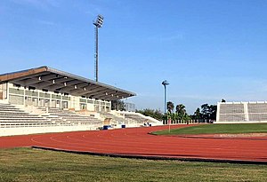
Khao Kradong Stadium
Distance: Approx. 5551 meters
Latitude and longitude: 14.945915,103.103482
Khao Kradong Stadium (Thai: สนามกีฬาเขากระโดง), or Buriram City Stadium, is a football stadium in Buriram, Thailand. It is used for football matches. The stadium's capacity is 8,000 spectators and is currently used mostly for football matches, serving as the home stadium to Buriram United Academy.
Chang Arena
Football stadium in Buriram, Thailand
Distance: Approx. 3748 meters
Latitude and longitude: 14.965952,103.094555
The Buriram Stadium (known for sponsorship purposes as Chang Arena) is a 32,600-seat football stadium in Buriram, Thailand. The stadium is the home of Buriram United. Chang Arena is the largest club-owned football stadium in Thailand.
Buriram railway station
Railway station in Buriram, Thailand
Distance: Approx. 1011 meters
Latitude and longitude: 15.003313,103.107977
Buri Ram station (Thai: สถานีบุรีรัมย์), 1st class station is the main railway station in Buriram Province located on the northern side of the town of Buriram.

Buriram Pittayakhom School
Secondary school in Buriram, Thailand
Distance: Approx. 1208 meters
Latitude and longitude: 15.003013,103.104308
Buriram Pittayakhom School (Thai: โรงเรียนบุรีรัมย์พิทยาคม) is a secondary school located in downtown Buriram Province, Thailand. It admits secondary students (mathayom 1–6, equivalent to grades 7–12). Founded in 1904, it then became the first coeducational school in Buriram.
Marie Anusorn School
Private school in Buriram, Thailand
Distance: Approx. 1490 meters
Latitude and longitude: 15.000777,103.124551
Marie Anusorn School (Thai: โรงเรียนมารีย์อนุสรณ์) is a private school located in Buriram Province, Thailand. It admits primary and secondary students. Founded in 1982.
Khao Kradong Forest Park
Forest park in Thailand
Distance: Approx. 6752 meters
Latitude and longitude: 14.93694444,103.09416667
Khao Kradong Forest Park (Thai: วนอุทยานเขากระโดง) is a forest park in Buriram Province. The site of the park is a former volcano. Near the top of the volcano is the Suphatthara Bophit Buddha image.

Buriram International Circuit
Motorsport race track in Buriram, Thailand
Distance: Approx. 4618 meters
Latitude and longitude: 14.96284444,103.08499722
The Buriram International Circuit (known as Chang International Circuit (ช้าง อินเตอร์เนชั่นแนล เซอร์กิต) for commercial purposes, but listed by its non-commercial name because of alcohol restrictions in some countries) is a motorsport race track in Buriram, Buriram Province, Thailand. The circuit was opened in October 2014. This is the first FIA Grade 1 and FIM Grade A circuit in Thailand.
Buriram Hospital
Hospital in Buriram, Thailand
Distance: Approx. 1683 meters
Latitude and longitude: 15.005522,103.100657
Buriram Hospital (Thai: โรงพยาบาลบุรีรัมย์) is the main hospital of Buriram Province, Thailand and is classified under the Ministry of Public Health as a regional hospital. It has a CPIRD Medical Education Center which trains doctors for the Institute of Medicine of Suranaree University of Technology and is an affiliated hospital of the Faculty of Medicine Ramathibodi Hospital, Mahidol University.
Huai Rat railway station
Railway station in Thailand
Distance: Approx. 8747 meters
Latitude and longitude: 14.9728,103.19
Huai Rat railway station is a railway station located in Huai Racha Subdistrict, Huai Rat District, Buriram Province. It is a class 2 railway station located 385.51 km (239.5 mi) from Bangkok railway station and is the main station for Huai Rat District.
Weather in this IP's area
light rain
29 Celsius
36 Celsius
29 Celsius
29 Celsius
1011 hPa
92 %
1011 hPa
993 hPa
10000 meters
2.1 m/s
5.65 m/s
41 degree
100 %
06:04:51
17:37:25

