Country:
Region:
City:
Latitude and Longitude:
Time Zone:
Postal Code:
IP information under different IP Channel
ip-api
Country
Region
City
ASN
Time Zone
ISP
Blacklist
Proxy
Latitude
Longitude
Postal
Route
Luminati
Country
ASN
Time Zone
Asia/Tokyo
ISP
SECOM Trust Systems Co.,Ltd.
Latitude
Longitude
Postal
IPinfo
Country
Region
City
ASN
Time Zone
ISP
Blacklist
Proxy
Latitude
Longitude
Postal
Route
db-ip
Country
Region
City
ASN
Time Zone
ISP
Blacklist
Proxy
Latitude
Longitude
Postal
Route
ipdata
Country
Region
City
ASN
Time Zone
ISP
Blacklist
Proxy
Latitude
Longitude
Postal
Route
Popular places and events near this IP address

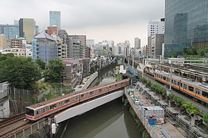
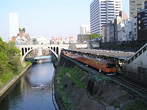
Ochanomizu Station
Railway and metro station in Tokyo, Japan
Distance: Approx. 140 meters
Latitude and longitude: 35.69972222,139.76388889
Ochanomizu Station (御茶ノ水駅, Ochanomizu-eki) is a railway station in Tokyo, Japan, operated by the East Japan Railway Company (JR East) and Tokyo subway operator Tokyo Metro. The station straddles the boundary between the Chiyoda and Bunkyō special wards; the JR station is in the former while the Tokyo Metro station is in the latter.

Holy Resurrection Cathedral
Church in Chiyoda ward Tokyo, Japan
Distance: Approx. 289 meters
Latitude and longitude: 35.69803611,139.76553333
Holy Resurrection Cathedral (復活大聖堂, fukkatsu daiseidō, Russian: Токийский собор Воскресения), also known as Nikorai-do (ニコライ堂, nikorai-dō), in Chiyoda, Tokyo, is the main cathedral of the Japanese Orthodox Church.

Shin-ochanomizu Station
Metro station in Tokyo, Japan
Distance: Approx. 327 meters
Latitude and longitude: 35.697739,139.76584
Shin-ochanomizu Station (新御茶ノ水駅, Shin-ochanomizu-eki) is a subway station on the Tokyo Metro Chiyoda Line in Chiyoda, Tokyo, Japan, operated by Tokyo Metro. Its station number is C-12. Adjacent stations on the Chiyoda Line are Otemachi (C-11) and Yushima Station (C-13).
Tokyo Medical and Dental University
Former public university in Tokyo, Japan
Distance: Approx. 91 meters
Latitude and longitude: 35.70138889,139.76527778
Tokyo Medical and Dental University (東京医科歯科大学, Tōkyō ika shika daigaku) was a public university in Bunkyō, Tokyo, Japan. It merged with the Tokyo Institute of Technology to form the Institute of Science Tokyo on 1 October 2024. Established in 1928, Tokyo Medical and Dental University was the oldest national school of dentistry in Japan.

Ochanomizu
Neighborhood in Tokyo, Japan
Distance: Approx. 263 meters
Latitude and longitude: 35.69833333,139.76416667
Ochanomizu (御茶ノ水) is a neighborhood in Tokyo, Japan. It extends from the Yushima section of Bunkyo-ku to the Kanda section of Chiyoda-ku. Sundai Preparatory School, Meiji University, Tokyo Medical and Dental University, and Juntendo University all have main campuses in the area.

Yushima Seidō
Confucian temple in Bunkyō, Tokyo, Japan
Distance: Approx. 128 meters
Latitude and longitude: 35.70083333,139.76638889
Yushima Seidō (湯島聖堂, lit. 'Yushima Sacred Hall'), is a Confucian temple (聖堂) in Yushima, Bunkyō, Tokyo, Japan. It was established in end of the 17th century during the Genroku era of the Edo period. Towards the late Edo period, one of the most important educational institutions of the shogunate, the Shōhei-zaka Gakumonjo (昌平坂学問所)), or Shōheikō (昌平黌), was founded on its grounds.
The Association of Japanese Animations
Japanese animation studio association
Distance: Approx. 378 meters
Latitude and longitude: 35.70366667,139.76319444
The Association of Japanese Animations (AJA; 日本動画協会, Nippon Douga Kyoukai) is an industry group consisting of 52 affiliate animation production companies.

Surugadai
District of Chiyoda, Tokyo
Distance: Approx. 203 meters
Latitude and longitude: 35.69916667,139.76361111
Kanda-Surugadai (神田駿河台, Kanda-Surugadai) is a district of Chiyoda, Tokyo, Japan. It was named after Tokugawa Ieyasu's death, when the Edo government allowed officials from Sunpu (now Shizuoka) to live in the area. Kanda-Surugadai is often called Surugadai (駿河台, Surugadai) or, colloquially, Sundai (駿台, Sundai).
Kanda Shrine
Shinto shrine in Tokyo, Japan
Distance: Approx. 292 meters
Latitude and longitude: 35.70194444,139.76777778
Kanda Shrine (神田明神, Kanda-myōjin, officially 神田神社 Kanda-jinja), is a Shinto shrine located in Chiyoda, Tokyo, Japan. The shrine dates back 1,270 years, but the current structure was rebuilt several times due to fire and earthquakes. It is situated in one of the most expensive estate areas of Tokyo.

Juntendo University
Private university in Chiba Prefecture, Japan
Distance: Approx. 418 meters
Latitude and longitude: 35.70222222,139.76083333
Juntendo University (順天堂大学, Juntendō Daigaku) is a private university in Bunkyo, Tokyo, Japan. Its headquarters are on its campus in Bunkyo, for the School of Medicine and in Inzai, Chiba, for the School of Health and Sports Science. The university was established in 1838 as a medical school and in 1946 it expanded its educational reach.
Bunka Gakuin
Japanese vocational school
Distance: Approx. 389 meters
Latitude and longitude: 35.69972222,139.76083333
Bunka Gakuin (文化学院) is a Japanese vocational school. It opened in 1921 as the first co-educational school in Japan.
Meiji University Museum
Crime museum, Archaeological museum, in Chiyoda-ku, Tokyo-to
Distance: Approx. 351 meters
Latitude and longitude: 35.6987,139.7619
Meiji University Museum (Japanese: 明治大学博物館(めいじだいがくはくぶつかん), romanized: Meiji Daigaku Hakubutsukan) is a university museum run by Meiji University. It is located in Surugadai campus, and houses a crime museum, commercial goods museum, archaeology museum, and an exhibition of the university's history.
Weather in this IP's area
broken clouds
15 Celsius
15 Celsius
14 Celsius
17 Celsius
1022 hPa
75 %
1022 hPa
1019 hPa
10000 meters
6.69 m/s
360 degree
75 %
06:17:50
16:33:49
