113.52.151.213 - IP Lookup: Free IP Address Lookup, Postal Code Lookup, IP Location Lookup, IP ASN, Public IP
Country:
Region:
City:
Location:
Time Zone:
Postal Code:
IP information under different IP Channel
ip-api
Country
Region
City
ASN
Time Zone
ISP
Blacklist
Proxy
Latitude
Longitude
Postal
Route
Luminati
Country
ASN
Time Zone
Asia/Kuching
ISP
IP Core Sdn Bhd
Latitude
Longitude
Postal
IPinfo
Country
Region
City
ASN
Time Zone
ISP
Blacklist
Proxy
Latitude
Longitude
Postal
Route
IP2Location
113.52.151.213Country
Region
melaka
City
melaka
Time Zone
Asia/Kuala_Lumpur
ISP
Language
User-Agent
Latitude
Longitude
Postal
db-ip
Country
Region
City
ASN
Time Zone
ISP
Blacklist
Proxy
Latitude
Longitude
Postal
Route
ipdata
Country
Region
City
ASN
Time Zone
ISP
Blacklist
Proxy
Latitude
Longitude
Postal
Route
Popular places and events near this IP address

Bukit Cina
Chinese cemetery in Melaka, Malaysia
Distance: Approx. 669 meters
Latitude and longitude: 2.2,102.2577
Bukit China (Malay: "Chinese Hill"; Chinese: 三宝山) is a hillside of historical significance in Malacca City, the capital of the Malaysian state of Malacca. It is located several kilometres to the north from the historical centre of Malacca (Dutch town and Chinatown). The site is today surrounded by the modern city on all sides.

Malacca River
River in Melaka, Malaysia
Distance: Approx. 905 meters
Latitude and longitude: 2.2,102.25
The Malacca River (Malay: Sungai Melaka) is a river in Malaysia which flows through the middle of the state of Malacca. It was a vital trade route during the heyday of Malacca Sultanate in the 15th century.

Melaka Monorail
Monorail in Melaka, Malaysia
Distance: Approx. 518 meters
Latitude and longitude: 2.2037,102.2516
Melaka Monorail was a monorail system in Malacca City, Malacca, Malaysia with 3 stations – Tun Ali, Hang Tuah and Hang Jebat. Troubled since its inception in 2010, with services suspended between 2013 and 2017, the monorail has not been operational since the COVID-19 Malaysian movement control order in 2020.

Capture of Malacca (1511)
Portuguese military conquest
Distance: Approx. 38 meters
Latitude and longitude: 2.20555556,102.25611111
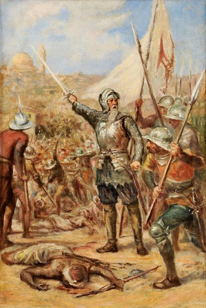
The Capture of Malacca in 1511 occurred when the governor of Portuguese India Afonso de Albuquerque conquered the city of Malacca in 1511. The port city of Malacca controlled the narrow, strategic Strait of Malacca, through which all seagoing trade between China and India was concentrated. The capture of Malacca was the result of a plan by King Manuel I of Portugal, who since 1505 had intended to beat the Castilians to the Far-East, and Albuquerque's own project of establishing firm foundations for Portuguese India, alongside Hormuz, Goa and Aden, to ultimately control trade and thwart Muslim shipping in the Indian Ocean.

Siege of Malacca (1641)
Dutch siege against Portugal in Malacca, Malaysia
Distance: Approx. 905 meters
Latitude and longitude: 2.2,102.25
The siege of Malacca (3 August 1640 – 14 January 1641) was initiated by the Dutch East India Company and their local ally, Johor, against Portuguese Malacca. It ended with a Portuguese surrender and, according to Portugal, the deaths of thousands of Portuguese individuals. The roots of the conflict began in the late 16th century when the Dutch arrived in the vicinity of Malacca.

Malacca
State of Malaysia
Distance: Approx. 905 meters
Latitude and longitude: 2.2,102.25
Malacca (Malay: Melaka), officially the Historic State of Malacca (Malay: Melaka Negeri Bersejarah), is a state in Malaysia located in the southern region of the Malay Peninsula, facing the Strait of Malacca. The state is bordered by Negeri Sembilan to the north and west and Johor to the south. The exclave of Tanjung Tuan also borders Negeri Sembilan to the north.

St. Peter's Church (Melaka)
Church in Melaka City, Melaka State, Malaysia
Distance: Approx. 466 meters
Latitude and longitude: 2.20244444,102.25316667
St. Peter's Church (Malay: Gereja St. Peter) is a church in Melaka City, Melaka, Malaysia.
Hang Li Poh's Well
Water well in Melaka City, Melaka, Malaysia
Distance: Approx. 1084 meters
Latitude and longitude: 2.19597222,102.25538889
The Hang Li Poh's Well (Malay: Perigi Hang Li Poh), also known as King's Well, is a historical water well in Melaka City, Melaka, Malaysia. It is the oldest water well in Malaysia.

Melaka Warrior Monument
Monument at Bukit Cina in Malacca City, Malacca, Malaysia
Distance: Approx. 1121 meters
Latitude and longitude: 2.19563889,102.25544444
Melaka Warrior Monument, officially the Melaka Warrior Monument for the Chinese victims of Anti-Japanese occupation (Chinese: 马六甲华人抗日义士纪念碑; pinyin: Mǎliùjiǎ huárén kàngrì yìshì jìniànbēi; lit. 'Malacca Chinese Anti-Japanese Volunteers Monument', Malay: Tugu Pahlawan-pahlawan Melaka untuk Mangsa-mangsa Cina akibat menentang penjajahan Jepun, lit. 'Malacca Warrior Monument for the Chinese victims as a result of opposing Japanese colonisation') is a monument at Bukit Cina in Malacca City, Malacca, Malaysia. It was built to commemorate the Chinese victims of the Japanese occupation of Malacca as part of the British Straits Settlements during World War II and was unveiled officially by the then high commissioner, Sir Edward Gent in 1948.

Little India, Malacca
Ethnic enclave in Malacca, Malaysia
Distance: Approx. 1107 meters
Latitude and longitude: 2.19666667,102.25163889
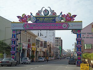
Little India Malacca is a Little India in Malacca City, Malacca, Malaysia.
Poh San Teng Temple
Temple in Melaka City, Melaka, Malaysia
Distance: Approx. 1083 meters
Latitude and longitude: 2.19597222,102.25552778
The Poh San Teng Temple (Chinese: 宝山亭; pinyin: Bǎo Shān Tíng is a Chinese temple located at the foot of Bukit China, next to the Malacca Warrior Monument and King's well in Malacca City, Malacca, Malaysia. The temple is dedicated to Tua Pek Kong and was founded in 1795 during the era of Dutch Malacca by Chinese Kapitan Chua Su Cheong (Tsai Shih-chang).
Kampung Morten
Village in Malacca City, Malacca, Malaysia
Distance: Approx. 590 meters
Latitude and longitude: 2.20338889,102.25102778
Kampung Morten (lit. 'Morten Village') is a historically traditional Malay village in Malacca City Centre in the Malaysian state of Malacca. It is named after a British land revenue collector during the British Malaya, Frederick Joseph Morten. A quiet place during the 1960s and 1970s, this village was then evolved to become a tourist attraction when it was declared a heritage village under Malacca's Preservation and Conservation Enactment in 1989.
Weather in this IP's area
light rain
28 Celsius
30 Celsius
28 Celsius
28 Celsius
1008 hPa
69 %
1008 hPa
1007 hPa
10000 meters
4.47 m/s
100 %


