Country:
 Spain
SpainRegion:
City:
Latitude and Longitude:
Time Zone:
Postal Code:
IP information under different IP Channel
ip-api
Country
Region
City
ASN
Time Zone
ISP
Blacklist
Proxy
Latitude
Longitude
Postal
Route
IPinfo
Country
Region
City
ASN
Time Zone
ISP
Blacklist
Proxy
Latitude
Longitude
Postal
Route
MaxMind
Country
Region
City
ASN
Time Zone
ISP
Blacklist
Proxy
Latitude
Longitude
Postal
Route
Luminati
Country
ESASN
Time Zone
Europe/Madrid
ISP
Orange Espagne SA
Latitude
Longitude
Postal
db-ip
Country
Region
City
ASN
Time Zone
ISP
Blacklist
Proxy
Latitude
Longitude
Postal
Route
ipdata
Country
Region
City
ASN
Time Zone
ISP
Blacklist
Proxy
Latitude
Longitude
Postal
Route
Popular places and events near this IP address

Pozuelo de Alarcón
Place in Community of Madrid, Spain
Distance: Approx. 2129 meters
Latitude and longitude: 40.43611111,-3.81388889
Pozuelo de Alarcón (Spanish pronunciation: [poˈθwelo ðe alaɾˈkon]) is a municipality in the Community of Madrid, Spain. Bordering the Moncloa-Aravaca district of Madrid proper to its west, Pozuelo de Alarcón is surrounded by large Mediterranean pine-tree forests: the Casa de Campo, the Monte del Pardo, and the Monte del Pilar. As of 2022, it ranks as the wealthiest municipality in Spain.
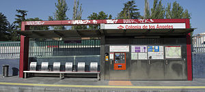
Colonia de los Ángeles (Madrid Metro)
Distance: Approx. 1983 meters
Latitude and longitude: 40.4072109,-3.7844041
Colonia de los Ángeles [koˈlonja ðe los ˈaŋxeles] is a station on Line 2 of the Metro Ligero. It is located in fare Zone B1.
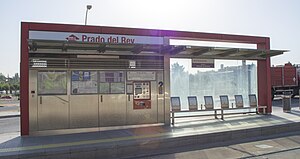
Prado del Rey (Madrid Metro)
Tramway station in Pozuelo de Alarcón, Madrid, Spain
Distance: Approx. 1545 meters
Latitude and longitude: 40.4104693,-3.7874826
Prado del Rey [ˈpɾa.ðo ðel ˈrej] is a station on Line 2 of the Metro Ligero. It is located in fare Zone B1. It serves nearby Radiotelevisión Española (RTVE) central headquarters and production center.

Somosaguas Sur (Madrid Metro)
Distance: Approx. 874 meters
Latitude and longitude: 40.4153629,-3.7925254
Somosaguas Sur [somoˈsaɣwas ˈsuɾ] is a station on Line 2 of the Metro Ligero. It is located in fare Zone B1.

Somosaguas Centro (Madrid Metro)
Distance: Approx. 211 meters
Latitude and longitude: 40.4193653,-3.798737
Somosaguas Centro [somoˈsaɣwas ˈθen.tɾo] is a station on Line 2 of the Metro Ligero. It is located in fare Zone B1.

Pozuelo Oeste (Madrid Metro)
Distance: Approx. 475 meters
Latitude and longitude: 40.4230733,-3.8044744
Pozuelo Oeste [poˈθwelo oˈeste] is a station on Line 2 of the Metro Ligero. It is located in fare Zone B1.
Bélgica (Madrid Metro)
Metropolitan station
Distance: Approx. 1335 meters
Latitude and longitude: 40.4305834,-3.8075464
Bélgica [ˈbel.xi.ka] is a station on Line 2 of the Metro Ligero. It is located in fare Zone B2.

Dos Castillas (Madrid Metro)
Railway station in Pozuelo de Alarcón, Spain
Distance: Approx. 1440 meters
Latitude and longitude: 40.4325346,-3.801616
Dos Castillas [ˈdos kasˈtiʝas] is a station on Line 2 of the Metro Ligero, servicing Madrid, Spain. It is located in fare Zone B1.

Campus de Somosaguas (Madrid Metro)
Distance: Approx. 1615 meters
Latitude and longitude: 40.4333803,-3.7952478
Campus de Somosaguas [ˈkampus ðe somoˈsaɣwas] is a station on Line 2 of the Metro Ligero. It is located in fare Zone B1.

Avenida de Europa
Distance: Approx. 2300 meters
Latitude and longitude: 40.4393053,-3.7930537
Avenida de Europa [aβeˈniða ðe ewˈɾo.pa] is a station on Line 2 of the Metro Ligero. It is in fare Zone B1.

Cocheras (Madrid Metro)
Distance: Approx. 2539 meters
Latitude and longitude: 40.3968792,-3.8038565
Cocheras [koˈt͡ʃeɾas] is a station on Line 3 of the Metro Ligero. It is located in fare Zone B1.

Prado del Rey (studios)
RTVE central Headquarters
Distance: Approx. 1270 meters
Latitude and longitude: 40.4107065,-3.79182322
Prado del Rey is the central headquarters of Radiotelevisión Española (RTVE), the Spanish state-owned public broadcasting corporation, and the main production center for its subsidiaries Televisión Española (TVE) and Radio Nacional de España (RNE). The complex is in Pozuelo de Alarcón (Madrid).
Weather in this IP's area
thunderstorm with heavy rain
16 Celsius
16 Celsius
15 Celsius
16 Celsius
1011 hPa
100 %
1011 hPa
934 hPa
3000 meters
3.6 m/s
330 degree
100 %
08:00:07
20:17:47