112.79.114.8 - IP Lookup: Free IP Address Lookup, Postal Code Lookup, IP Location Lookup, IP ASN, Public IP
Country:
 India
IndiaRegion:
City:
Location:
Time Zone:
Postal Code:
ISP:
ASN:
language:
User-Agent:
Proxy IP:
Blacklist:
IP information under different IP Channel
ip-api
Country
Region
City
ASN
Time Zone
ISP
Blacklist
Proxy
Latitude
Longitude
Postal
Route
db-ip
Country
Region
City
ASN
Time Zone
ISP
Blacklist
Proxy
Latitude
Longitude
Postal
Route
IPinfo
Country
Region
City
ASN
Time Zone
ISP
Blacklist
Proxy
Latitude
Longitude
Postal
Route
IP2Location
112.79.114.8Country
inRegion
west bengal
City
darjiling
Time Zone
Asia/Kolkata
ISP
Language
User-Agent
Latitude
Longitude
Postal
ipdata
Country
Region
City
ASN
Time Zone
ISP
Blacklist
Proxy
Latitude
Longitude
Postal
Route
Popular places and events near this IP address

Darjeeling
City in West Bengal, India
Distance: Approx. 591 meters
Latitude and longitude: 27.0375,88.26305556
Darjeeling (, Nepali: [ˈdard͡ziliŋ], Bengali: [ˈdarˌdʒiliŋ]) is a city in the northernmost region of the Indian state of West Bengal. Located in the Eastern Himalayas, it has an average elevation of 2,045 metres (6,709 ft). To the west of Darjeeling lies the easternmost province of Nepal, to the east the Kingdom of Bhutan, to the north the Indian state of Sikkim, and farther north the Tibet Autonomous Region region of China.

St. Paul's School, Darjeeling
Private boarding school in Darjeeling, West Bengal, India
Distance: Approx. 344 meters
Latitude and longitude: 27.0325065,88.2633448
St. Paul's School is a private boarding school for boys in the town of Darjeeling, West Bengal, India. It is known as "Eton of the East" because it is thought to follow the similar cultural and traditional values of Eton College.

Roman Catholic Diocese of Darjeeling
Latin Catholic jurisdiction in India
Distance: Approx. 1478 meters
Latitude and longitude: 27.0464,88.2643
The Diocese of Darjeeling is a Latin Church ecclesiastical jurisdiction or diocese of the Catholic Church in India. It is a suffragan in the ecclesiastical province of the metropolitan Archdiocese of Calcutta, yet depends on the missionary Dicastery for Evangelization. It includes within its territory the independent Himalayan country of Bhutan, where Christianity is practiced by a tiny minority and proselytism is forbidden.

Lloyd's Botanical Garden
Botanical garden in Darjeeling in the Indian state of West Bengal
Distance: Approx. 1313 meters
Latitude and longitude: 27.0446,88.2629
Lloyd's Botanical Garden, or Darjeeling Botanical Garden, is a botanical garden in Darjeeling in the Indian state of West Bengal.

Darjeeling Lok Sabha constituency
Lok Sabha Constituency in West Bengal, India
Distance: Approx. 689 meters
Latitude and longitude: 27.039,88.264
Darjeeling Lok Sabha constituency is one of the 543 parliamentary constituencies in India. The constituency centres on Darjeeling in West Bengal. While five assembly segments are in Darjeeling district, one assembly segment is in Kalimpong district and one assembly segment is in Uttar Dinajpur district.

Peace Pagoda, Darjeeling
Distance: Approx. 996 meters
Latitude and longitude: 27.02756111,88.259
Peace Pagoda, Darjeeling or Darjeeling Peace Pagoda is one of the Peace Pagodas designed to provide a focus for people of all races and creeds to help unite them in their search for world peace. It is located in the town of Darjeeling in the Indian state of West Bengal. Like most of the other Peace Pagodas, it was built under the guidance of Nichidatsu Fujii (1885–1985), a Buddhist monk from Japan and founder of the Nipponzan-Myōhōji Buddhist Order.

St. Robert's School, Darjeeling
Government aided school in West Bengal, India
Distance: Approx. 1422 meters
Latitude and longitude: 27.046,88.2652
St. Robert's School is a higher secondary school for boys, which is situated in Nagpur Hill, West Bengal, India. It is affiliated with the West Bengal Board of Secondary Education and the West Bengal Council of Higher Secondary Education.
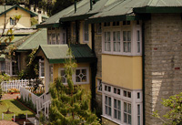
Windamere Hotel
Heritage hotel in India
Distance: Approx. 1399 meters
Latitude and longitude: 27.04583333,88.26777778
Windamere Hotel, built as 'Ada Villa' in 1841 and then turned into a boarding house for tea planters and other Raj types, on contract, in the late 1880s. In 1939, it became 'Windamere Hotel', a colonial hotel situated on Observatory Hill, in Darjeeling, India.
Maharani Girls' High School, Darjeeling
School in West Bengal, India
Distance: Approx. 649 meters
Latitude and longitude: 27.0372835,88.2619141
Maharani Girls High School is a Higher Secondary school for girls located at Darjeeling, West Bengal, India.

Darjeeling railway station
Railway station in West Bengal, India
Distance: Approx. 621 meters
Latitude and longitude: 27.0378,88.263
Darjeeling railway station is the main railway station in Darjeeling district in the Indian state of West Bengal. The station lies on UNESCO World Heritage Site Darjeeling Himalayan Railway. Darjeeling station is located at an altitude of 2,073 metres (6,801 ft) above mean sea level.

Chowrasta (Darjeeling)
Historical public square in Darjeeling
Distance: Approx. 1284 meters
Latitude and longitude: 27.0448,88.2677
Chowrasta "Intersection" lit. where four roads meet) is a historical public square in the Victorian era hill resort town of Darjeeling in the state of West Bengal, India. Located in the heart of the town it was the fashionable place of assembly for residents and visitors in the 18th century.

Dhirdham Temple
Replica of Pashupatinath temple of Kathmandu in India
Distance: Approx. 829 meters
Latitude and longitude: 27.0375,88.2598
Dhirdham Temple is a Hindu temple located in Darjeeling, India. The temple was constructed in 1939 by Rai Saheb Purna Bahadur Pradhan from Nepal. The architectural design was done by Beg Raj Shakya and has a similar design to that of Pashupatinath Temple in Kathmandu.
Weather in this IP's area
overcast clouds
9 Celsius
9 Celsius
9 Celsius
9 Celsius
1015 hPa
61 %
1015 hPa
867 hPa
10000 meters
1.14 m/s
1.07 m/s
349 degree
100 %