112.39.163.112 - IP Lookup: Free IP Address Lookup, Postal Code Lookup, IP Location Lookup, IP ASN, Public IP
Country:
Region:
City:
Location:
Time Zone:
Postal Code:
IP information under different IP Channel
ip-api
Country
Region
City
ASN
Time Zone
ISP
Blacklist
Proxy
Latitude
Longitude
Postal
Route
Luminati
Country
ASN
Time Zone
Asia/Shanghai
ISP
China Mobile communications corporation
Latitude
Longitude
Postal
IPinfo
Country
Region
City
ASN
Time Zone
ISP
Blacklist
Proxy
Latitude
Longitude
Postal
Route
IP2Location
112.39.163.112Country
Region
liaoning
City
jinzhou
Time Zone
Asia/Shanghai
ISP
Language
User-Agent
Latitude
Longitude
Postal
db-ip
Country
Region
City
ASN
Time Zone
ISP
Blacklist
Proxy
Latitude
Longitude
Postal
Route
ipdata
Country
Region
City
ASN
Time Zone
ISP
Blacklist
Proxy
Latitude
Longitude
Postal
Route
Popular places and events near this IP address

Jinzhou
Prefecture-level city in Liaoning, People's Republic of China
Distance: Approx. 2418 meters
Latitude and longitude: 41.129,121.148
Jinzhou (, simplified Chinese: 锦州; traditional Chinese: 錦州; pinyin: Jǐnzhōu), formerly Chinchow, is a coastal prefecture-level city in central-west Liaoning province, China. It is a geographically strategic city located in the Liaoxi Corridor, which connects most of the land transports between North China and Northeast China, and is the economic center of western Liaoning. Located on the northern shore of Liaodong Bay, Jinzhou encompasses a coastline of 97.7 km (60.7 mi), with the Port of Jinzhou being China's northernmost seaport.

Battle of Jinzhou
1948 battle
Distance: Approx. 1896 meters
Latitude and longitude: 41.0957,121.1258
Battle of Chinchow (simplified Chinese: 锦州之战; traditional Chinese: 錦州之戰; pinyin: Jǐnzhou Zhīzhàn) took place between the People's Liberation Army and the National Revolutionary Army during the Liaoshen Campaign in the Chinese Civil War. The battle was a turning point in the campaign, which eventually led to capture of Northeast China by the Communist Party.
Jinzhou Xiaolingzi Airport
Airport in Liaoning, China
Distance: Approx. 6751 meters
Latitude and longitude: 41.10138889,121.06166667
Jinzhou Xiaolingzi Airport (Chinese: 锦州小岭子机场) is a military airport in the city of Jinzhou in Liaoning province, Northeast China. It was converted to a civil/military dual-use airport in 1993. On 10 December 2015, the new Jinzhou Bay Airport was opened and all civil flights were transferred to the new airport.
Jinzhou City Stadium
Sports venue in Jinzhou, Liaoning, China
Distance: Approx. 1124 meters
Latitude and longitude: 41.11350278,121.15276389
Jinzhou City Stadium (Chinese: 锦州体育场) is a multi-use stadium in Jinzhou, Liaoning, China. It is currently used mostly for football matches and athletics events. The stadium has a capacity of 24,000 people.

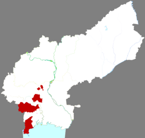
Taihe District
District in Liaoning, China
Distance: Approx. 3177 meters
Latitude and longitude: 41.10944444,121.10388889
Taihe District (simplified Chinese: 太和区; traditional Chinese: 太和區; pinyin: Tàihé Qū) is a district of the city of Jinzhou, Liaoning, China.

Guta District
District in Liaoning, People's Republic of China
Distance: Approx. 5867 meters
Latitude and longitude: 41.15861111,121.16027778
Guta District (simplified Chinese: 古塔区; traditional Chinese: 古塔區; pinyin: Gǔtǎ Qū) is a district of the city of Jinzhou, Liaoning, People's Republic of China.

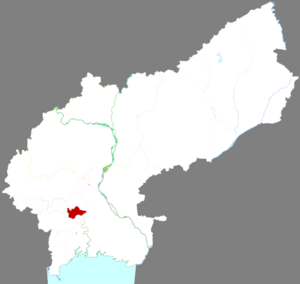
Linghe District
District in Liaoning, People's Republic of China
Distance: Approx. 1113 meters
Latitude and longitude: 41.115,121.1509
Linghe District (simplified Chinese: 凌河区; traditional Chinese: 淩河區; pinyin: Línghé Qū) is a district of the city of Jinzhou, Liaoning, People's Republic of China.

Jinzhou railway station (Jinzhou)
Railway station in Jinzhou, Liaoning, China
Distance: Approx. 1916 meters
Latitude and longitude: 41.125,121.14083333
Jinzhou railway station (simplified Chinese: 锦州站; traditional Chinese: 錦州站) is a railway station in Jinzhou, Liaoning, China. It is the eastern terminus of the Jinzhou–Chengde railway.
Songshan, Liaoning
Town in Liaoning, People's Republic of China
Distance: Approx. 9068 meters
Latitude and longitude: 41.0264,121.1459
Songshan (Chinese: 松山; pinyin: Sōngshān) is a town of Taihe District, in the southern suburbs of Jinzhou, Liaoning, People's Republic of China, situated 7 kilometres (4.3 mi) from downtown and located along China National Highway 102. As of 2011, it has 24 villages under its administration.
Weather in this IP's area
clear sky
-6 Celsius
-12 Celsius
-6 Celsius
-6 Celsius
1024 hPa
48 %
1024 hPa
1021 hPa
10000 meters
4.23 m/s
8.62 m/s
354 degree
8 %