112.134.53.135 - IP Lookup: Free IP Address Lookup, Postal Code Lookup, IP Location Lookup, IP ASN, Public IP
Country:
Region:
City:
Location:
Time Zone:
Postal Code:
ISP:
ASN:
language:
User-Agent:
Proxy IP:
Blacklist:
IP information under different IP Channel
ip-api
Country
Region
City
ASN
Time Zone
ISP
Blacklist
Proxy
Latitude
Longitude
Postal
Route
db-ip
Country
Region
City
ASN
Time Zone
ISP
Blacklist
Proxy
Latitude
Longitude
Postal
Route
IPinfo
Country
Region
City
ASN
Time Zone
ISP
Blacklist
Proxy
Latitude
Longitude
Postal
Route
IP2Location
112.134.53.135Country
Region
sabaragamuwa province
City
kegalle
Time Zone
Asia/Colombo
ISP
Language
User-Agent
Latitude
Longitude
Postal
ipdata
Country
Region
City
ASN
Time Zone
ISP
Blacklist
Proxy
Latitude
Longitude
Postal
Route
Popular places and events near this IP address

Kegalle
City in Sabaragamuwa Province, Sri Lanka
Distance: Approx. 203 meters
Latitude and longitude: 7.25305556,80.34527778
Kegalle (Sinhala: කෑගල්ල, romanized: Kǣgalla; Tamil: கேகாலை, romanized: Kēkālai) is a large town in Sabaragamuwa Province of Sri Lanka. It is located on the Colombo–Kandy road, approximately 78 km (48 mi) from Colombo, 40 km (25 mi) from Kandy, 32 km (20 mi) from Kurunegala and 46 km (29 mi) from Avissavella. It is the main town in the Kegalle District, which is one of two districts which comprise Sabaragamuwa Province.
Pussella
Village in Sri Lanka
Distance: Approx. 1748 meters
Latitude and longitude: 7.26666667,80.35
Pussella is a village situated about 8 km away from Mawathagama in Sri Lanka.
Devalegama
Settlement in Sri Lanka
Distance: Approx. 4219 meters
Latitude and longitude: 7.283552,80.321989
Devalegama is a small town in Sri Lanka located on the A19 highway running from Kegalla to Polgahawela. The phrase 'Devalegama' means 'The village of the shrine'. The townspeople believe that this name originates from the fact that there is an ancient shrine dedicated to one of the local deities in the vicinity of the town.

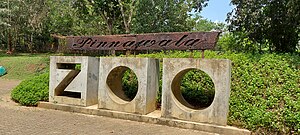
Pinnawala Elephant Orphanage
Elephant orphanage in Sri Lanka
Distance: Approx. 7298 meters
Latitude and longitude: 7.30055556,80.38833333
Pinnawala Elephant Orphanage (Sinhala: පින්නවල අලි අනාථාගාරය), is a captive breeding and conservation institute for wild Asian elephants located at Pinnawala village, 13 km (8.1 mi) northeast of Kegalle town in Sabaragamuwa Province of Sri Lanka. Pinnawala has the largest herd of captive elephants in the world. In 2023, there were 71 elephants, including 30 males and 41 females from 3 generations, living in Pinnawala.

Kegalu Vidyalaya
National school in Kegalle, Sabaragamuwa Province, Sri Lanka
Distance: Approx. 659 meters
Latitude and longitude: 7.25111111,80.34944444
Kegalu Vidyalaya (Sinhala: කෑගලු විද්යාලය; Tamil: கேகளு வித்தியாலய) is a boys' school in Kegalle, Sri Lanka. It was founded on 14 February 1942 and is a Government national school, providing primary and secondary education through 13 grades. It is the largest boys' School in Kegalle.

St. Mary's College, Kegalle
National school in Kegalle, Sabaragamuwa Province, Sri Lanka
Distance: Approx. 613 meters
Latitude and longitude: 7.2525,80.33805556
St. Mary's College (Sinhala: සාන්ත මරියා විදුහල) is a multi-faith school located in Kegalle, Sabaragamuwa Province, Sri Lanka. Established in 1867, it is the oldest boys' school in the city.
A19 highway (Sri Lanka)
Road in Sri Lanka
Distance: Approx. 4219 meters
Latitude and longitude: 7.283551,80.321989
The A19 road is an A-Grade trunk road in Sri Lanka. It connects Polgahawela with Kegalle.
Kegalu Balika Vidyalaya
National school in Kegalle, Sabaragamuwa Province, Sri Lanka
Distance: Approx. 860 meters
Latitude and longitude: 7.24944444,80.35083333
Kegalu Balika Vidyalaya (Sinhala: කෑගලු බලිකා විද්යාලය) is a National Buddhist girls' School in Kegalle, Sri Lanka. The school, the Kegalu Buddhist English Ladies College, was established in 02 November 1943 by the Buddhist Theosophical Society, in response to the prevailing English missionary school system. It was the first Buddhist girls’ school in the Kegalle District.
Molagoda
Village in Sabaragamuwa Province, Sri Lanka
Distance: Approx. 4395 meters
Latitude and longitude: 7.25,80.38333333
Molagoda is a village in Sri Lanka. It is located within Sabaragamuwa Province.
Millennium Elephant Foundation
Zoo in Sabaragamuwa, Sri Lanka
Distance: Approx. 5063 meters
Latitude and longitude: 7.275,80.38333333
Millennium Elephant Foundation (MEF) is an organization and charity set up to rescue and care for captive Asian elephants in Sri Lanka. The foundation is situated on a 15-acre estate by the name of Samaragiri, which is located 10 km (6.2 mi) northwest of Kegalle, within the Sabaragamuwa Province of Sri Lanka. As of 2019 there are 10 elephants that either permanently or temporarily reside at the sanctuary.

Pinnawala Open Zoo
Sri Lankan zoo
Distance: Approx. 7298 meters
Latitude and longitude: 7.30055556,80.38833333
Pinnawala Open Zoo (also called Pinnawala Zoo: Sinhala: පින්නවල සත්වෝද්යානය) is a zoological garden in Pinnawala, Sri Lanka, which is situated closer to the Pinnawala Elephant Orphanage. The zoo was opened for public on 17 April 2015. This is the first open-air zoo in Sri Lanka and second zoo in Sri Lanka after Dehiwala zoo.
ATI Kegalle
Distance: Approx. 1364 meters
Latitude and longitude: 7.2473193,80.3548891
Advanced Technological Institute, Kegalle is one of the Government Institutes for Higher Studies. ATI Kegalle offers Four courses: Higher National Diploma in Information Technology, Higher National Diploma in Accountancy, and Higher National Diploma in English & Higher National Diploma in Project Management.
Weather in this IP's area
broken clouds
23 Celsius
24 Celsius
23 Celsius
23 Celsius
1008 hPa
93 %
1008 hPa
986 hPa
10000 meters
0.43 m/s
0.57 m/s
146 degree
75 %