Country:
Region:
City:
Latitude and Longitude:
Time Zone:
Postal Code:
IP information under different IP Channel
ip-api
Country
Region
City
ASN
Time Zone
ISP
Blacklist
Proxy
Latitude
Longitude
Postal
Route
Luminati
Country
Region
1
City
dehiwala
ASN
Time Zone
Asia/Colombo
ISP
Sri Lanka Telecom Internet
Latitude
Longitude
Postal
IPinfo
Country
Region
City
ASN
Time Zone
ISP
Blacklist
Proxy
Latitude
Longitude
Postal
Route
db-ip
Country
Region
City
ASN
Time Zone
ISP
Blacklist
Proxy
Latitude
Longitude
Postal
Route
ipdata
Country
Region
City
ASN
Time Zone
ISP
Blacklist
Proxy
Latitude
Longitude
Postal
Route
Popular places and events near this IP address

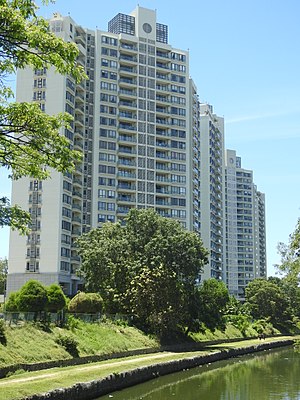
Dehiwala-Mount Lavinia
Suburb in Colombo District, Western Province, Sri Lanka
Distance: Approx. 3316 meters
Latitude and longitude: 6.87305556,79.87583333
Dehiwala-Mount Lavinia (Sinhala: දෙහිවල-ගල්කිස්ස, romanized: Dehivala-Galkissa; Tamil: தெஹிவளை-கல்கிசை, romanized: Tehivaḷai-Kalkicai), population 245,974 (2012), is a large municipality in Sri Lanka, covering 2,109 ha (5,210 acres). It lies south of the Colombo Municipal Council area and is separated from it by the Dehiwala canal which forms the northern boundary of DMMC. Its southern limits lie in Borupana Road and the eastern boundary is Weras Ganga with its canal system and it includes some areas to its east (Pepiliyana, Gangodawila and Kohuwala). This town has experienced extensive population growth and rapid industrialisation and urbanisation in recent years.

Wellawatte
Suburb in Western Province, Sri Lanka
Distance: Approx. 2713 meters
Latitude and longitude: 6.874657,79.860483
Wellawatta is a neighbourhood of Colombo, Sri Lanka. It lies immediately south of Bambalapitiya and is classified as zone 6 within the Colombo Municipal region. The town begins at the old Dutch canal just before the Savoy Cinema and extends south to the same canal that reaches the sea just before the junction at Hospital Road where Dehiwela begins.

Havelock Town
Suburb in Western Province, Sri Lanka
Distance: Approx. 3360 meters
Latitude and longitude: 6.87944444,79.86527778
Havelock Town is a neighbourhood of Colombo, Sri Lanka, part of an area zoned as Colombo 5. It is located approximately 6 kilometres south of Fort, the central business district of Colombo. Havelock City, a mixed-used development in Havelock Town is to be the largest property development in Sri Lanka incorporating residential and commercial facilities.

National Zoological Gardens of Sri Lanka
Zoo in Dehiwala, Colombo
Distance: Approx. 1987 meters
Latitude and longitude: 6.85680556,79.87288889
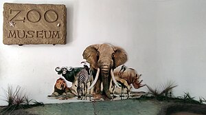
National Zoological Gardens of Sri Lanka (also called Dehiwala Zoo or Colombo Zoo) is a zoological garden in Dehiwala, Sri Lanka, founded in 1936. It is home to various birds, mammals, reptiles, fish and amphibians. The zoo not only exhibits animals from Sri Lanka, but also exhibits species from across Asian and other parts of the globe.

Mount-Lavinia
Suburb in Western Province, Sri Lanka
Distance: Approx. 2133 meters
Latitude and longitude: 6.86666667,79.86666667
Mount Lavinia (Sinhala: ගල්කිස්ස, Tamil: கல்கிசை) is a suburb in Colombo, Sri Lanka located within the administrative boundaries of the Dehiwala-Mount Lavinia municipal limits. The area is a mostly residential suburb, known as Colombo's beach retreat it is famed for its "Golden Mile" of beaches and has long been a hot spot for tourism and nightlife. It is one of the most liberal regions in Sri Lanka and has played host to the island's annual Gay Pride and Rainbow Kite Festival since 2005.

Sri Subodharama Raja Maha Vihara
Sri Lankan historic Buddhist temple
Distance: Approx. 1375 meters
Latitude and longitude: 6.84888889,79.86830556
Sri Subodharama Raja Maha Vihara (Also known as Karagampitiya Vihara) is a historic Buddhist temple situated at Dehiwala in the Western province, Sri Lanka. The temple is located at the Dehiwala junction on the Colombo-Galle main road, about 9 miles south of Colombo city. The temple has been formally recognised by the Government as an archaeological site in Sri Lanka.

Samudrasanna Vihara
Distance: Approx. 2584 meters
Latitude and longitude: 6.82891667,79.86408333
Samudrasanna Vihara ( Sinhala: සමුද්රාසන්න විහාරය) is a historic Buddhist temple situated at Mount-Lavinia in the Western province, Sri Lanka. It is located near to the Templers road junction on the Colombo-Galle main road. The temple has been formally recognised by the Government as an archaeological site in Sri Lanka.

St. Lawrence's Church, Wellawatte
Distance: Approx. 2384 meters
Latitude and longitude: 6.87080556,79.86341667
St. Lawrence's Church is the seat of the Wellawatte parish of Roman Catholic Archdiocese of Colombo. It is located at Galle Road (near Pereira Lane), Wellawatte, Colombo 06.

Christ Church, Galkissa
Church in Sri Lanka
Distance: Approx. 1095 meters
Latitude and longitude: 6.84841667,79.86563889
Christ Church, (also known as the Church of the Open Door) is an Anglican church in Dehiwala-Mount Lavinia in Sri Lanka. The church is located on Colombo-Galle main road (A2) approximately 0.35 km (0.22 mi) away from the Dehiwala junction. It was consecrated on 16 February 1843.
Aishwaraya Lakshmi Amman Temple, Wellawatte
Distance: Approx. 1738 meters
Latitude and longitude: 6.86509,79.8621
Aishwarya Lakshmi Amman Kovil is a Hindu Temple located in the Colombo District, Wellawatte, western province Sri Lanka.
Colombo South Teaching Hospital
Hospital in Colombo, Sri Lanka
Distance: Approx. 2933 meters
Latitude and longitude: 6.86722222,79.87666667
The Colombo South Teaching Hospital (also called Kalubowila Hospital) is located in Kalubowila, Sri Lanka. The University of Sri Jayewardenepura uses the hospital for practical instruction. The hospital hundreds of dengue patients during an epidemic in 2014.
Sri Anjaneyar Kovil
Hindu temple in Western, Sri Lanka
Distance: Approx. 2163 meters
Latitude and longitude: 6.86730556,79.86616667
Sri Anjaneyar Kovil is a Hindu temple situated in Mount Lavinia, in Colombo, Sri Lanka. It is dedicated to God Hanuman, one of the central characters of the Hindu epic Ramayana. Established on 30 June 1996, the temple is considered to be the only Hindu shrine in the country where a statue of Hanuman with Panchamuga (five faced) is found.
Weather in this IP's area
light rain
31 Celsius
38 Celsius
31 Celsius
31 Celsius
1006 hPa
74 %
1006 hPa
1006 hPa
10000 meters
2.75 m/s
2.46 m/s
305 degree
26 %
06:01:20
17:49:40