112.134.187.137 - IP Lookup: Free IP Address Lookup, Postal Code Lookup, IP Location Lookup, IP ASN, Public IP
Country:
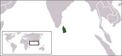
 Sri Lanka
Region:
City:
Location:
Time Zone:
Postal Code:
ISP:
ASN:
language:
User-Agent:
Proxy IP:
Blacklist:
IP information under different IP Channel
ip-api
Country
Region
City
ASN
Time Zone
ISP
Blacklist
Proxy
Latitude
Longitude
Postal
Route
db-ip
Country
Region
City
ASN
Time Zone
ISP
Blacklist
Proxy
Latitude
Longitude
Postal
Route
IPinfo
Country
Region
City
ASN
Time Zone
ISP
Blacklist
Proxy
Latitude
Longitude
Postal
Route
IP2Location
112.134.187.137Country
lkRegion
northern province
City
valvedditturai
Time Zone
Asia/Colombo
ISP
Language
User-Agent
Latitude
Longitude
Postal
ipdata
Country
Region
City
ASN
Time Zone
ISP
Blacklist
Proxy
Latitude
Longitude
Postal
Route
Popular places and events near this IP address

Alvai
Village in Sri Lanka
Distance: Approx. 3653 meters
Latitude and longitude: 9.81666667,80.2
Alvai or Alvaay (Tamil: அல்வாய் Alvāy) is a coastal village in Vadamaraadchi, northern Jaffna Peninsula, Sri Lanka. It is located 30 kilometers (19 mi) from the city of Jaffna or 5 kilometers (3.1 mi) from the town of Point Pedro. Panai Munai (Point Palmyra), the northernmost point of Sri Lanka, is in Alvai.
1989 Valvettiturai massacre
Killing of Sri Lankan Tamil civilians by Indian soldiers
Distance: Approx. 5 meters
Latitude and longitude: 9.81666667,80.16666667
The 1989 Valvettiturai massacre occurred on 2 and 3 August 1989 in the small coastal town of Valvettiturai, on the Jaffna Peninsula in Sri Lanka. Sixty-four Sri Lankan Tamil civilians were killed by soldiers of the Indian Peace Keeping Force. The massacre followed an attack on the soldiers by rebel Liberation Tigers of Tamil Eelam cadres.
1985 Valvettiturai massacre
Distance: Approx. 5 meters
Latitude and longitude: 9.81666667,80.16666667
The 1985 Valvettiturai massacre happened on May 12, 1985 after 2 landmine attacks killed 10 soldiers and an officer in Valvettiturai. 70 minority Sri Lankan Tamil civilians from the town of Valvettithurai (abbreviated as VVT), Sri Lanka were rounded up. They were asked to go inside the town library and then the library was blown up by the Sri Lankan Army killing all of them.

Valvettithurai
Town in Sri Lanka
Distance: Approx. 5 meters
Latitude and longitude: 9.81666667,80.16666667
Valvettithurai (Tamil: வல்வெட்டித்துறை, romanized: Valveṭṭittuṟai; Sinhala: වල්වෙට්ටිතුරෙයි, romanized: Valveṭṭitureyi), sometimes shortened as VVT or Valvai, is a coastal town of Jaffna District on the northeast coast of the Jaffna Peninsula in Northern Province, Sri Lanka governed by an Urban Council of the same name. Valvettithurai was historically known for its seafaring traditions and olden transnational shipping trade. The town is popularly known for being the birthplace of Velupillai Prabhakaran, the head of the Liberation Tigers of Tamil Eelam or the Tamil Tigers, a separatist group that waged a war for an independent state in the North and East.
Kerudavil
Place in Northern Province, Sri Lanka
Distance: Approx. 1832 meters
Latitude and longitude: 9.81666667,80.15
Kerudavil is a small town in Sri Lanka. It is located within Northern Province.
Thondaimanaru
Place in Northern Province, Sri Lanka
Distance: Approx. 3660 meters
Latitude and longitude: 9.81666667,80.13333333
Thondaimanaru is a small town in Sri Lanka. It is located within Northern Province.
Udupiddy
Place in Northern Province, Sri Lanka
Distance: Approx. 1461 meters
Latitude and longitude: 9.80444444,80.16194444
Udupiddy is a small town located in the Jaffna District in the Northern Province of Sri Lanka. Udupiddy roughly translates to "get dressed". The town has a population of 1,414 and an area of 1.217 km².
Valveddi
Town in Northern, Sri Lanka
Distance: Approx. 1825 meters
Latitude and longitude: 9.81666667,80.18333333
Valvetty (Tamil: வல்வெட்டி, romanized: Valveṭṭy), is a small town in Jaffna District in the northeast region of the Jaffna Peninsula in Northern Province, Sri Lanka. It is located south of the larger town of Valvettithurai, and northeast of the small town of Udupiddy.
Udupiddy American Mission College
Public provincial school in Udupiddy, Jaffna District, Sri Lanka
Distance: Approx. 1242 meters
Latitude and longitude: 9.80561111,80.16544444
Udupiddy American Mission College (Tamil: உடுப்பிட்டி அமெரிக்கன் மிஷன் கல்லூரி Uṭuppiṭṭi Amerikkaṉ Micaṉ Kallūri) is a national school in Udupiddy, Sri Lanka. It was founded on 4 January 1852 by American Ceylon Mission. It was started in 1852.
Udupiddy Girls' College
Public provincial school in Udupiddy, Jaffna District, Northern Province, Sri Lanka
Distance: Approx. 1068 meters
Latitude and longitude: 9.80719444,80.16538889
Udupiddy Girls' College (Tamil: உடுப்பிட்டி மகளிர் கல்லூரி Uṭuppiṭṭi Makaḷir Kallūri) is a national school in Udupiddy, Sri Lanka.

Polikandy
Town in Sri Lanka
Distance: Approx. 2408 meters
Latitude and longitude: 9.82361111,80.1875
Polikandy is a town located in Jaffna District, Northern Province, Sri Lanka, governed by an Urban Council. Cities, towns. Places near Polikandy include Point Pedro (which is an extreme point of Sri Lanka), Valvettithurai, Karanavai and Karanavai North.

Thondamannar Bridge
Bridge in Valvettithurai, Jaffna District
Distance: Approx. 5 meters
Latitude and longitude: 9.81666667,80.16666667
Thondamannar Bridge(Tamil: தொண்டைமானாறு பாலம், Thondamanaru Palam) is a road and pedestrian bridge on the Jaffna - Point Pedro highway across the Vadamarachchi Lagoon near the Valvettithurai town of the Northern Province, Sri Lanka in Sri Lanka. It was built in 1953 and destroyed in 1987, and rebuilt afterwards in 2004. The Thondamannar Bridge was primarily used as a barrage since the beginning of its construction period to prevent sea water entering the Vadamarachchi Lagoon that serves as a primary water source for several villages in the neighborhood.
Weather in this IP's area
broken clouds
25 Celsius
25 Celsius
25 Celsius
25 Celsius
1010 hPa
78 %
1010 hPa
1010 hPa
10000 meters
3.55 m/s
4.97 m/s
61 degree
65 %