111.92.22.205 - IP Lookup: Free IP Address Lookup, Postal Code Lookup, IP Location Lookup, IP ASN, Public IP
Country:
Region:
City:
Location:
Time Zone:
Postal Code:
ISP:
ASN:
language:
User-Agent:
Proxy IP:
Blacklist:
IP information under different IP Channel
ip-api
Country
Region
City
ASN
Time Zone
ISP
Blacklist
Proxy
Latitude
Longitude
Postal
Route
db-ip
Country
Region
City
ASN
Time Zone
ISP
Blacklist
Proxy
Latitude
Longitude
Postal
Route
IPinfo
Country
Region
City
ASN
Time Zone
ISP
Blacklist
Proxy
Latitude
Longitude
Postal
Route
IP2Location
111.92.22.205Country
Region
kerala
City
neyyattinkara
Time Zone
Asia/Kolkata
ISP
Language
User-Agent
Latitude
Longitude
Postal
ipdata
Country
Region
City
ASN
Time Zone
ISP
Blacklist
Proxy
Latitude
Longitude
Postal
Route
Popular places and events near this IP address

Neyyattinkara
Suburb of Thiruvananthapuram, Kerala, India
Distance: Approx. 363 meters
Latitude and longitude: 8.4,77.08
Neyyattinkara is a municipal town in Thiruvananthapuram district, Kerala. It also serves as the administrative headquarters of Neyyattinkara Taluk. Nestled along the banks of the Neyyar River, one of the district's principal rivers, the town derives its name from its location, with 'Neyyatinkara' in Malayalam translating to 'the shore of the river Neyyar.' Neyyattinkara ranks as the second most densely populated municipality in the district, following Varkala.
Balaramapuram
Suburb in Kerala, India
Distance: Approx. 1855 meters
Latitude and longitude: 8.38333333,77.08333333
Balaramapuram is one of the panchayats that form the city of Thiruvananthapuram, the capital of Kerala, India. It is the most urbanized panchayat in Thiruvananthapuram. Balaramapuram is the centre for production for traditional varieties of handloom worn in contemporary styles throughout Kerala.

Aruvippuram
Village in Kerala, India
Distance: Approx. 2853 meters
Latitude and longitude: 8.4219,77.09675
Aruvippuram is a village in the southern district of Thiruvananthapuram in Kerala, India. It is famous for the Siva temple established by Sri Narayana Guru. The Guru consecrated the Siva idol, the first non Brahmin to do so in Kerala society, in the year 1888.
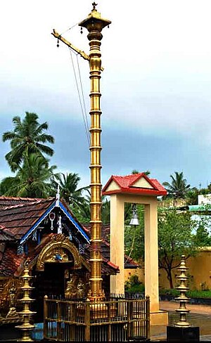
Sree Maha Ganapathy Temple
Hindu Temple
Distance: Approx. 530 meters
Latitude and longitude: 8.401775,77.087762
The Sree Maha Ganapathy temple is located in Thamarakulam, also known as the heart of Kollam. The main deity is Lord Vigneshwara, who is believed to be the person who takes responsibility of the whole region.
Roman Catholic Diocese of Neyyattinkara
Roman Catholic diocese in Kerala, India
Distance: Approx. 660 meters
Latitude and longitude: 8.3955,77.0872
The Roman Catholic Diocese of Neyyattinkara (Latin: Neyyattinkaraen(sis)) is a diocese located in the town of Neyyattinkara in the ecclesiastical province of Trivandrum in India.
Anavoor
Village in Kerala, India
Distance: Approx. 1855 meters
Latitude and longitude: 8.41666667,77.08333333
Anavoor is a village in Thiruvananthapuram district in the state of Kerala, India.

Amaravila
Village in Kerala, India
Distance: Approx. 363 meters
Latitude and longitude: 8.4,77.08
Amaravila is a village in Neyyattinkara town in Trivandrum district, Kerala State, India. Kerala's second largest checkpost after Walayar is situated in Amaravila. This village is situated in NH 47 on the way to Kanyakumari, on the Kerala - Tamil Nadu border.
Neyyattinkara taluk
Taluk in Trivandrum district in Kerala, India
Distance: Approx. 363 meters
Latitude and longitude: 8.4,77.08
Neyyattinkara is a Taluk (tehsil) located in the southern region of Thiruvananthapuram district, in the Indian state of Kerala. This taluk encompasses a total of 21 villages and one municipality, making it the southernmost taluk in the state.
Venpakal
Village in Kerala, India
Distance: Approx. 2586 meters
Latitude and longitude: 8.38388889,77.06638889
Venpakal is a village in Thiruvananthapuram district in the state of Kerala, India.

Neyyattinkara railway station
Railway station in Kerala, India
Distance: Approx. 1196 meters
Latitude and longitude: 8.4105,77.081
Neyyattinkara railway station (station code: NYY) is an NSG–5 category Indian railway station in Thiruvananthapuram railway division of Southern Railway zone. It is a major railway station in Kerala serving the capital Thiruvananthapuram district of Kerala. The station serves as the southern gateway to the capital city Trivandrum.

Amaravila Rameswaram Sri Mahadeva Temple
Ancient Hindu temple in Kerala, India
Distance: Approx. 1226 meters
Latitude and longitude: 8.399,77.09438889
Amaravila Rameswaram Sri Mahadeva Temple , an ancient Hindu temple dedicated to Shiva is situated on the banks of the Neyyar (river) at Amaravila of Neyyattinkara (tehsil) in Thiruvananthapuram District in Kerala state in India. The presiding deity of the temple is Lord Rameswara facing west. It is believed that Amaravila Rameswaram Sri Mahadeva temple is one of the 108 Shiva temples of Kerala and is installed by sage Parasurama dedicated to Shiva.
Panachamoodu
Village in Kerala, India
Distance: Approx. 458 meters
Latitude and longitude: 8.40166,77.0871079
Panachamoodu is a village in Neyyattinkara Taluk in Trivandrum district, Kerala State, India. and also sharing its border with Tamil Nadu.
Weather in this IP's area
few clouds
32 Celsius
33 Celsius
32 Celsius
32 Celsius
1011 hPa
43 %
1011 hPa
1005 hPa
10000 meters
5.19 m/s
5.16 m/s
220 degree
14 %