Country:
Region:
City:
Latitude and Longitude:
Time Zone:
Postal Code:
IP information under different IP Channel
ip-api
Country
Region
City
ASN
Time Zone
ISP
Blacklist
Proxy
Latitude
Longitude
Postal
Route
Luminati
Country
Region
sd
City
karachi
ASN
Time Zone
Asia/Karachi
ISP
Connect Communications
Latitude
Longitude
Postal
IPinfo
Country
Region
City
ASN
Time Zone
ISP
Blacklist
Proxy
Latitude
Longitude
Postal
Route
db-ip
Country
Region
City
ASN
Time Zone
ISP
Blacklist
Proxy
Latitude
Longitude
Postal
Route
ipdata
Country
Region
City
ASN
Time Zone
ISP
Blacklist
Proxy
Latitude
Longitude
Postal
Route
Popular places and events near this IP address

Pan Am Flight 73
1986 airliner hijacking
Distance: Approx. 2680 meters
Latitude and longitude: 24.90666667,67.16083333
Pan Am Flight 73 was a Pan American World Airways flight from Bombay, India, to New York, United States, with scheduled stops in Karachi, Pakistan, and Frankfurt, West Germany. On September 5, 1986, the Boeing 747-121 serving the flight was hijacked while on the ground at Karachi by four armed Palestinian terrorists of the Abu Nidal Organization. The aircraft, with 360 passengers on board, had just arrived from Bombay.
University of Karachi
Public university in Karachi, Pakistan
Distance: Approx. 2877 meters
Latitude and longitude: 24.94,67.12
The University of Karachi (Urdu: ڪراچی يونيورسٹی; informally Karachi University, KU, or UoK) is a public research university located in Karachi, Sindh, Pakistan. Established in June 1951 by an act of Parliament and as a successor to the University of Sindh (which is now located in Jamshoro), the university is a "Sindh Government University" and designed by Mohsin Baig as its chief architect. With a total student body of 41,000 full-time students and a campus size spanning over 1200 acres, Karachi University is one of the largest universities in Pakistan with a distinguished reputation for multi-disciplinary research in science and technology, medical, and social sciences.

All Pakistan Newspapers Society
Pakistani newspaper organization
Distance: Approx. 2866 meters
Latitude and longitude: 24.92415155,67.11391628
All Pakistan Newspapers Society (APNS) is an organization of major Pakistani newspapers, their publishers, companies, and corporations. It includes the Jang Group of Newspapers, Dawn Group of Newspapers, and Nawa-i-Waqt Group of Newspapers.

Safoora Goth
Residential neighbourhood locality in Karachi, Pakistan
Distance: Approx. 1866 meters
Latitude and longitude: 24.916,67.126
Safoora Goth (Urdu: صفورہ گوٹھ) is a neighborhood in the Karachi East district of Karachi, Pakistan. Safoora Goth or Safoora Chowk was previously administered as part of the Gulshan Town borough.

Gulistan-e-Johar
Residential neighborhood locality in Karachi, Pakistan
Distance: Approx. 1386 meters
Latitude and longitude: 24.93333333,67.13333333
Gulistan-e-Jauhar or Gulistan-e-Johar (Urdu: گلستانِ جوہر) is a prominent neighborhood in the Karachi East district of Karachi, Pakistan. Famous for its vibrant culture, Gulistan-e-Jauhar ("Garden of Jauhar") is named after Maulana Mohammad Ali Jauhar, a prominent figure in the Pakistan Movement. The neighborhood is distinguished by a myriad of apartment blocks, contributing to its dynamic urban landscape.
Dow International Medical College
Medical school in Karachi, Pakistan
Distance: Approx. 2274 meters
Latitude and longitude: 24.9438,67.1372
Dow International Medical College (Urdu: ڈاؤ بین القوامی طبی کالج) is a government-owned public sector medical college in Karachi, Sindh, Pakistan, which is recognised by the Pakistan Medical and Dental Council (PMDC) . Admittance is limited to 150 students per year. It is a constituent college of Dow University of Health Sciences Dow University of Health Sciences,.
Karachi Race Club
Distance: Approx. 2498 meters
Latitude and longitude: 24.93222222,67.16527778
Karachi Race Club (KRC) is the biggest race course of Pakistan.

Jinnah International Airport
International airport in Karachi, Pakistan
Distance: Approx. 2680 meters
Latitude and longitude: 24.90666667,67.16083333
Jinnah International Airport (Urdu: جناح بین الاقوامی ہوائی اڈا) (IATA: KHI, ICAO: OPKC), formerly Drigh Road Airport or Karachi Civil Airport, is Pakistan's busiest international and domestic airport, and handled 7,267,582 passengers in 2017–2018. Located in Karachi, the largest city and commercial capital of Pakistan and capital of the province of Sindh, it is named after Muhammad Ali Jinnah, the statesman founder of Pakistan. It is one of the oldest airports in the world.

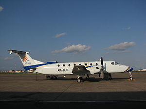
JS Air Flight 201
2010 aviation accident
Distance: Approx. 2322 meters
Latitude and longitude: 24.90527778,67.13194444
On 5 November 2010, JS Air Flight 201, a Beechcraft 1900 passenger aircraft on a charter service from Karachi to the Bhit Shah gas field in Sindh, Pakistan, crashed near Karachi's Jinnah International Airport, after suffering an engine malfunction at take-off. All 21 people on board were killed. The investigation by Pakistan's Civil Aviation Authority concluded that the primary cause of the accident was the "inappropriate skill level" of the captain in dealing with the malfunction, and more generally the flight crew's non-adherence to the procedures prescribed by the aircraft manufacturer in such abnormal circumstances.
2014 Jinnah International Airport attack
Tehrik-i-Taliban attack in Sindh, Pakistan
Distance: Approx. 2680 meters
Latitude and longitude: 24.90666667,67.16083333
On 8 June 2014, 10 militants armed with automatic weapons, a rocket launcher, suicide vests, and grenades attacked Jinnah International Airport in Karachi, Pakistan. 36 people were killed, including all 10 attackers, and 18 others were wounded. The militant organisation Tehrik-i-Taliban Pakistan (TTP) initially claimed responsibility for the attack.
Area Study Center for Europe
Distance: Approx. 2877 meters
Latitude and longitude: 24.94,67.12
The Area Study Centre for Europe (ASCE) (علاقائی دانش گاہ برائے یورپ) is a federally funded autonomous research institute in Karachi. Academic oversight is provided by the University of Karachi. It was established in 1975.
Habib University
University in Karachi, Pakistan
Distance: Approx. 2137 meters
Latitude and longitude: 24.90515,67.13774
Habib University (HU) (Urdu: دانش گاہِ حبیب) is a university for Liberal arts education located in Karachi. Funded by the House of Habib, the Habib University Foundation was established in 2010, and was chartered in 2012 as an independent university. Based on a 6.3 acres (295,800 sq ft.) campus in Gulistan-e-Jauhar, Karachi, it is a multi-disciplinary university offering undergraduate degree's in science, engineering, arts, humanities and social sciences.
Weather in this IP's area
haze
31 Celsius
34 Celsius
31 Celsius
31 Celsius
1014 hPa
58 %
1014 hPa
1011 hPa
4000 meters
3.09 m/s
230 degree
06:43:17
17:47:08