Country:
Region:
City:
Latitude and Longitude:
Time Zone:
Postal Code:
IP information under different IP Channel
ip-api
Country
Region
City
ASN
Time Zone
ISP
Blacklist
Proxy
Latitude
Longitude
Postal
Route
Luminati
Country
ASN
Time Zone
Asia/Karachi
ISP
Connect Communications
Latitude
Longitude
Postal
IPinfo
Country
Region
City
ASN
Time Zone
ISP
Blacklist
Proxy
Latitude
Longitude
Postal
Route
db-ip
Country
Region
City
ASN
Time Zone
ISP
Blacklist
Proxy
Latitude
Longitude
Postal
Route
ipdata
Country
Region
City
ASN
Time Zone
ISP
Blacklist
Proxy
Latitude
Longitude
Postal
Route
Popular places and events near this IP address

Gaddafi Stadium
Cricket ground in Lahore, Pakistan
Distance: Approx. 2060 meters
Latitude and longitude: 31.51333333,74.33333333
Gaddafi Stadium (Punjabi, Urdu: قذافی اسٹیڈیم, romanized: Qaẕẕāfī Isṭeḍiyam), previously known as Lahore Stadium, is a cricket stadium in Lahore, Punjab, Pakistan, owned by the Pakistan Cricket Board (PCB). With a capacity of 27,000, it is the fourth largest cricket stadium of Pakistan. It is the home ground of Lahore Qalandars in the Pakistan Super League.
Alamgir Tower Lahore
Mixed use in Lahore, Pakistan
Distance: Approx. 1255 meters
Latitude and longitude: 31.5145,74.3436
The Alamgir Tower is a high rise building in Lahore, Pakistan. Alamgir Tower had applied for approval of digging 80 feet deep below ground level but the application was not approved. As of August 2011 Alamgir Tower had until on August 20 they paid the fine.

Roman Catholic Archdiocese of Lahore
Roman Catholic archdiocese in Pakistan
Distance: Approx. 2028 meters
Latitude and longitude: 31.53333333,74.33333333
The Roman Catholic Metropolitan Archdiocese of Lahore is a Latin Metropolitan Archdiocese in Punjab province, Pakistan. Its episcopal seat is the Sacred Heart Cathedral in Lahore.
Gora Kabristan, Lahore
Cemetery in Lahore, Pakistan
Distance: Approx. 1178 meters
Latitude and longitude: 31.5339767,74.348965
The Gora Kabristan or Gora Cemetery (Punjabi/Urdu: گورا قبرِستان) in Lahore, Pakistan is one of the oldest Christian cemeteries in Lahore.
2009 attack on the Sri Lanka national cricket team
Attack on cricket team in Pakistan by terrorists
Distance: Approx. 1795 meters
Latitude and longitude: 31.51055556,74.34027778
The 2009 attack on the Sri Lanka national cricket team occurred on 3 March 2009, when a bus carrying Sri Lankan cricketers, part of a larger convoy, was fired upon by 12 gunmen near Gaddafi Stadium in Lahore, Pakistan. The cricketers were on their way to play the third day of the second Test against the Pakistani cricket team. Six members of the Sri Lanka national cricket team were wounded and six Pakistani policemen and two civilians were killed.

Lahore Gymkhana Club
Sports club in Lahore, Pakistan
Distance: Approx. 1636 meters
Latitude and longitude: 31.5382647,74.3525039
The Lahore Gymkhana Club is a gentleman's and sports club, founded in 1878 in Lahore, Pakistan. It offers sports facilities, including golf, swimming, cricket, squash, tennis, billiards, and a gymnasium, and organizes family concerts, lectures, and seminars for its members. The club is spread over 117.03 acres (0.4736 km2).
Esena Foundation High School
Preparatory school in Lahore, Punjab, Pakistan
Distance: Approx. 1296 meters
Latitude and longitude: 31.52277778,74.33777778
Esena Foundation High School (Urdu: ایسنا فاؤنڈیشن ہائی اسکول) was a private fee-paying academic institution for girls only. It was located in Gulberg, Lahore, Punjab, Pakistan.

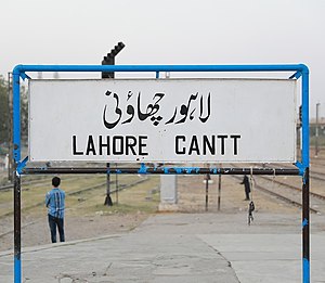
Lahore Cantonment railway station
Railway station in Pakistan
Distance: Approx. 1206 meters
Latitude and longitude: 31.5305,74.3612
Lahore Cantonment Railway Station (Urdu and Punjabi: لاہور کینٹ ریلوے اسٹیشن) is located in Lahore Cantonment, in Lahore district of Pakistan's Punjab province.
Amal Academy
Distance: Approx. 1788 meters
Latitude and longitude: 31.53888,74.357222
Amal Academy (Urdu: عمل اکیڈمی) was founded in 2013 by Stanford University graduates Benje Williams and Kunal Chawla and is funded by Acumen Fund, Stanford Graduate School of Business, Echoing Green and Syed Babar Ali.
Customs Public School
Private school in Pakistan
Distance: Approx. 700 meters
Latitude and longitude: 31.52947222,74.34875
Customs Public School (Urdu: کسٹمز پبلک اسکول), or CPS, was established in 1982 through the joint efforts of Pakistan Customs and Central Excise Lahore. It is a private school located in Gulberg, Lahore, Punjab, Pakistan. The school offers primary education, secondary education, matriculation, and British systems of education, including GCE (O-Level and A-Level).
Punjab Institute of Mental Health
Psychiatric facility in Lahore, Pakistan
Distance: Approx. 2036 meters
Latitude and longitude: 31.53583,74.33545
Punjab Institute of Mental Health is an institute situated in Lahore, Pakistan. It is the largest psychiatric facility in South Asia.
United Christian Hospital, Lahore
Hospital in Lahore, Pakistan
Distance: Approx. 1930 meters
Latitude and longitude: 31.509009,74.340419
United Christian Hospital (UCH) (Urdu: یونائیٹڈ کرسچن ہسپتال) is a 250-bed non-profit hospital located in Lahore, Pakistan. It is affiliated with the Church of Pakistan.
Weather in this IP's area
mist
19 Celsius
19 Celsius
19 Celsius
20 Celsius
1015 hPa
82 %
1015 hPa
991 hPa
600 meters
3 %
06:24:29
17:08:16