111.6.53.117 - IP Lookup: Free IP Address Lookup, Postal Code Lookup, IP Location Lookup, IP ASN, Public IP
Country:
Region:
City:
Location:
Time Zone:
Postal Code:
IP information under different IP Channel
ip-api
Country
Region
City
ASN
Time Zone
ISP
Blacklist
Proxy
Latitude
Longitude
Postal
Route
Luminati
Country
ASN
Time Zone
Asia/Shanghai
ISP
Henan Mobile Communications Co.,Ltd
Latitude
Longitude
Postal
IPinfo
Country
Region
City
ASN
Time Zone
ISP
Blacklist
Proxy
Latitude
Longitude
Postal
Route
IP2Location
111.6.53.117Country
Region
henan
City
anyang
Time Zone
Asia/Shanghai
ISP
Language
User-Agent
Latitude
Longitude
Postal
db-ip
Country
Region
City
ASN
Time Zone
ISP
Blacklist
Proxy
Latitude
Longitude
Postal
Route
ipdata
Country
Region
City
ASN
Time Zone
ISP
Blacklist
Proxy
Latitude
Longitude
Postal
Route
Popular places and events near this IP address

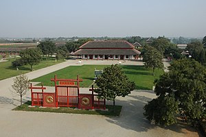
Yinxu
Site of the last capital of the Shang dynasty
Distance: Approx. 3332 meters
Latitude and longitude: 36.12666667,114.31388889
Yinxu (Mandarin pronunciation: [ín.ɕý]; Chinese: 殷墟; lit. 'Ruins of Yin') is a Chinese archeological site corresponding to Yin, the final capital of the Shang dynasty (c. 1600 – c. 1046 BCE). Located in present-day Anyang, Henan, Yin served as the capital during the Late Shang period (c. 1250 – c. 1046 BCE) which spanned the reigns of 12 Shang kings and saw the emergence of oracle bone script, the earliest known Chinese writing.

Anyang
Prefecture-level city in Henan, People's Republic of China
Distance: Approx. 5676 meters
Latitude and longitude: 36.099,114.392
Anyang (simplified Chinese: 安阳; traditional Chinese: 安陽; [án.jǎŋ]) is a prefecture-level city in Henan, China. Geographical coordinates are 35° 41'~ 36° 21' north latitude and 113° 38'~ 114° 59' east longitude. The northernmost city in Henan, Anyang borders Puyang to the east, Hebi and Xinxiang to the south, and the provinces of Shanxi and Hebei to its west and north respectively.

Tomb of Fu Hao
Shang Dynasty royal tomb
Distance: Approx. 2675 meters
Latitude and longitude: 36.12103056,114.31620556
The Tomb of Fu Hao (traditional Chinese: 婦好墓; simplified Chinese: 妇好墓; pinyin: Fù Hǎo Mù) lies within Yinxu, the site of the Late Shang capital, within the modern city of Anyang in Henan, China. The tomb was discovered in 1976 by Zheng Zhenxiang and excavated by the Anyang Working Team of the Archaeological Institute of the Chinese Academy of Social Sciences, who designated the tomb as M5. It is to date the only Shang royal tomb found intact with its contents and excavated by archaeologists.
Beiguan, Anyang
District in Henan, People's Republic of China
Distance: Approx. 4260 meters
Latitude and longitude: 36.1033,114.376
Beiguan District (simplified Chinese: 北关区; traditional Chinese: 北關區; pinyin: Běiguān Qū) is a district of the city of Anyang, Henan province, China.
Wenfeng, Anyang
District in Henan, People's Republic of China
Distance: Approx. 4157 meters
Latitude and longitude: 36.07777778,114.36666667
Wenfeng District (Chinese: 文峰区; pinyin: Wénfēng Qū) is a district in Anyang, Henan province, China.
Yindu, Anyang
District in Henan, People's Republic of China
Distance: Approx. 2616 meters
Latitude and longitude: 36.11,114.303
Yindu District (Chinese: 殷都区; pinyin: Yīndū Qū) is a district of the city of Anyang, Henan province, China. The archeological site of Yinxu is located in Yindu District's Xijiao Township.

Long'an, Anyang
District in Henan, People's Republic of China
Distance: Approx. 3149 meters
Latitude and longitude: 36.08333333,114.3
Long'an District (simplified Chinese: 龙安区; traditional Chinese: 龍安區; pinyin: Lóng'ān Qū) is a district of the city of Anyang, Henan province, China.
Huanbei
Bronze Age archaeological site in China
Distance: Approx. 3560 meters
Latitude and longitude: 36.13,114.34
Huanbei (Chinese: 洹北; pinyin: Huánběi), also known as Huayuanzhuang, is the site of a Bronze Age city on the northern outskirts of the modern city of Anyang in Henan province, China, discovered in 1999. The name refers to its position to the north (běi) of the Huan River. The city seems to have been burnt to the ground after 50 years of occupation, shortly before the construction on the other side of the river of the site now known as Yinxu, the source of the earliest Chinese written records, oracle bones relating to the last nine kings of the Shang dynasty.
Anyang Airport
Airport
Distance: Approx. 4080 meters
Latitude and longitude: 36.13388889,114.34388889
Anyang Airport (IATA: AYN, ICAO: ZHAY) is a military airport in the city of Anyang in Henan Province, China.

Anyang railway station
Railway station in Henan, China
Distance: Approx. 1168 meters
Latitude and longitude: 36.10464722,114.34006944
Anyang railway station (Chinese: 安阳站) is a station on the Beijing–Guangzhou railway in Anyang, Henan. It is the northernmost station operated by CR Zhengzhou on the Beijing–Guangzhou railway.
Xijiao Township
Distance: Approx. 4199 meters
Latitude and longitude: 36.10931,114.28389
Xijiao Township is a township in Yindu District, Anyang, Henan, China. It is divided into Wangyukou Community, Xiliang Village, Dongliang Village, Wangshao Village, Nanliusi Village, Beiliusi Village, Guoliusi Village, Shiche Village, Pianjiazhuang Village, Xiaotun Village, Huayuanzhuang Village, Xiaozhuang Village, Sipanmo Villages, Fanjiazhuang Village, Feng'an Village, Beishiwang Village, Lushiwang Village, Zhaochangzhuang Village and Nanshiwang Village. The Late Shang capital of Yinxu is located in Xiaotun Village, Xijiao.

Anyang funerary bed
Distance: Approx. 5676 meters
Latitude and longitude: 36.099,114.392
The Anyang funerary bed (Chinese: 安阳北齐石棺), also known locally as the Bed of Ts'ao Ts'ao (from the Chinese hero Cao Cao), is a Chinese funerary couch belonging to a Sogdian merchant and official active in China in the 6th century CE. The tomb was discovered in 1911, and the components of the funerary bed were dispersed among various museums in the world after being offered on the art market. It is thought the funerary bed was excavated in Anyang (ancient Zhangdefu), capital of the Northern Qi dynasty. It is stylically dated to the Northern Qi dynasty (550–577 CE).
Weather in this IP's area
clear sky
-5 Celsius
-5 Celsius
-5 Celsius
-5 Celsius
1035 hPa
33 %
1035 hPa
1021 hPa
10000 meters
0.95 m/s
0.94 m/s
315 degree