111.6.29.228 - IP Lookup: Free IP Address Lookup, Postal Code Lookup, IP Location Lookup, IP ASN, Public IP
Country:
Region:
City:
Location:
Time Zone:
Postal Code:
IP information under different IP Channel
ip-api
Country
Region
City
ASN
Time Zone
ISP
Blacklist
Proxy
Latitude
Longitude
Postal
Route
Luminati
Country
ASN
Time Zone
Asia/Shanghai
ISP
Henan Mobile Communications Co.,Ltd
Latitude
Longitude
Postal
IPinfo
Country
Region
City
ASN
Time Zone
ISP
Blacklist
Proxy
Latitude
Longitude
Postal
Route
IP2Location
111.6.29.228Country
Region
henan
City
nanyang
Time Zone
Asia/Shanghai
ISP
Language
User-Agent
Latitude
Longitude
Postal
db-ip
Country
Region
City
ASN
Time Zone
ISP
Blacklist
Proxy
Latitude
Longitude
Postal
Route
ipdata
Country
Region
City
ASN
Time Zone
ISP
Blacklist
Proxy
Latitude
Longitude
Postal
Route
Popular places and events near this IP address

Nanyang, Henan
Prefecture-level city in Henan, People's Republic of China
Distance: Approx. 642 meters
Latitude and longitude: 32.9902,112.5285
Nanyang is a prefecture-level city in the southwest of Henan province, China. The city with the largest administrative area in Henan, Nanyang borders Xinyang to the southeast, Zhumadian to the east, Pingdingshan to the northeast, Luoyang to the north, Sanmenxia to the northwest, the province of Shaanxi to the west, and the province of Hubei to the south. Nanyang is known for its outstanding people and land, producing numerous talents.

Wolong, Nanyang
District in Henan, People's Republic of China
Distance: Approx. 614 meters
Latitude and longitude: 32.9906,112.5284
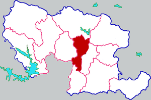
Wolong District (simplified Chinese: 卧龙区; traditional Chinese: 臥龍區; pinyin: Wòlóng Qū) is a District in the center part of Nanyang, in the southwest of Henan province, People's Republic of China. It possesses a total area of 1,017 km2 (393 sq mi), and has a population of 930,000.
Mount Du
Mountain in the country of Japan
Distance: Approx. 9788 meters
Latitude and longitude: 33.07027778,112.58638889
Mount Du (Chinese: 独山; pinyin: Dú Shān), which means Lonely Hill in Chinese, is a small mountain near Nanyang City, Henan province, China.

Wancheng, Nanyang
District in Henan, People's Republic of China
Distance: Approx. 1196 meters
Latitude and longitude: 33.0038,112.5396
Wancheng District (simplified Chinese: 宛城区; traditional Chinese: 宛城區; pinyin: Wǎnchéng Qū) is one of two districts of the city of Nanyang, in the southwest of Henan province, People's Republic of China.
Nanyang Jiangying Airport
Airport serving Nanyang. Henan Province, China
Distance: Approx. 7737 meters
Latitude and longitude: 32.97833333,112.61333333
Nanyang Jiangying Airport (IATA: NNY, ICAO: ZHNY) is an airport serving the city of Nanyang in Henan Province, China. It is located near Jiangying, in Wancheng District, 12 km (7.5 mi) east of the city center. The airport was opened in October 1992 and expanded in 1998.
Wolong Gang
Distance: Approx. 2922 meters
Latitude and longitude: 32.97833333,112.50833333
Wolong Gang (simplified Chinese: 卧龙岗; traditional Chinese: 臥龍崗; pinyin: Wòlóng Gāng) is a cultural site and scenic area in the Chinese city of Nanyang, Henan. It is famous for having been the home of the strategist Zhuge Liang before his rise to prominence during the Three Kingdoms period. Zhuge lived in the area for about ten years, and it is now known by his epithet Wolong 卧龙, which means 'crouching dragon'.
Nanyang Normal University
University in Nanyang, China
Distance: Approx. 4535 meters
Latitude and longitude: 32.975065,112.49025111
The Nanyang Normal University is an ordinary undergraduate college in Henan Province. It was founded in 1951 in Nanyang Normal School of Henan Province. In 1958, it was upgraded to Nanyang Normal College.
Nanyang Institute of Technology
Public college in Nanyang, Henan, China
Distance: Approx. 2793 meters
Latitude and longitude: 32.97371806,112.54919111
The Nanyang Institute of Technology (NYIST) is a public undergraduate college in Nanyang City, Henan Province, China. The school has 19 teaching colleges, covering nine departments of science, engineering, management, literature, economics, education, law, medicine, and art. There are more than 20,000 full-time students and students.
Nanyang Medical College
University in Nanyang, Henan, China
Distance: Approx. 4922 meters
Latitude and longitude: 32.96888889,112.49
The predecessor of Nanyang Medical College was the Nanyang Health College founded in 1951. In 2004, it was approved by the Ministry of Education to be upgraded to Nanyang Medical College. In 2006, the Nanyang Municipal Party Committee and Municipal Government integrated the Nanyang Medical Education Resources, and merged Nanyang Chinese Medicine School with Zhang Zhongjing University of Traditional Chinese Medicine into Nanyang Medical College.

Nanyang railway station
Railway station on Jiaozuo–Liuzhou railway , China
Distance: Approx. 2575 meters
Latitude and longitude: 33.0005,112.5061
Nanyang railway station (simplified Chinese: 南阳火车站; traditional Chinese: 南陽火車站; pinyin: Nányáng huǒchē zhàn is a first-class railway station in Nanyang, Henan, China on the Nanjing–Xi'an railway and Jiaozuo–Liuzhou railway operated byt China Railway Zhengzhou Group.
Weather in this IP's area
clear sky
13 Celsius
11 Celsius
13 Celsius
13 Celsius
1020 hPa
29 %
1020 hPa
1004 hPa
10000 meters
1.97 m/s
1.98 m/s
278 degree
