111.22.119.89 - IP Lookup: Free IP Address Lookup, Postal Code Lookup, IP Location Lookup, IP ASN, Public IP
Country:
Region:
City:
Location:
Time Zone:
Postal Code:
ISP:
ASN:
language:
User-Agent:
Proxy IP:
Blacklist:
IP information under different IP Channel
ip-api
Country
Region
City
ASN
Time Zone
ISP
Blacklist
Proxy
Latitude
Longitude
Postal
Route
db-ip
Country
Region
City
ASN
Time Zone
ISP
Blacklist
Proxy
Latitude
Longitude
Postal
Route
IPinfo
Country
Region
City
ASN
Time Zone
ISP
Blacklist
Proxy
Latitude
Longitude
Postal
Route
IP2Location
111.22.119.89Country
Region
hunan
City
changde
Time Zone
Asia/Shanghai
ISP
Language
User-Agent
Latitude
Longitude
Postal
ipdata
Country
Region
City
ASN
Time Zone
ISP
Blacklist
Proxy
Latitude
Longitude
Postal
Route
Popular places and events near this IP address

Battle of Changde
Battle during the Second Sino-Japanese War
Distance: Approx. 492 meters
Latitude and longitude: 29.0333,111.683
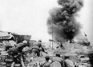
The Battle of Changde (Battle of Changteh; simplified Chinese: 常德会战; traditional Chinese: 常德會戰; pinyin: Chángdé Huìzhàn) was a major engagement in the Second Sino-Japanese War in and around the Chinese city of Changde (Changteh) in the province of Hunan. The purpose of the Japanese offensive was to maintain pressure on the Chinese National Revolutionary Army to reduce its combat ability in the region and its ability to reinforce the Burma Campaign. The Japanese were initially successful in their offensive operation by bacteria-infected bombs and captured parts of the city of Changde, which forced civilians to evacuate.

Changde
Prefecture-level city in Hunan, People's Republic of China
Distance: Approx. 2039 meters
Latitude and longitude: 29.031,111.699
Changde (Chinese: 常德; pinyin: Chángdé; traditional Chinese: 常德區 [ʈʂʰǎŋ.tɤ̌]) is a prefecture-level city in the northwest of Hunan province, People's Republic of China. Changde, known as "Wuling" in ancient times, is located on the west side of Dongting Lake in the south of the Yangtze River, at the foot of Wuling Mountain. It is historically known as "the throat of Sichuan and Guizhou, and the gateway to Yunnan and Guizhou".

Wuling, Changde
District in Hunan, People's Republic of China
Distance: Approx. 3364 meters
Latitude and longitude: 29.0126,111.7044
Wuling District (simplified Chinese: 武陵区; traditional Chinese: 武陵區; pinyin: Wǔlíng Qū) is one of two urban districts in Changde City, Hunan Province, China. Located on the central area of Changde, the district is surrounded by Dingcheng District to the north and south, bordered to the west by Taoyuan County, to the east by Hanshou County. Wuling District has an area of 289 kilometres (180 mi) with 426,694 of registered population (as of 2015).

Dingcheng, Changde
District in Hunan, China
Distance: Approx. 3501 meters
Latitude and longitude: 29.0035,111.6928
Dingcheng District (simplified Chinese: 鼎城区; traditional Chinese: 鼎城區; pinyin: Dǐngchéng Qū) is one of two urban districts in Changde City, Hunan Province, China; it is also the 2nd most populous district (after Heshan District) in Hunan. The district is bordered to the north by Anxiang County, Jinshi City and Linli County, to the west by Taoyuan County, to the north by Anhua and Taojiang Counties, to the east by Hanshou County, Wuling District is in the central west of Dingcheng District. Dingcheng is the largest district by population or by area in Hunan, it has an area of 2,322.5 kilometres (1,443.1 mi) with 764,700 of registered population (as of 2015).
Hunan University of Arts and Science
Provincial public college in Changde, Hunan, China
Distance: Approx. 2436 meters
Latitude and longitude: 29.05166667,111.66666667
The Hunan University of Arts and Science (HUAS; Chinese: 湖南文理学院; lit. 'Hunan Arts and Science College') is a provincial public college in Changde, Hunan, China. Despite its English name, the institute has not been granted university status.
Chengbei Subdistrict, Changde
Subdistrict in Hunan, People's Republic of China
Distance: Approx. 2391 meters
Latitude and longitude: 29.04472222,111.69805556
Chengbei Subdistrict (Chinese: 城北街道; pinyin: Chéngběi Jiēdào; lit. 'city north') is a subdistrict of Wuling District, Changde, Hunan, People's Republic of China. As of 2011, it has four residential communities (居委会) and three villages under its administration.
Changde Vocational and Technical College
College in Changde, China
Distance: Approx. 3776 meters
Latitude and longitude: 29.0381,111.6399
Changde Vocational and Technical College (college code 13039; simplified Chinese: 常德职业技术学院; traditional Chinese: 常德職業技術學院; pinyin: Chángdé Zhíyè Jìshù Xuéyuàn) is a post-secondary institution in Changde, Hunan in China. In 2003 the Changde Agricultural School, the Changde Hygiene School and the Changde Mechatronic Engineering School merged to form the Changde Vocational and Technical College.

Changde railway station
Railway station in Changde, China
Distance: Approx. 4836 meters
Latitude and longitude: 29.0745,111.6894
Changde railway station is a railway station in Wuling District, Changde, Hunan, China on the Shimen–Changsha railway, Qianjiang–Changde railway, and Changde–Yiyang–Changsha high-speed railway. It was built in 1997.
Weather in this IP's area
broken clouds
8 Celsius
7 Celsius
8 Celsius
8 Celsius
1033 hPa
37 %
1033 hPa
1028 hPa
10000 meters
2.26 m/s
2.31 m/s
84 degree
75 %