Country:
 The Philippines
Region:
City:
Latitude and Longitude:
Time Zone:
Postal Code:
IP information under different IP Channel
ip-api
Country
Region
City
ASN
Time Zone
ISP
Blacklist
Proxy
Latitude
Longitude
Postal
Route
IPinfo
Country
Region
City
ASN
Time Zone
ISP
Blacklist
Proxy
Latitude
Longitude
Postal
Route
MaxMind
Country
Region
City
ASN
Time Zone
ISP
Blacklist
Proxy
Latitude
Longitude
Postal
Route
Luminati
Country
PHRegion
03
City
clark
ASN
Time Zone
Asia/Manila
ISP
Converge ICT Solutions Inc.
Latitude
Longitude
Postal
db-ip
Country
Region
City
ASN
Time Zone
ISP
Blacklist
Proxy
Latitude
Longitude
Postal
Route
ipdata
Country
Region
City
ASN
Time Zone
ISP
Blacklist
Proxy
Latitude
Longitude
Postal
Route
Popular places and events near this IP address

Pampanga
Province in Central Luzon, Philippines
Distance: Approx. 2904 meters
Latitude and longitude: 15.07,120.67
Pampanga, officially the Province of Pampanga (Kapampangan: Lalawigan ning Pampanga; Tagalog: Lalawigan ng Pampanga IPA: [pɐmˈpaŋɡa] pəm-PAHNG-ga), is a province in Central Luzon in the Philippines. Lying on the northern shore of Manila Bay, Pampanga is bordered by Tarlac to the north, Nueva Ecija to the northeast, Bulacan to the east, Manila Bay to the central-south, Bataan to the southwest and Zambales to the west. Its capital is the City of San Fernando, the regional center of Central Luzon.

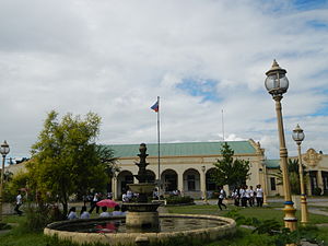
San Fernando, Pampanga
Capital of Pampanga, Philippines
Distance: Approx. 5687 meters
Latitude and longitude: 15.03,120.68
San Fernando, officially the City of San Fernando (Kapampangan: Ciudad/Lakanbalen ning San Fernandu; Filipino: Lungsod ng San Fernando), is a 1st class component city and capital of the province of Pampanga, Philippines. According to the 2020 census, it has a population of 354,666 people. It is the regional center of Central Luzon and located 66 kilometres (41 mi) north of Manila, 72 kilometres (45 mi) east of Subic in Zambales, 58 kilometres (36 mi) south of Tarlac City in Tarlac, and 17 kilometres (11 mi) south of Clark Air Base in Angeles City.

Paskuhan Village
Philippine theme park
Distance: Approx. 5619 meters
Latitude and longitude: 15.05038889,120.69266667
The Paskuhan Village, officially known as the Philippine Christmas Village also known as Hilaga, is a Christmas-themed park located in San Fernando, Pampanga, Philippines. It is operational all year-round and is under the management of the Tourism Infrastructure and Enterprise Zone Authority.
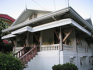
Dayrit–Cuyugan House
Distance: Approx. 5574 meters
Latitude and longitude: 15.0363,120.6844
The Dayrit-Cuyugan House is a Bahay na Bato heritage house in the City of San Fernando, in the province of Pampanga, Philippines. This ancestral house, which exemplifies the architecture prevalent during the American colonial period was declared a Heritage House by the National Historical Institute on 27 January 2003 by virtue of Resolution No. 5, S. 2003.

San Vicente Ferrer Church (Calulut)
Roman Catholic church in Pampanga, Philippines
Distance: Approx. 3212 meters
Latitude and longitude: 15.09509,120.64853
San Vicente Ferrer Parish Church is a Roman Catholic church located in Calulut, San Fernando, Pampanga, Philippines. It is under the jurisdiction of the Archdiocese of San Fernando. Established as a parish in 1914, it originally encompassed 28 barangays from as far as Anao in Mexico to the east, Dolores to the south, Telabastagan to the north and a number of villages of San Fernando on the west side along what is now known as MacArthur Highway.
Pampanga High School
Public high school in Pampanga, Philippines
Distance: Approx. 6191 meters
Latitude and longitude: 15.0314,120.6877
Pampanga National High School (also known as Pampanga High School, or PHS) is a high school in San Fernando, Pampanga, Philippines. It was formerly known as Jose Abad Santos High School. The current main building was completed in 1935, follows Standard Plan No.

Jose B. Lingad Memorial Regional Hospital
Government hospital in Pampanga, Philippines
Distance: Approx. 5712 meters
Latitude and longitude: 15.03443,120.68451
The Jose B. Lingad Memorial General Hospital is located in San Fernando, Pampanga, Philippines. It is a Level III tertiary, training and teaching hospital with 250 authorized beds as mandated by Republic Act (R.A.) 6780 enacted in 1990. The hospital caters to the people of Region III, with the people of Pampanga as its primary catchment area and the nearby provinces of Bataan, Nueva Ecija, Bulacan, Tarlac, Zambales and Aurora as its secondary catchment areas.

San Lorenzo Ruiz Center of Studies and Schools
Private k12 school in San Fernando, Pampanga, Philippines
Distance: Approx. 5943 meters
Latitude and longitude: 15.03786667,120.689725
San Lorenzo Ruiz Center of Studies and Schools (SLRCSS) is a school in Dolores, City of San Fernando, Pampanga serving preschool through the sixth grade and fourth year. It was founded on September 28, 1990, by a group of professional educators.

SM City Pampanga
Shopping mall in Pampanga, Philippines
Distance: Approx. 6229 meters
Latitude and longitude: 15.052615,120.699277
SM City Pampanga is a shopping mall owned and operated by SM Prime Holdings. It is located along the Jose Abad Santos Avenue (formerly Olongapo-Gapan Road) in San Fernando and Mexico in the province of Pampanga. It has a land area of 316,000 m2 (3,400,000 sq ft) and a total gross floor area of 132,484 m2 (1,426,050 sq ft).

St. Scholastica's Academy, Pampanga
Roman Catholic school in Pampanga, Philippines
Distance: Approx. 2621 meters
Latitude and longitude: 15.05387,120.66364
The St. Scholastica's Academy is a private Catholic education institution run by the Congregation of the Missionary Benedictine Sisters of Tutzing in San Fernando City, Pampanga, Philippines. It was founded in June 1925 by the Benedictine Sisters.

Mother Teresa of Calcutta Medical Center
Private hospital in Pampanga, Philippines
Distance: Approx. 1143 meters
Latitude and longitude: 15.065816,120.65379
Mother Teresa of Calcutta Medical Center (MTCMC) is a tertiary hospital in San Fernando, Pampanga, Philippines.
OFW Hospital
Hospital in Pampanga, Philippines
Distance: Approx. 1662 meters
Latitude and longitude: 15.08054,120.6374
The Overseas Filipino Workers (OFW) Hospital and Diagnostic Center, or simply the OFW Hospital, is a specialty hospital in San Fernando, Pampanga, Philippines. It is meant to cater to Filipino migrant workers.
Weather in this IP's area
overcast clouds
25 Celsius
26 Celsius
25 Celsius
25 Celsius
1010 hPa
93 %
1010 hPa
1006 hPa
10000 meters
1.81 m/s
3.15 m/s
11 degree
100 %
05:45:44
18:04:53