110.92.92.116 - IP Lookup: Free IP Address Lookup, Postal Code Lookup, IP Location Lookup, IP ASN, Public IP
Country:
Region:
City:
Location:
Time Zone:
Postal Code:
IP information under different IP Channel
ip-api
Country
Region
City
ASN
Time Zone
ISP
Blacklist
Proxy
Latitude
Longitude
Postal
Route
Luminati
Country
Region
11
City
kawaguchi
ASN
Time Zone
Asia/Tokyo
ISP
JCOM Co., Ltd.
Latitude
Longitude
Postal
IPinfo
Country
Region
City
ASN
Time Zone
ISP
Blacklist
Proxy
Latitude
Longitude
Postal
Route
IP2Location
110.92.92.116Country
Region
tokyo
City
higashimurayama
Time Zone
Asia/Tokyo
ISP
Language
User-Agent
Latitude
Longitude
Postal
db-ip
Country
Region
City
ASN
Time Zone
ISP
Blacklist
Proxy
Latitude
Longitude
Postal
Route
ipdata
Country
Region
City
ASN
Time Zone
ISP
Blacklist
Proxy
Latitude
Longitude
Postal
Route
Popular places and events near this IP address
Higashimurayama, Tokyo
City in Kantō, Japan
Distance: Approx. 533 meters
Latitude and longitude: 35.75461111,139.4685
Higashimurayama (東村山市, Higashi-murayama-shi) is a city located in the western portion of the Tokyo Metropolis, Japan. As of 1 March 2021, the city had an estimated population of 148,275, and a population density of 8700 persons per km2. The total area of the city is 17.14 square kilometres (6.62 sq mi).
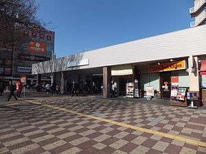
Higashi-Murayama Station
Railway station in Higashimurayama, Tokyo, Japan
Distance: Approx. 1171 meters
Latitude and longitude: 35.76048889,139.46586389
Higashi-Murayama Station (東村山駅, Higashi-Murayama-eki) is a junction passenger railway station located in the city of Higashimurayama, Tokyo, Japan, operated by the private railway operator Seibu Railway.

Hagiyama Station
Railway station in Higashimurayama, Tokyo, Japan
Distance: Approx. 1367 meters
Latitude and longitude: 35.740763,139.476875
Hagiyama Station (萩山駅, Hagiyama-eki) is a passenger railway station located in the city of Higashimurayama, Tokyo, Japan, operated by the private railway operator Seibu Railway. It functions as an interchange between the Seibu Haijima Line and the Seibu Tamako Line, both of which offer through services to the Seibu Shinjuku Line.

Shōfuku-ji (Higashimurayama)
Distance: Approx. 1778 meters
Latitude and longitude: 35.7648,139.4595
Shōfuku-ji (正福寺, lit. Temple of the Correct Fortune) is a Rinzai Zen Buddhist temple in Higashimurayama, Tokyo, Japan. Its early 15th century Jizō hall is a registered National Treasure of Japan.

Ogawa Station (Tokyo)
Railway station in Kodaira, Tokyo, Japan
Distance: Approx. 1423 meters
Latitude and longitude: 35.7375,139.46361111
Ogawa Station (小川駅, Ogawa-eki) is a junction passenger railway station located in the city of Kodaira, Tokyo, Japan, operated by the private railway operator Seibu Railway.

Yasaka Station (Tokyo)
Railway station in Higashimurayama, Tokyo, Japan
Distance: Approx. 548 meters
Latitude and longitude: 35.7451,139.4675
Yasaka Station (八坂駅, Yasaka-eki) is a passenger railway station located in the city of Higashimurayama, Tokyo, Japan, operated by the private railway operator Seibu Railway.

Musashi-Yamato Station
Railway station in Higashimurayama, Tokyo, Japan
Distance: Approx. 2189 meters
Latitude and longitude: 35.7562,139.4439
Musashi-Yamato Station (武蔵大和駅, Musashi-Yamato-eki) is a passenger railway station located in the city of Higashimurayama, Tokyo, Japan, operated by the private railway operator Seibu Railway.

Shin-Kodaira Station
Railway station in Kodaira, Tokyo, Japan
Distance: Approx. 2159 meters
Latitude and longitude: 35.73083333,139.47055556
Shin-Kodaira Station (新小平駅, Shin-Kodaira-eki) is a passenger railway station located in the city of Kodaira, Tokyo, Japan, operated by East Japan Railway Company (JR East).

Kumegawa Station
Railway station in Higashimurayama, Tokyo, Japan
Distance: Approx. 545 meters
Latitude and longitude: 35.7495,139.4729
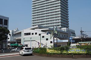
Kumegawa Station (久米川, Kumegawa-eki) is a passenger railway station located in the city of Higashimurayama, Tokyo, Japan, operated by the private railway operator Seibu Railway.

Mayoi no Sakura
Japanese cherry tree in Kodaira, Tokyo
Distance: Approx. 680 meters
Latitude and longitude: 35.74388889,139.46694444
The Guidepost Cherry Tree (迷いの桜, Mayoi no Sakura) is a Japanese cherry tree in Kodaira, Tokyo, Japan originally planted by Nitta Yoshisada in the year 1333.

Tachikawa air disaster
1953 U.S. Air Force plane crash in Japan
Distance: Approx. 2125 meters
Latitude and longitude: 35.7325,139.4575
The Tachikawa air disaster (Japanese: 立川基地グローブマスター機墜落事故, Hepburn: Tachikawa kichi Gurōbumasutā-ki tsuiraku jiko) occurred on the afternoon of Thursday, June 18, 1953, when a United States Air Force (USAF) Douglas C-124 Globemaster II aircraft crashed three minutes after takeoff from Tachikawa, Japan, killing all 129 people on board. At the time, the crash was the deadliest in aviation history.
Statue of Ken Shimura
Statue in Tokyo, Japan
Distance: Approx. 1242 meters
Latitude and longitude: 35.76113889,139.46616667
A bronze statue of Ken Shimura was unveiled in Higashimurayama, Tokyo, Japan, in 2021.
Weather in this IP's area
clear sky
2 Celsius
-1 Celsius
1 Celsius
3 Celsius
1010 hPa
20 %
1010 hPa
1000 hPa
10000 meters
3.09 m/s
270 degree

