Country:
 Pakistan
Region:
City:
Latitude and Longitude:
Time Zone:
Postal Code:
IP information under different IP Channel
ip-api
Country
Region
City
ASN
Time Zone
ISP
Blacklist
Proxy
Latitude
Longitude
Postal
Route
IPinfo
Country
Region
City
ASN
Time Zone
ISP
Blacklist
Proxy
Latitude
Longitude
Postal
Route
MaxMind
Country
Region
City
ASN
Time Zone
ISP
Blacklist
Proxy
Latitude
Longitude
Postal
Route
Luminati
Country
PKRegion
pb
City
lahore
ASN
Time Zone
Asia/Karachi
ISP
National WiMAXIMS environment
Latitude
Longitude
Postal
db-ip
Country
Region
City
ASN
Time Zone
ISP
Blacklist
Proxy
Latitude
Longitude
Postal
Route
ipdata
Country
Region
City
ASN
Time Zone
ISP
Blacklist
Proxy
Latitude
Longitude
Postal
Route
Popular places and events near this IP address

Gaddafi Stadium
Cricket ground in Lahore, Pakistan
Distance: Approx. 1252 meters
Latitude and longitude: 31.51333333,74.33333333
Gaddafi Stadium (Punjabi, Urdu: قذافی اسٹیڈیم, romanized: Qaẕẕāfī Isṭeḍiyam), previously known as Lahore Stadium, is a cricket stadium in Lahore, Punjab, Pakistan, owned by the Pakistan Cricket Board (PCB). With a capacity of 27,000, it is the fourth largest cricket stadium of Pakistan. It is the home ground of Lahore Qalandars in the Pakistan Super League.

Punjab Stadium
Distance: Approx. 1445 meters
Latitude and longitude: 31.51083333,74.33194444
The Punjab Stadium is a football stadium in Lahore, Pakistan. It was nicknamed the "Ian Rush Stadium" after the Liverpool striker visited Pakistan to promote grassroots football in the country.
National Hockey Stadium, Lahore
Distance: Approx. 1161 meters
Latitude and longitude: 31.51111111,74.335
National Hockey Stadium is a purpose-built field hockey stadium in Lahore, Pakistan. Located inside the Nishtar Park Sports Complex, it is the biggest terrace field hockey stadium in the world, having a capacity of 45,000 spectators. The offices of Sports Board Punjab and Pakistan Hockey Federation are also located in the stadium compound.
Alamgir Tower Lahore
Mixed use in Lahore, Pakistan
Distance: Approx. 269 meters
Latitude and longitude: 31.5145,74.3436
The Alamgir Tower is a high rise building in Lahore, Pakistan. Alamgir Tower had applied for approval of digging 80 feet deep below ground level but the application was not approved. As of August 2011 Alamgir Tower had until on August 20 they paid the fine.
Gora Kabristan, Lahore
Cemetery in Lahore, Pakistan
Distance: Approx. 2138 meters
Latitude and longitude: 31.5339767,74.348965
The Gora Kabristan or Gora Cemetery (Punjabi/Urdu: گورا قبرِستان) in Lahore, Pakistan is one of the oldest Christian cemeteries in Lahore.
2009 attack on the Sri Lanka national cricket team
Attack on cricket team in Pakistan by terrorists
Distance: Approx. 756 meters
Latitude and longitude: 31.51055556,74.34027778
The 2009 attack on the Sri Lanka national cricket team occurred on 3 March 2009, when a bus carrying Sri Lankan cricketers, part of a larger convoy, was fired upon by 12 gunmen near Gaddafi Stadium in Lahore, Pakistan. The cricketers were on their way to play the third day of the second Test against the Pakistani cricket team. Six members of the Sri Lanka national cricket team were wounded and six Pakistani policemen and two civilians were killed.
Esena Foundation High School
Preparatory school in Lahore, Punjab, Pakistan
Distance: Approx. 1199 meters
Latitude and longitude: 31.52277778,74.33777778
Esena Foundation High School (Urdu: ایسنا فاؤنڈیشن ہائی اسکول) was a private fee-paying academic institution for girls only. It was located in Gulberg, Lahore, Punjab, Pakistan.

Muslim Town Flyover
Road junction
Distance: Approx. 2177 meters
Latitude and longitude: 31.521,74.3246
Muslim Town Flyover (Punjabi, Urdu: شہرکِ مسلم سر پل, Shahrak-e-Muslim Sar Pul) is a flyover and interchange between Ferozepur Road, Wahdat Road and Canal Bank Road in Lahore, Pakistan. Muslim Town Flyover is the longest flyover of Pakistan with a length of about 2.6 km (1.6 mi).
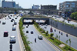
Kalma Underpass
Road junction
Distance: Approx. 1834 meters
Latitude and longitude: 31.504382,74.331527
Kalma Underpass (Urdu: کلمہ زیرگذر) is an underpass where east-west Main Boulevard Garden Town and Main Boulevard Gulberg join under north-south Ferozepur Road, connecting two southern suburbs of Lahore, Pakistan.
Quaid e Azam International Cycling Velodrome
Distance: Approx. 1590 meters
Latitude and longitude: 31.511966,74.330002
The Quaid e Azam International Cycling Velodrome is a velodrome in Lahore, Pakistan; it is the only velodrome in Pakistan and was constructed in 1954, though plans exist to build a velodrome in Peshawar. However, its condition had deteriorated to the point that by 2011, Pakistan's Senate Standing Committee on Sports had become concerned about its continuing suitability.
Customs Public School
Private school in Pakistan
Distance: Approx. 1637 meters
Latitude and longitude: 31.52947222,74.34875
Customs Public School (Urdu: کسٹمز پبلک اسکول), or CPS (established in 1982; In the Joint efforts of Pakistan Customs and Central Excise Lahore) is a private school situated in Gulberg, Lahore, Punjab, Pakistan. It offers primary education, secondary education, matriculation and British systems of education GCE (O-Level)(A-Level). Candidates are admitted on the basis of an admission test and an interview.
United Christian Hospital, Lahore
Hospital in Lahore, Pakistan
Distance: Approx. 867 meters
Latitude and longitude: 31.509009,74.340419
United Christian Hospital (UCH) (Urdu: یونائیٹڈ کرسچن ہسپتال) is a 250-bed non-profit hospital located in Lahore, Pakistan. It is affiliated with the Church of Pakistan.
Weather in this IP's area
smoke
26 Celsius
26 Celsius
23 Celsius
26 Celsius
1011 hPa
65 %
1011 hPa
987 hPa
4000 meters
05:59:27
17:41:41