Country:
 Thailand
Region:
City:
Latitude and Longitude:
Time Zone:
Postal Code:
IP information under different IP Channel
ip-api
Country
Region
City
ASN
Time Zone
ISP
Blacklist
Proxy
Latitude
Longitude
Postal
Route
IPinfo
Country
Region
City
ASN
Time Zone
ISP
Blacklist
Proxy
Latitude
Longitude
Postal
Route
MaxMind
Country
Region
City
ASN
Time Zone
ISP
Blacklist
Proxy
Latitude
Longitude
Postal
Route
Luminati
Country
THRegion
10
City
bangkok
ASN
Time Zone
Asia/Bangkok
ISP
HUAWEI CLOUDS
Latitude
Longitude
Postal
db-ip
Country
Region
City
ASN
Time Zone
ISP
Blacklist
Proxy
Latitude
Longitude
Postal
Route
ipdata
Country
Region
City
ASN
Time Zone
ISP
Blacklist
Proxy
Latitude
Longitude
Postal
Route
Popular places and events near this IP address

Bueng Kum district
Khet in Bangkok, Thailand
Distance: Approx. 3928 meters
Latitude and longitude: 13.78527778,100.66916667
Bueng Kum (Thai: บึงกุ่ม, pronounced [bɯ̄ŋ kùm]) is one of the 50 districts (Khet) of Bangkok, Thailand. From north clockwise, it is bounded by Bang Khen, Khan Na Yao, Saphan Sung, Bang Kapi, and Lat Phrao.
Satriwitthaya 2 School
Public school in Bangkok, Thailand
Distance: Approx. 5418 meters
Latitude and longitude: 13.831,100.6158
Satriwitthaya 2 School In the royal patronage of the princess mother, Srinagarindra (โรงเรียนสตรีวิทยา 2 ในพระราชูปถัมภ์สมเด็จพระศรีนครินทราบรมราชชนนี), with 5333 students, is the most populous high school in Thailand.

Siam Amazing Park
Amusement and water park in the Khan Na Yao District of Bangkok, Thailand
Distance: Approx. 3895 meters
Latitude and longitude: 13.805242,100.697229
Siam Amazing Park (Thai: สยามอะเมซิ่งพาร์ค), more commonly known as Siam Park City or Suansiam (สวนสยาม, RTGS: Suan Sayam, pronounced [sǔa̯n sā.jǎːm]), is an amusement and water park located in the Khan Na Yao district of Bangkok, Thailand. It was founded in November 1980 and remains the oldest amusement and water park complex in Southeast Asia. Located near Bangkok's Suvarnabhumi Airport, it contains attractions such as Southeast Asia's first suspended looping coaster with five inversions, a large wave pool and seven-story slides.

Fashion Island (Bangkok)
Shopping mall in Bangkok
Distance: Approx. 1672 meters
Latitude and longitude: 13.825803,100.679096
Fashion Island is a shopping mall located on Ramintra Road, in Khan Na Yao District outskirt of Bangkok, Thailand. Fashion Island is currently ranked as the Twenty-sixth largest mall in the World along with Dubai Mall and West Edmonton Mall (once biggest mall in the world until 2004). The shopping mall featured an amusement park with a monorail circling around the mall.
Highway 351 (Thailand)
Road in Thailand
Distance: Approx. 5195 meters
Latitude and longitude: 13.830759,100.61786
Prasert Manukit Road (Thai: ถนนประเสริฐมนูกิจ) or Highway 351, commonly known as Kaset-Nawamin Road (Thai: ถนนเกษตร-นวมินทร์), is a highway in Bangkok, Thailand. It begins at Kasetsart Intersection on Phahonyothin Road, Chatuchak district, as a continuation after the end of Ngamwongwan Road, and runs east until its end at a three-way intersection with Nawamin Road, in Bueng Kum district. Its total length is 9.178 km.
Niva International School
Private school in Bangkok, Thailand
Distance: Approx. 3900 meters
Latitude and longitude: 13.803033,100.633307
NIVA American International School (Thai: โรงเรียนนานาชาตินีวาอเมริกัน, RTGS: Rong Rian Nana Chat Niwa Amerikan) is a privately owned coeducational school located in Bang Kapi District, Bangkok, Thailand. NIVA is a K-12 school with approximately 350 students. The international school was founded in 1991.

Wat Bueng Thonglang
Distance: Approx. 4856 meters
Latitude and longitude: 13.79666667,100.62694444
Wat Bueng Thonglang (Thai: วัดบึงทองหลาง, pronounced [wát bɯ̄ŋ tʰɔ̄ːŋ.lǎːŋ]) is a Buddhist temple in Bang Kapi District, Bangkok, Thailand. It was measured under Theravada School, Section of Maha Nikai. It is located at Lat Phrao 101 Road.

Khwan Riam Floating Market
Distance: Approx. 5389 meters
Latitude and longitude: 13.8001,100.71
Khwan Riam Floating Market (Thai: ตลาดน้ำขวัญเรียม, pronounced [tā.làːt náːm kʰwǎn rīam]) is one of the central floating markets of Bangkok, Thailand. It located between Soi Seri Thai 60 and Soi Ramkhamhaeng 187 in Min Buri District, eastern Bangkok. The name of the market "Khwan Riam" comes from the name of main characters in Thai romance-drama novel titled Phlae Kao.
Klong Chan Sports Center
Multi-purpose stadium in Thailand
Distance: Approx. 5158 meters
Latitude and longitude: 13.778111,100.644962
Klong Chan Sports Center (Thai: สนามกีฬาการเคหะแห่งชาติคลองจั่น) is a multi-purpose stadium in Bang Kapi, Bangkok, Thailand. It is currently used mostly for football matches.
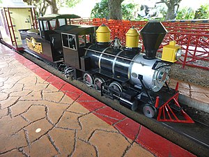
Siam Park City Railway
Distance: Approx. 3466 meters
Latitude and longitude: 13.805675,100.693003
Siam Amazing Park Railway is a former miniature railway at Siam Park City in Bangkok.
Nopparat Rajathanee Hospital
Hospital in Bangkok , Thailand
Distance: Approx. 2541 meters
Latitude and longitude: 13.817454,100.688026
Nopparat Rajathanee Hospital (Thai: โรงพยาบาลนพรัตนราชธานี) is a hospital located in Khan Na Yao District, Bangkok, Thailand. It is a main teaching hospital for the College of Medicine, Rangsit University. It is also an affiliated teaching hospital of the Faculty of Medicine Siriraj Hospital, Mahidol University, the Faculty of Medicine, Srinakharinwirot University and Phramongkutklao College of Medicine.

Lat Phrao subdistrict
Khwaeng in Thailand
Distance: Approx. 5345 meters
Latitude and longitude: 13.81708333,100.61536111
Lat Phrao (Thai: ลาดพร้าว, pronounced [lâːt pʰráːw]) is a khwaeng (subdistrict) of Lat Phrao district, Bangkok.
Weather in this IP's area
moderate rain
30 Celsius
35 Celsius
29 Celsius
31 Celsius
1007 hPa
68 %
1007 hPa
1006 hPa
10000 meters
4.12 m/s
250 degree
20 %
06:06:12
18:24:12