Country:
 Australia
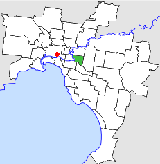
Region:
City:
Latitude and Longitude:
Time Zone:
Postal Code:
IP information under different IP Channel
ip-api
Country
Region
City
ASN
Time Zone
ISP
Blacklist
Proxy
Latitude
Longitude
Postal
Route
IPinfo
Country
Region
City
ASN
Time Zone
ISP
Blacklist
Proxy
Latitude
Longitude
Postal
Route
MaxMind
Country
Region
City
ASN
Time Zone
ISP
Blacklist
Proxy
Latitude
Longitude
Postal
Route
Luminati
Country
AURegion
vic
City
melbourne
ASN
Time Zone
Australia/Melbourne
ISP
TPG Telecom Limited
Latitude
Longitude
Postal
db-ip
Country
Region
City
ASN
Time Zone
ISP
Blacklist
Proxy
Latitude
Longitude
Postal
Route
ipdata
Country
Region
City
ASN
Time Zone
ISP
Blacklist
Proxy
Latitude
Longitude
Postal
Route
Popular places and events near this IP address

Swinburne University of Technology
Public university in Hawthorn, Australia
Distance: Approx. 875 meters
Latitude and longitude: -37.82111111,145.03833333
The Swinburne University of Technology (or simply Swinburne) is a public research university in Melbourne, Australia. It is the modern descendant of the Eastern Suburbs Technical College established in 1908 that was renamed Swinburne Technical College in 1913 after its co-founders George and Ethel Swinburne. It has three campuses in metropolitan Melbourne in Hawthorn, where its main campus is located, Wantirna and Croydon as well as a campus in the East Malaysian state of Sarawak.

Hawthorn, Victoria
Suburb of Melbourne, Victoria, Australia
Distance: Approx. 834 meters
Latitude and longitude: -37.826,145.034
Hawthorn is an inner suburb of Melbourne, Victoria, Australia, 6 kilometres (3.7 mi) east of Melbourne's central business district, located within the City of Boroondara local government area. Hawthorn recorded a population of 22,322 at the 2021 census.

Hawthorn railway station, Melbourne
Railway station in Melbourne, Australia
Distance: Approx. 540 meters
Latitude and longitude: -37.8219,145.0229
Hawthorn railway station is a commuter railway station on the Alamein, Belgrave and Lilydale lines, which are all part of the Melbourne railway network. It serves the eastern suburb of Hawthorn, in Melbourne, Victoria, Australia. Hawthorn station is a ground level unstaffed station, featuring three platforms, an island platform with two faces and one side platform.

Glenferrie railway station
Railway station in Melbourne, Australia
Distance: Approx. 745 meters
Latitude and longitude: -37.8216,145.0367
Glenferrie railway station is a commuter railway station on the Alamein, Belgrave and Lilydale lines, which are all part of the Melbourne railway network. It serves the eastern suburb of Hawthorn, in Melbourne, Victoria, Australia. Glenferrie station is an elevated structure premium station, featuring three platforms, an island platform with two faces and one side platform.
Xavier College
Roman catholic school in Melbourne, Australia
Distance: Approx. 899 meters
Latitude and longitude: -37.81222222,145.03166667
Xavier College is a Roman Catholic, day and boarding school predominantly for boys, founded in 1872 by the Society of Jesus, with its main campus located in Kew, an eastern suburb of Melbourne, Victoria, Australia. Classes started in 1878. The college is part of the international network of Jesuit schools begun in Messina, Sicily in 1548.

Glenferrie Oval
Australian rules football stadium in Hawthorn, Melbourne, Victoria, Australia
Distance: Approx. 383 meters
Latitude and longitude: -37.82055556,145.03277778
Glenferrie Oval is an Australian rules football stadium located in Hawthorn, a suburb of Melbourne, Victoria, Australia. It is the historic home of, and is synonymous with, the Hawthorn Football Club, who played there from 1903 and as a VFL/AFL club from 1925–1973, and retained the ground as an administrative and training base until 2006. Hawthorn moved to a redeveloped Waverley Park early in 2006 in preparation for the 2006 AFL season.
Barker railway station
Former railway station in Victoria, Australia
Distance: Approx. 592 meters
Latitude and longitude: -37.8147,145.0299
Barker railway station was the only intermediate station on the Kew railway line in Melbourne, Australia. It was opened on 19 December 1887 and closed with the line on 13 May 1957. The station was located between Barkers Road and Hawthorn Grove and has since been demolished.

Victorian Telecommunications Museum
Heritage telecommunications collection
Distance: Approx. 758 meters
Latitude and longitude: -37.82255833,145.03643611
The Victorian Telecommunications Museum was a small museum in the Hawthorn Telephone Exchange, Burwood Road, Hawthorn, Victoria, Australia. It housed historical telecommunications equipment that had been used by what originally was called the Postmaster-General's Department. The department split in 1975 into Telecom Australia and Australia Post.
City of Hawthorn
Local government area in Victoria, Australia
Distance: Approx. 745 meters
Latitude and longitude: -37.8216,145.0367
The City of Hawthorn was a local government area about 4 kilometres (2.5 mi) east of Melbourne, the state capital of Victoria, Australia, on the southeast bank of the Yarra River. The city covered an area of 9.71 square kilometres (3.75 sq mi), and existed from 1860 until 1994.
Rossbourne School
Special school in Australia
Distance: Approx. 370 meters
Latitude and longitude: -37.82277778,145.02638889
Rossbourne School is an independent, non denominational, co-educational special school located in Hawthorn, Victoria, Australia, that was founded in 1967. Rossbourne serves students who have had difficulties in mainstream schools due to the demands, both educational and social, of mainstream education. Many of the students have an identifiable learning disability, such as dyslexia, a condition such as ADHD, or an autism-spectrum disorder.

Hawthorn Arts Centre
Arts building in Melbourne, Australia
Distance: Approx. 756 meters
Latitude and longitude: -37.82305556,145.03611111
The Hawthorn Arts Centre (formerly the Hawthorn Town Hall) is a former civic building located in Hawthorn, a suburb of Melbourne, Australia. Designed by architect John Beswicke in the Second Empire style, the hall was built from 1888 to 1890 and housed the council chambers for the City of Hawthorn. After the City of Hawthorn was dissolved in 1994 and absorbed into the newly created City of Boroondara, the building was used as a library, museum and gallery space.

Hawthorn tram depot
Distance: Approx. 903 meters
Latitude and longitude: -37.8274,145.0246
Hawthorn tram depot was built in April 1916 by the Hawthorn Tramways Trust (HTT). It was built on the corner of Power Street and Wallen Road, Hawthorn, a suburb of Melbourne, Australia. It is also known as the Melbourne Tram Museum.
Weather in this IP's area
clear sky
11 Celsius
10 Celsius
10 Celsius
13 Celsius
1019 hPa
65 %
1019 hPa
1016 hPa
10000 meters
2.9 m/s
7.69 m/s
10 degree
06:41:43
19:31:47