Country:
 Australia
Region:
City:
Latitude and Longitude:
Time Zone:
Postal Code:
IP information under different IP Channel
ip-api
Country
Region
City
ASN
Time Zone
ISP
Blacklist
Proxy
Latitude
Longitude
Postal
Route
IPinfo
Country
Region
City
ASN
Time Zone
ISP
Blacklist
Proxy
Latitude
Longitude
Postal
Route
MaxMind
Country
Region
City
ASN
Time Zone
ISP
Blacklist
Proxy
Latitude
Longitude
Postal
Route
Luminati
Country
AURegion
wa
City
perth
ASN
Time Zone
Australia/Perth
ISP
TPG Telecom Limited
Latitude
Longitude
Postal
db-ip
Country
Region
City
ASN
Time Zone
ISP
Blacklist
Proxy
Latitude
Longitude
Postal
Route
ipdata
Country
Region
City
ASN
Time Zone
ISP
Blacklist
Proxy
Latitude
Longitude
Postal
Route
Popular places and events near this IP address

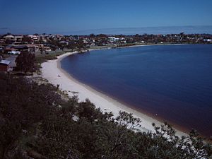
City of Melville
Local government area in Western Australia
Distance: Approx. 1463 meters
Latitude and longitude: -32.039,115.831
The City of Melville is a local government area in the southern suburbs of the Western Australian capital city of Perth, east of the port city of Fremantle and about 12 kilometres (7.5 mi) south of Perth's central business district. The City covers an area of 52.73 square kilometres (20.36 sq mi) and had a population of about 98,000 as at the 2016 Census.

Booragoon, Western Australia
Suburb of Perth, Western Australia
Distance: Approx. 1472 meters
Latitude and longitude: -32.0395384,115.8336757
Booragoon is a southern suburb of Perth, Western Australia, located within the City of Melville. Booragoon is the indigenous name for the lower reaches of the Canning River. It is home to Westfield Booragoon (formerly the Garden City Shopping Centre) and the council offices for the City of Melville.

Booragoon bus station
Bus station in Western Australia
Distance: Approx. 1079 meters
Latitude and longitude: -32.036,115.837
Booragoon bus station is a Transperth bus station located next to the Westfield Booragoon shopping centre in Booragoon, Western Australia. It has 13 stands and is served by nine Transperth routes, in addition to a number of school buses and School Special services. The original Booragoon bus station opened in September 1976.

Ardross, Western Australia
Suburb of Perth, Western Australia
Distance: Approx. 81 meters
Latitude and longitude: -32.0271228,115.8355245
Ardross is a suburb of Perth, Western Australia, located within the City of Melville. It was once an area of land acquired by the Scotsman, Sir Alexander Percival Matheson in 1896. In Matheson's subdivision of the adjoining suburb of Applecross, he created "Ardross Street" naming it after either the town of Ardrossan on the Scottish west coast or Ardross Castle, located about 40 kilometres north of Inverness.
Alfred Cove, Western Australia
Suburb of Perth, Western Australia
Distance: Approx. 1876 meters
Latitude and longitude: -32.0328506,115.8170316
Alfred Cove is a southern suburb of Perth, Western Australia. Its local government area is the City of Melville.

Applecross, Western Australia
Suburb of Perth, Western Australia
Distance: Approx. 1418 meters
Latitude and longitude: -32.0137091,115.8366566
Applecross is an affluent riverside suburb of Perth, Western Australia, bounded by Canning Highway and the Swan River. It is located within the City of Melville.

Mount Pleasant, Western Australia
Suburb of Perth, Western Australia
Distance: Approx. 1294 meters
Latitude and longitude: -32.028214,115.8489476
Mount Pleasant is a suburb of Perth, Western Australia, located within Wajuk country, and the City of Melville, on the Canning River. It is bounded by Canning Highway to the north, the Canning River to the east, Cranford Avenue, Moolyeen Road and Canning Avenue to the south, and Rogerson Road, Coomoora Road, Henley Road and Ardross Street to the west. Mount Pleasant Primary School is located entirely within the boundaries of Mount Pleasant, and Brentwood Primary School abuts Mount Pleasant in the south west of Mount Pleasant just south of Blue Gum Park.

Applecross Senior High School
Public co-educational high school in Australia
Distance: Approx. 351 meters
Latitude and longitude: -32.0295114,115.8348206
Applecross Senior High School is a public co-educational high school, located in Ardross, a southern suburb of Perth, Western Australia. Founded in 1958, Applecross Senior High School has traditionally been one of the leading public high schools in Western Australia and consistently ranks academically within the top ten secondary schools in the state. Applecross has produced two Rhodes Scholars.
Westfield Booragoon
Major regional shopping centre in the city of Perth, Western Australia
Distance: Approx. 845 meters
Latitude and longitude: -32.033969,115.836028
Westfield Booragoon (formerly known as Garden City) is a major regional shopping centre in the city of Perth, Western Australia. Westfield Booragoon is located at the corner of Marmion Street and Riseley Street in the southern suburb of Booragoon. 50% of the shopping complex is owned by Dexus with the remaining 50% owned by Scentre Group which owns and operates its properties under the Westfield name from which the company is derived.

Booragoon Lake
Lake in Perth, Western Australia
Distance: Approx. 2126 meters
Latitude and longitude: -32.04444444,115.84277778
Booragoon Lake is a small freshwater lake in suburban Perth, Western Australia. The freshwater lake is situated in the suburb of Booragoon and is bounded by Leach Highway, Lang Street and Aldridge Road. It makes up part of the eastern wetland of the Beeliar Regional Park along with Blue Gum Lake and North Lake.

Wireless Hill Park
Park in Ardross, Western Australia
Distance: Approx. 802 meters
Latitude and longitude: -32.02921,115.82758
Wireless Hill Park is a 40-hectare (99-acre) park in Ardross, Western Australia that is the location of the former Applecross Wireless Station, an early radio station in Western Australia. The station buildings have been preserved and now house the Wireless Hill Museum. The site is listed in the Register of the National Estate and the State Register of Heritage Places.
Mount Pleasant Baptist Church
Church in Australia
Distance: Approx. 1848 meters
Latitude and longitude: -32.0403,115.8247
Mount Pleasant Baptist Church is a Baptist church in the suburb of Booragoon, in Perth, Western Australia, Australia. The church is affiliated with the Australian Baptist Ministries.
Weather in this IP's area
clear sky
16 Celsius
16 Celsius
15 Celsius
18 Celsius
1025 hPa
51 %
1025 hPa
1022 hPa
10000 meters
4.12 m/s
120 degree
05:43:58
18:23:34