Country:
 Australia
Region:
City:
Latitude and Longitude:
Time Zone:
Postal Code:
IP information under different IP Channel
ip-api
Country
Region
City
ASN
Time Zone
ISP
Blacklist
Proxy
Latitude
Longitude
Postal
Route
IPinfo
Country
Region
City
ASN
Time Zone
ISP
Blacklist
Proxy
Latitude
Longitude
Postal
Route
MaxMind
Country
Region
City
ASN
Time Zone
ISP
Blacklist
Proxy
Latitude
Longitude
Postal
Route
Luminati
Country
AURegion
wa
City
perth
ASN
Time Zone
Australia/Perth
ISP
TPG Telecom Limited
Latitude
Longitude
Postal
db-ip
Country
Region
City
ASN
Time Zone
ISP
Blacklist
Proxy
Latitude
Longitude
Postal
Route
ipdata
Country
Region
City
ASN
Time Zone
ISP
Blacklist
Proxy
Latitude
Longitude
Postal
Route
Popular places and events near this IP address
Eden Hill, Western Australia
Suburb of Perth, Western Australia
Distance: Approx. 2087 meters
Latitude and longitude: -31.891,115.944
Eden Hill is an eastern suburb of Perth, Western Australia, located within the Town of Bassendean. The origin of its name is unknown, either coming from a farm in the area or an estate name used by Henry Brockman when he subdivided the area in 1892. It was approved as a suburb in 1954.

Beechboro, Western Australia
Suburb of Perth, Western Australia
Distance: Approx. 1191 meters
Latitude and longitude: -31.862,115.939
Beechboro is a suburb of Perth, Western Australia, located within the City of Swan.

Electoral district of Bassendean
State electoral district in Perth, Western Australia
Distance: Approx. 1927 meters
Latitude and longitude: -31.89,115.94
Bassendean is an electoral district of the Legislative Assembly in the Australian state of Western Australia. The district is based in the eastern suburbs of Perth. It is a safe Labor seat.
Kiara, Western Australia
Suburb of Perth, Western Australia
Distance: Approx. 1035 meters
Latitude and longitude: -31.882,115.939
Kiara is a suburb of Perth, Western Australia, situated approximately 11 kilometres (7 mi) northeast of Perth's central business district and 8 kilometres (5 mi) from Midland, and located within the City of Swan local government area. Schools in Kiara are Kiara College and Good Shepherd Catholic School.
Lockridge, Western Australia
Suburb of Perth, Western Australia
Distance: Approx. 1182 meters
Latitude and longitude: -31.881,115.947
Lockridge is a suburb of Perth, in the Bassendean division of Western Australia, and the City of Swan local government area. Land was first granted in the area to Edward Hamersley in 1837. Lockridge's name is derived from that of Lockeridge House, a property built by Edward Hamersley's son, Samuel Hamersley, in 1874.

Bennett Brook Railway
Tourist oriented railway
Distance: Approx. 3095 meters
Latitude and longitude: -31.8452,115.944
The Bennett Brook Railway is a 2 ft (610 mm) narrow gauge tourist oriented railway operated by the West Australian Light Railway Preservation Association and is located within the boundaries of Whiteman Park, 19 kilometres (12 mi) from Perth.
Bennett Springs, Western Australia
Suburb of Perth, Western Australia
Distance: Approx. 1621 meters
Latitude and longitude: -31.859,115.945
Bennett Springs is a northeastern suburb of Perth, Western Australia, located in the City of Swan. Formed from parts of the suburbs of Beechboro, Whiteman and West Swan, it was originally a subdivision from Beechboro until April 2011 when it was gazetted following a 10-year campaign by residents. The suburb was named after Matilda Bennett, the wife of John Septimus Roe.

Morley railway station, Perth
Proposed railway station in Perth, Western Australia
Distance: Approx. 3166 meters
Latitude and longitude: -31.896,115.92
Morley railway station is a suburban rail and bus interchange station under construction as part of the Metronet Morley–Ellenbrook railway line, serving the Perth suburbs of Bayswater, Embleton and Morley. It is to be built in the median strip of Tonkin Highway at Broun Avenue.

Noranda railway station
Proposed railway station in Australia
Distance: Approx. 2009 meters
Latitude and longitude: -31.874,115.918
Noranda railway station is a suburban rail station under construction as part of the Transperth network. It is planned to open in 2024 as a station on the Morley–Ellenbrook railway line, serving the Perth suburbs of Beechboro, Kiara and Noranda. It is being built in the median of Tonkin Highway, just north of Benara Road.
Ballajura railway station
Under-construction railway station in Perth, Western Australia
Distance: Approx. 3150 meters
Latitude and longitude: -31.849,115.921
Ballajura railway station is an unopened suburban railway station on the Morley–Ellenbrook line in Perth, Western Australia. The station is located east of Tonkin Highway, north of Marshall Road, and west of Beechboro Road North, within the rural area of Whiteman, and near the residential areas of Ballajura, Beechboro, and Bennett Springs. Ballajura station consists of an island platform with entrances to the north and south via a bridge.

Hampton Senior High School
School in Australia
Distance: Approx. 2341 meters
Latitude and longitude: -31.891,115.927
Hampton Senior High School is an Independent public co-educational high day school, located in the Perth suburb of Morley, Western Australia.
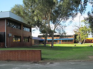
Kiara College
School in Australia
Distance: Approx. 622 meters
Latitude and longitude: -31.877,115.935
Kiara College is an Independent public co-educational high day school, located in the Perth suburb of Kiara, Western Australia
Weather in this IP's area
clear sky
17 Celsius
16 Celsius
15 Celsius
18 Celsius
1025 hPa
52 %
1025 hPa
1022 hPa
10000 meters
4.12 m/s
120 degree
05:43:40
18:23:03