110.170.44.123 - IP Lookup: Free IP Address Lookup, Postal Code Lookup, IP Location Lookup, IP ASN, Public IP
Country:
 Thailand
Region:
City:
Location:
Time Zone:
Postal Code:
ISP:
ASN:
language:
User-Agent:
Proxy IP:
Blacklist:
IP information under different IP Channel
ip-api
Country
Region
City
ASN
Time Zone
ISP
Blacklist
Proxy
Latitude
Longitude
Postal
Route
db-ip
Country
Region
City
ASN
Time Zone
ISP
Blacklist
Proxy
Latitude
Longitude
Postal
Route
IPinfo
Country
Region
City
ASN
Time Zone
ISP
Blacklist
Proxy
Latitude
Longitude
Postal
Route
IP2Location
110.170.44.123Country
thRegion
ranong
City
ranong
Time Zone
Asia/Bangkok
ISP
Language
User-Agent
Latitude
Longitude
Postal
ipdata
Country
Region
City
ASN
Time Zone
ISP
Blacklist
Proxy
Latitude
Longitude
Postal
Route
Popular places and events near this IP address
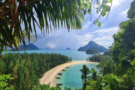
Ranong province
Province in Thailand
Distance: Approx. 152 meters
Latitude and longitude: 9.96694444,98.63555556
Ranong (Thai: ระนอง [rá.nɔ̄ːŋ]. not to be confused with Rayong) is one of Thailand's southern provinces (changwat), on the west coast along the Andaman Sea. It has the fewest inhabitants of all Thai provinces (making it the least populous of all the Thai provinces).

Ranong
Town in Ranong Province, Thailand
Distance: Approx. 621 meters
Latitude and longitude: 9.96194444,98.63888889
Ranong (Thai: ระนอง) is a town (thesaban mueang) in southern Thailand, capital of the Ranong Province and the Mueang Ranong District. The town covers completely the area of the tambon Khao Niwet (เขานิเวศน์). As of 2005, it had a population of 16,163.

Kawthaung
Town in Tanintharyi Region, Myanmar
Distance: Approx. 9500 meters
Latitude and longitude: 9.98333333,98.55
Kawthaung (Burmese: ကော့သောင်း; MLCTS: kau. saung:, pronounced [kɔ̰θáʊ̯ɰ̃]; Mon: ကအ်ပိ; Thai: เกาะสอง; RTGS: Ko Song, pronounced [kɔ̀ʔ sɔ̌ːŋ]; Malay: Pulodua, ڤولودوا) is a border town located in the southernmost part of Myanmar, in the Tanintharyi Region. During British rule in Burma between 1824 and 1948, it was known as Victoria Point.

Mueang Ranong district
District in Ranong, Thailand
Distance: Approx. 187 meters
Latitude and longitude: 9.96722222,98.63388889
Mueang Ranong (Thai: เมืองระนอง) is the capital district (amphoe mueang) of Ranong province, in southern Thailand.

Kraburi River
Thailand-Myanmar boundary river
Distance: Approx. 8430 meters
Latitude and longitude: 10.03333333,98.6
The Kraburi River (Thai: แม่น้ำกระบุรี, RTGS: Maenam Kra Buri, pronounced [mɛ̂ːnáːm kràʔ buriː]; Burmese: မြစ်ကြီးနား, BGN/PCGN: myitkyina, Kyan River), also Kra (Thai: กระ) or Pak Chan River (Thai: แม่น้ำปากจั่น), is the boundary river between Thailand and Myanmar at the Kra Isthmus of the Malay Peninsula. The river has its source in the Tenasserim Hills and flows into the Andaman Sea near the Thai town of Ranong and Kawthaung (Victoria Point), Myanmar. At its mouth, the river is a 6-kilometre (3.7 mi) wide tidal estuary, which contains the largest preserved mangrove forests of Thailand.

Kawthaung Township
Township in Taninthayi Region, Burma
Distance: Approx. 9500 meters
Latitude and longitude: 9.98333333,98.55
Kawthaung Township (Burmese: ကော့သောင်းမြို့နယ်; Thai: เกาะสอง, RTGS: Ko Song; meaning Second Island or Twice Island) is a township of Kawthaung District in the Taninthayi Division of Myanmar. The principal town is Kawthaung. The township covers an area of 2,527 km2, and had a population of 140,020 at the 2014 Census.

Ranong United F.C.
Thai football club
Distance: Approx. 900 meters
Latitude and longitude: 9.959766,98.640265
Ranong United Football Club (Thai: สโมสรฟุตบอลระนอง ยูไนเต็ด) is a Thai professional football club based in Ranong province. The club currently play in Thai League 3. The club changed its name to Ranong United in 2015 following the change of its chairman.

Mu Ko Kam
Island in Ranong, Thailand
Distance: Approx. 187 meters
Latitude and longitude: 9.96722222,98.63388889
Mu Ko Kam (Thai: หมู่เกาะกำ) is a group of Islands in Ranong Province, Thailand.
Weather in this IP's area
overcast clouds
27 Celsius
27 Celsius
27 Celsius
27 Celsius
1014 hPa
63 %
1014 hPa
995 hPa
10000 meters
1.03 m/s
1.43 m/s
30 degree
98 %