109.77.222.69 - IP Lookup: Free IP Address Lookup, Postal Code Lookup, IP Location Lookup, IP ASN, Public IP
Country:
Region:
City:
Location:
Time Zone:
Postal Code:
ISP:
ASN:
language:
User-Agent:
Proxy IP:
Blacklist:
IP information under different IP Channel
ip-api
Country
Region
City
ASN
Time Zone
ISP
Blacklist
Proxy
Latitude
Longitude
Postal
Route
db-ip
Country
Region
City
ASN
Time Zone
ISP
Blacklist
Proxy
Latitude
Longitude
Postal
Route
IPinfo
Country
Region
City
ASN
Time Zone
ISP
Blacklist
Proxy
Latitude
Longitude
Postal
Route
IP2Location
109.77.222.69Country
Region
clare
City
shannon
Time Zone
Europe/Dublin
ISP
Language
User-Agent
Latitude
Longitude
Postal
ipdata
Country
Region
City
ASN
Time Zone
ISP
Blacklist
Proxy
Latitude
Longitude
Postal
Route
Popular places and events near this IP address

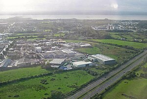
Shannon, County Clare
Town in County Clare, Ireland
Distance: Approx. 1134 meters
Latitude and longitude: 52.713731,-8.868628
Shannon (Irish: Sionainn) or Shannon Town (Baile na Sionnainne), named after the river near which it stands, is a town in County Clare, Ireland. It was given town status on 1 January 1982. The town is located just off the N19 road, a spur of the N18/M18 road between Limerick and Ennis.

Shannon Free Zone
Free Trade Zone in Ireland
Distance: Approx. 2387 meters
Latitude and longitude: 52.70525833,-8.89951111
The Shannon Free Zone is a 2.43 square kilometres (600 acres), international business park adjacent to Shannon Airport, County Clare, in Ireland. It is 18 km from Ennis and 20 km from Limerick. It was established in 1959, as the world's first "modern" free-trade zone.

N19 road (Ireland)
Road in Ireland
Distance: Approx. 1697 meters
Latitude and longitude: 52.71138889,-8.88611111
The N19 road is a national primary road in Ireland, connecting from the N18 Limerick–Ennis–Galway road to Shannon Airport. It forms part of European route E20. The route in its current form consists mostly of a dual-carriageway passing around Shannon Town, which starts at an interchange near Hurlers Cross on the N18 road.

Hurlers Cross
Village in County Clare, Ireland
Distance: Approx. 1847 meters
Latitude and longitude: 52.717,-8.8474
Hurlers Cross (Irish: Crois na hIomána) is a small village in County Clare, Ireland. It is situated close to Shannon Town and 6 km (3.7 mi) from both Sixmilebridge and Newmarket-on-Fergus. It forms a part of Newmarket-on-Fergus parish.
Wolfe Tones na Sionna GAA
Distance: Approx. 266 meters
Latitude and longitude: 52.70373611,-8.86813611
Wolfe Tones is a Gaelic Athletic Association club in Shannon in County Clare, Ireland. The Wolfe Tones na Sionna club was founded in 1967.
Enterprise Ireland
Irish state economic development agency
Distance: Approx. 2089 meters
Latitude and longitude: 52.70935,-8.89383333
Enterprise Ireland is an Irish state economic development agency focused on helping Irish-owned business deliver new export sales.

Bunratty
Village in County Clare, Ireland
Distance: Approx. 2583 meters
Latitude and longitude: 52.708011,-8.826512
Bunratty (Irish: Bun na Raite, meaning "end of the Raite") is a village in County Clare, Ireland, near Bunratty Castle. It is connected by the N18 road to Limerick and Galway. The Raite river defines the parish's eastern boundary and flows into the Shannon Estuary, which defines the southern boundary.

Pan Am Flight 1-10
1948 aviation accident
Distance: Approx. 2692 meters
Latitude and longitude: 52.71607222,-8.89869444
Pan Am Flight 1-10 was a Pan American passenger flight from London to Shannon Airport, part of a flight around the world from San Francisco, California, to New York City. On 15 April 1948, the Lockheed Constellation serving the flight crashed 725 meters (2,379 ft) short of Runway 23 at Shannon. Ten flight crew and 20 passengers died in the crash; 1 passenger survived with minor injuries.
Clonloghan
Civil parish in Munster, Ireland
Distance: Approx. 2085 meters
Latitude and longitude: 52.72,-8.88
Clonloghan (Irish: Cluain Lócháin) is a civil parish of County Clare, Ireland, located 21.7 kilometres (13.5 mi) by road northwest of Limerick, just north of Shannon.

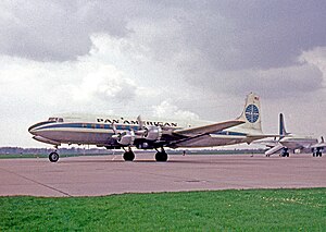
Pan Am Clipper Panama
1959 aviation accident
Distance: Approx. 2692 meters
Latitude and longitude: 52.71607222,-8.89869444
Pan Am Flight Clipper Panama, Douglas DC-6B N5026K, was a cargo flight from Frankfurt to New York City. On 22 June 1959 it caught fire on takeoff and was destroyed. All six flight crew and two passengers survived.

Siege of Bunratty
Part of the Irish Confederate Wars
Distance: Approx. 3560 meters
Latitude and longitude: 52.6996,-8.8119
The siege of Bunratty took place in County Clare in 1646 and was part of the Irish Confederate Wars, the Irish theatre of the Wars of the Three Kingdoms.
Shannon (parish)
Roman Catholic parish in Munster, Ireland
Distance: Approx. 1134 meters
Latitude and longitude: 52.713731,-8.868628
Shannon, officially - but largely unused - St. Senan's Parish, is a parish in County Clare, Ireland, and part of the Tradaree grouping of parishes within the Roman Catholic Diocese of Killaloe. It is a split off of the parish of Newmarket-on-Fergus: 205 As of 2021, the co-parish priest is Arnold Rosney.
Weather in this IP's area
broken clouds
10 Celsius
7 Celsius
10 Celsius
10 Celsius
1026 hPa
81 %
1026 hPa
1021 hPa
10000 meters
7.72 m/s
160 degree
75 %