109.77.196.247 - IP Lookup: Free IP Address Lookup, Postal Code Lookup, IP Location Lookup, IP ASN, Public IP
Country:
Region:
City:
Location:
Time Zone:
Postal Code:
ISP:
ASN:
language:
User-Agent:
Proxy IP:
Blacklist:
IP information under different IP Channel
ip-api
Country
Region
City
ASN
Time Zone
ISP
Blacklist
Proxy
Latitude
Longitude
Postal
Route
db-ip
Country
Region
City
ASN
Time Zone
ISP
Blacklist
Proxy
Latitude
Longitude
Postal
Route
IPinfo
Country
Region
City
ASN
Time Zone
ISP
Blacklist
Proxy
Latitude
Longitude
Postal
Route
IP2Location
109.77.196.247Country
Region
donegal
City
gweedore
Time Zone
Europe/Dublin
ISP
Language
User-Agent
Latitude
Longitude
Postal
ipdata
Country
Region
City
ASN
Time Zone
ISP
Blacklist
Proxy
Latitude
Longitude
Postal
Route
Popular places and events near this IP address

Gweedore
Gaeltacht area in County Donegal, Ireland
Distance: Approx. 159 meters
Latitude and longitude: 55.0516522,-8.2327056
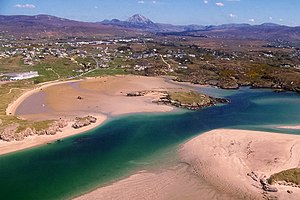
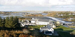
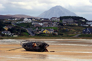
Gweedore ( gwee-DOR; officially known by its Irish language name, Gaoth Dobhair [ˌɡiː ˈd̪ˠoːɾʲ]) is a Gaeltacht (Irish-speaking) district and parish located on the Atlantic coast of County Donegal in the north-west of Ireland. Gweedore stretches some 26 kilometres (16 mi) from Glasserchoo and Bloody Foreland in the north to Crolly in the south and around 14 kilometres (9 mi) from Dunlewey in the east to Magheraclogher and Magheralosk in the west, and is sometimes described as one of Europe's most densely populated rural areas. It is the largest Irish-speaking parish in Ireland with a population of around 4,065, and is also the home of the northwest regional studios of the Irish-language radio service RTÉ Raidió na Gaeltachta, as well as an external campus of the University of Galway.

Amharclann Ghaoth Dobhair
Theatre in County Donegal, Republic of Ireland
Distance: Approx. 4661 meters
Latitude and longitude: 55.07076306,-8.29568806
Amharclann Ghaoth Dobhair (pronounced [ˈəuɾˠklˠən̪ˠ ˌɣiː ˈd̪ˠoːɾʲ]), anglicized as Gweedore Theatre, is a local theatre in the Gaeltacht region of Derrybeg in the parish of Gweedore, County Donegal, Ireland. It seats over 200 patrons, and ever since it was opened by actress Siobhán McKenna, it has staged hundreds of plays in the Irish language. Aisteoirí Ghaoth Dobhair was a group of actors founded in Srath na Corcra, Derrybeg in 1932, and they gained critical acclaim and travelled as far as Glasgow to perform.

Annagry
Village in County Donegal, Ireland
Distance: Approx. 6178 meters
Latitude and longitude: 55.01919,-8.312101
Anagaire (anglicised as Annagry) is a village in The Rosses district of County Donegal, Ireland. As of 2022, the population was 309.

Derrybeg
Townland in County Donegal, Ireland
Distance: Approx. 4927 meters
Latitude and longitude: 55.08333333,-8.28333333
Doirí Beaga (anglicised as Derrybeg, meaning 'small oak trees'), is a Gaeltacht village and townland in the parish of Gweedore (Gaoth Dobhair) in County Donegal, Ireland. It includes a Roman Catholic church, RTÉ Raidió na Gaeltachta regional studios, a Gaelic Athletic Association club and a golf club. According to the 2016 census 53.4% of the population spoke Irish on a daily basis outside the education system.

Bunbeg
Gaeltacht village in County Donegal, Ireland
Distance: Approx. 4515 meters
Latitude and longitude: 55.06083333,-8.30027778
An Bun Beag (anglicised as Bunbeg), meaning "the small river mouth", is a small Gaeltacht village and townland in County Donegal, Ireland. It is officially the smallest townland in Gaoth Dobhair (Gweedore), but today the name Bunbeg is used to describe a large region of the parish. It is situated between Derrybeg and the townland of Dore and is home to many of Gweedore's amenities and businesses.

Ranafast
Gaeltacht village in County Donegal, Ireland
Distance: Approx. 5041 meters
Latitude and longitude: 55.034569,-8.306013
Ranafast or Rinnafarset, officially only known by its Irish name Rann na Feirste (IPA: [ˌɾˠaːn̪ˠ n̪ˠə ˈfʲɛɾˠʃtʲə]), is a Gaeltacht village and townland in the Rosses district in the west of County Donegal in Ulster, the northern province in Ireland.

Leo's Tavern
Pub and music venue in County Donegal, Ireland
Distance: Approx. 3578 meters
Latitude and longitude: 55.027357,-8.271192
Leo's Tavern (Irish: Tábhairne Leo) is a pub in the Donegal Gaeltacht, known as the home of music artists Clannad, Enya and Moya Brennan. It serves food and is a music venue. The pub opened in 1968 and held Irish traditional music sessions nightly, becoming the musical starting block for the children of Leo Brennan, the pub's founder.
CLG Ghaoth Dobhair
Donegal-based Gaelic games club
Distance: Approx. 6110 meters
Latitude and longitude: 55.08249167,-8.309525
CLG Ghaoth Dobhair is a GAA club based in the parish of Gaoth Dobhair (anglicised to Gweedore) in northwest County Donegal, Republic of Ireland. They are one of the strongholds of Gaelic football in County Donegal. Their home ground is at Machaire Gathlán, and (as of January 2024) they share the record for most wins in both the Donegal Senior Football Championship and the Comórtas Peile na Gaeltachta.

Crolly
Gaeltacht village in County Donegal, Ireland
Distance: Approx. 6178 meters
Latitude and longitude: 55.01919,-8.312101
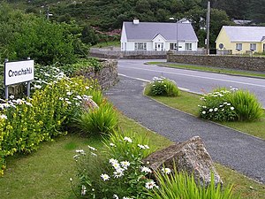
Croithlí or Croichshlí (anglicised as Crolly) is a village in the Gaeltacht parishes and traditional districts of Gweedore (Gaoth Dobhair) and The Rosses (Na Rossan) in the west of County Donegal in Ulster, the northern province in Ireland. The two 'districts' are separated by the Crolly River (also known as the Gweedore River). It has one convenience shop/restaurant and petrol station and one public house, Páidí Óg's.

Lough Nacung Upper
Lake in County Donegal, Ireland
Distance: Approx. 4671 meters
Latitude and longitude: 55.032,-8.166
Lough Nacung Upper (Irish: Loch na Cuinge Uachtarach, meaning 'upper narrowness lake' or 'upper lake of the isthmus'), also known as Upper Lough Nacung, is a lake in Gweedore, a district in the north-west of County Donegal, Ireland. It connects Lough Dunlewey to Lough Nacung Lower, which drains into the Clady River. Lough Nacung is a Special Area of Conservation.

R257 road (Ireland)
Regional road in Ireland
Distance: Approx. 4578 meters
Latitude and longitude: 55.062207,-8.300626
The R257 road is a regional road in Ireland, located in County Donegal. It is a scenic route, skirting around the edge of the Bloody Foreland.

Clady River (Gweedore)
River in County Donegal in Ulster
Distance: Approx. 5397 meters
Latitude and longitude: 55.0579,-8.3155
The Clady River (Irish: An Chláidigh, meaning 'the One Who Washes' or 'the Strong-Flowing One') is a small river in Gweedore (Irish: Gaoth Dobhair), a district in the north-west of County Donegal in Ulster, the northern province in Ireland. The river flows entirely within the Civil Parish of Tullaghobegly (Irish: Tulacha Beigile).
Weather in this IP's area
overcast clouds
6 Celsius
3 Celsius
6 Celsius
6 Celsius
977 hPa
90 %
977 hPa
965 hPa
10000 meters
6.16 m/s
9.82 m/s
24 degree
100 %