109.76.144.95 - IP Lookup: Free IP Address Lookup, Postal Code Lookup, IP Location Lookup, IP ASN, Public IP
Country:
Region:
City:
Location:
Time Zone:
Postal Code:
ISP:
ASN:
language:
User-Agent:
Proxy IP:
Blacklist:
IP information under different IP Channel
ip-api
Country
Region
City
ASN
Time Zone
ISP
Blacklist
Proxy
Latitude
Longitude
Postal
Route
db-ip
Country
Region
City
ASN
Time Zone
ISP
Blacklist
Proxy
Latitude
Longitude
Postal
Route
IPinfo
Country
Region
City
ASN
Time Zone
ISP
Blacklist
Proxy
Latitude
Longitude
Postal
Route
IP2Location
109.76.144.95Country
Region
longford
City
ballymahon
Time Zone
Europe/Dublin
ISP
Language
User-Agent
Latitude
Longitude
Postal
ipdata
Country
Region
City
ASN
Time Zone
ISP
Blacklist
Proxy
Latitude
Longitude
Postal
Route
Popular places and events near this IP address

Tang, County Westmeath
Village in County Westmeath, Ireland
Distance: Approx. 3776 meters
Latitude and longitude: 53.535,-7.787
Tang (Irish: An Teanga, meaning 'the tongue') is a village and a 'half-parish' in County Westmeath, on the N55 national secondary road between Athlone and Ballymahon, County Longford. Tang forms part of the ecclesiastical parish of Drumraney. It is in County Westmeath but on the border with County Longford from which it is separated by the Dungorman River which flows into Lough Ree 3 km downstream via the River Inny.

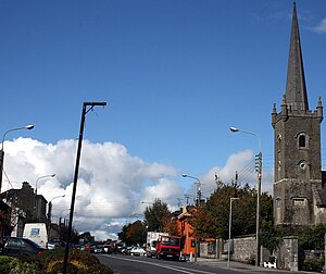
Ballymahon
Town in County Longford, Ireland
Distance: Approx. 4 meters
Latitude and longitude: 53.566667,-7.766667
Ballymahon (Irish: Baile Uí Mhatháin, meaning 'Mahon's town') on the River Inny is a town in the southern part of County Longford, Ireland. It is 19 km north-east of Athlone, at the junction of the N55 and R392 roads.

Abbeyshrule
Town in County Longford, Ireland
Distance: Approx. 7933 meters
Latitude and longitude: 53.583333,-7.65
Abbeyshrule (Irish: Mainistir Shruthla, meaning 'monastery of the river') is a village in south-east County Longford, Ireland, on the River Inny and the Royal Canal. The village is in a civil parish of the same name.

Taghshinny
Village in County Longford, Ireland
Distance: Approx. 5321 meters
Latitude and longitude: 53.59194444,-7.69833333
Taghshinny, also written as Tashinny, (Irish: Teach Sinche, meaning 'house of Sineach') is a village and civil parish in south-east County Longford, Ireland, north-east of Ballymahon. It is also in a townland of the same name. The local Church of Ireland is home to the large "Annaly monument".

Colehill, County Longford
Village and townland in County Longford, Ireland
Distance: Approx. 7933 meters
Latitude and longitude: 53.58333333,-7.65
Colehill (Irish: Cnoc na Góla) is a village and townland in south-east County Longford, Ireland. Its Irish name was historically anglicised as Knocknagoal and Knocknagole. It lies on the R399 regional road.

Keenagh
Village in County Longford, Ireland
Distance: Approx. 7111 meters
Latitude and longitude: 53.623458,-7.816086
Keenagh or Kenagh (Irish: Caonach, meaning 'mossy place') is a village in County Longford, Ireland. 14 km (9 mi) south of Longford town, it is on the R397 near the Royal Canal. The village has two churches (Catholic and Church of Ireland), a couple of shops and three pubs.

Forgney
Distance: Approx. 5126 meters
Latitude and longitude: 53.5456,-7.6978
Forgney (Irish: Forgnaí) is a civil parish and townland in County Longford, Ireland. Evidence of ancient settlement in the area include a number of ringfort and holy well sites in Forgney townland. The townland, which has an area of approximately 3.1 square kilometres (1.2 sq mi), had a population of 77 people as of the 2011 census.
Ballymore GAA
GAA club in Westmeath, Ireland
Distance: Approx. 8319 meters
Latitude and longitude: 53.5,-7.71
Ballymore GAA is a Gaelic Athletic Association club located in the town of Ballymore in County Westmeath, Ireland.
Doory Hall
Historic building in Ireland
Distance: Approx. 3931 meters
Latitude and longitude: 53.5981,-7.7395
Doory Hall is an estate and now-ruined historic building in County Longford, Ireland. While some parts of the estate (including a number of its outbuildings) are included on Longford County Council's Record of Protected Structures, the 19th century manor house itself is now a largely empty "shell". The estate was the home of the Jessop family, for whom the house was extensively remodeled by the architect John Hargrave c. 1820.
Noughaval (civil parish)
Civil parish in Leinster, Ireland
Distance: Approx. 4290 meters
Latitude and longitude: 53.53305556,-7.79833333
Noughaval (Irish: Nuachabháil) is a civil parish which spans the counties of Longford and Westmeath in Ireland. It is located about 30.02 kilometres (19 mi) west of Mullingar and 21.61 kilometres (13 mi) south of Longford.

Dunnamona
Distance: Approx. 7559 meters
Latitude and longitude: 53.499548,-7.783629
Dunnamona is a motte-and-bailey and National Monument in County Westmeath, Ireland.
Kilcommock
Civil parish in County Longford, Ireland
Distance: Approx. 4975 meters
Latitude and longitude: 53.6018,-7.8133
Kilcommock is a civil parish and townland in County Longford, Ireland.
Weather in this IP's area
overcast clouds
8 Celsius
5 Celsius
8 Celsius
8 Celsius
1015 hPa
79 %
1015 hPa
1007 hPa
10000 meters
4.03 m/s
9.22 m/s
154 degree
100 %