Country:
 Sweden
Region:
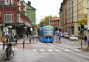
City:
Latitude and Longitude:
Time Zone:
Postal Code:
IP information under different IP Channel
ip-api
Country
Region
City
ASN
Time Zone
ISP
Blacklist
Proxy
Latitude
Longitude
Postal
Route
IPinfo
Country
Region
City
ASN
Time Zone
ISP
Blacklist
Proxy
Latitude
Longitude
Postal
Route
MaxMind
Country
Region
City
ASN
Time Zone
ISP
Blacklist
Proxy
Latitude
Longitude
Postal
Route
Luminati
Country
SERegion
ab
City
stockholm
ASN
Time Zone
Europe/Stockholm
ISP
GleSYS AB
Latitude
Longitude
Postal
db-ip
Country
Region
City
ASN
Time Zone
ISP
Blacklist
Proxy
Latitude
Longitude
Postal
Route
ipdata
Country
Region
City
ASN
Time Zone
ISP
Blacklist
Proxy
Latitude
Longitude
Postal
Route
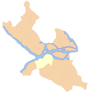
Popular places and events near this IP address
Gröndal
District of southern Stockholm, Sweden
Distance: Approx. 1388 meters
Latitude and longitude: 59.31666667,18
Gröndal (Green Valley) is a district of the Hägersten-Liljeholmen borough in Söderort, the southern suburban part of Stockholm, Sweden. The name Gröndal means Green Dale or Green Valley. Gröndal developed as a working class and industrial suburb after the opening of Liljeholmen freight station in the 1860s.

Axelsberg
Distance: Approx. 673 meters
Latitude and longitude: 59.30416667,17.97527778
Axelsberg (Axelhill) is a district of the Hägersten-Liljeholmen borough in Söderort, the southern suburban part of Stockholm. It is close to the Hägersten industrial area. The district's Metro station was opened in 1965.
Gröndalsbron
Distance: Approx. 1438 meters
Latitude and longitude: 59.31833333,17.99861111
Gröndalsbron (Swedish: The Gröndal bridge) are two bridges in central Stockholm, Sweden, connecting the island Stora Essingen to the southern mainland district Gröndal. The older bridge, inaugurated in 1967, forms a 460-metre section of the Essingeleden motorway, of which 260 metres constitute the bridge, divided into three pre-stressed concrete frames, 70, 120, and 70 metres in length. Due to several ramps connecting to the bridge the width varies from 38 to 45 metres, while the horizontal clearance is 26 metres throughout the entire structure.

Stora Essingen
Island in Sweden
Distance: Approx. 1365 meters
Latitude and longitude: 59.32111111,17.98888889
Stora Essingen is an island and a district in the Kungsholmen borough in Stockholm, Sweden. It is located adjacent to Lilla Essingen on Lake Mälaren. Both Essingen Islands are mainly residential areas.
Hägersten-Liljeholmen
Borough of Stockholm in Stockholm Municipality, Sweden
Distance: Approx. 990 meters
Latitude and longitude: 59.30194444,17.98777778
Hägersten-Liljeholmen is a borough (stadsdelsområde) in Stockholm, Sweden. It is part of the Söderort suburban area. The borough is located in South Stockholm.

Aspudden metro station
Stockholm metro station
Distance: Approx. 1296 meters
Latitude and longitude: 59.30555556,18.00083333
Aspudden metro station is a station on Line 13 in the Stockholm metro, located in the district of Aspudden. The station was opened on 5 April 1964 as part of the first stretch of Metro 2, between T-Centralen and Örnsberg, with a branch to Fruängen.
Axelsberg metro station
Stockholm Metro station
Distance: Approx. 670 meters
Latitude and longitude: 59.3042,17.9753
Axelsberg metro station is a station on the red line of the Stockholm metro, located in Axelsberg in the district of Hägersten. The station was opened on 16 May 1965 as part of the extension from Örnsberg to Sätra. The distance to Slussen is 6.4 km.

Örnsberg metro station
Stockholm Metro station
Distance: Approx. 696 meters
Latitude and longitude: 59.30556,17.98861
Örnsberg metro station is a station on the red line of the Stockholm metro, located in Aspudden in the south part of Stockholm Municipality. The station was opened on 5 April 1964 as the southwest terminus of the first stretch of the Red line, from T-Centralen to Örnsberg, with a branch to Fruängen. On 16 May 1965, the line was extended further southwest to Sätra.
Aspudden
Distance: Approx. 1296 meters
Latitude and longitude: 59.30555556,18.00083333
Aspudden (Aspen cape) is a district of the Hägersten-Liljeholmen borough in Söderort, the southern suburban part of Stockholm. Metro line 13 stops at Aspudden metro station.
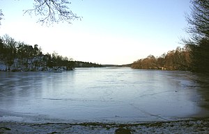
Vinterviken
Bay in southern Stockholm, Sweden
Distance: Approx. 498 meters
Latitude and longitude: 59.31133,17.98783
Vinterviken ("Winter-cove") is a bay in the Mälaren lake in southern Stockholm, Sweden. Vinterviken is located in a valley surrounded by the Gröndal and Aspudden suburb areas.
Hägersten
Urban district in south Stockholm, Sweden
Distance: Approx. 385 meters
Latitude and longitude: 59.30659444,17.98213056
Hägersten (Heronstone) is an urban district of Stockholm. It is located in the borough of Hägersten-Liljeholmen, which was formed 1 January 2007 by merging the former boroughs of Hägersten and Liljeholmen.
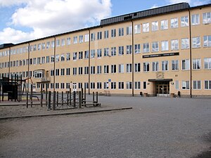
Lycée Français de Stockholm
French international school in Stockholm, Sweden
Distance: Approx. 1295 meters
Latitude and longitude: 59.3209,17.9864
Lycée français Saint-Louis de Stockholm is a French international school in Stockholm, Sweden. It serves levels maternelle through lycée.
Weather in this IP's area
clear sky
13 Celsius
12 Celsius
11 Celsius
14 Celsius
1028 hPa
87 %
1028 hPa
1027 hPa
10000 meters
1.03 m/s
330 degree
06:19:34
19:06:20