Country:
Region:
City:
Latitude and Longitude:
Time Zone:
Postal Code:
IP information under different IP Channel
ip-api
Country
Region
City
ASN
Time Zone
ISP
Blacklist
Proxy
Latitude
Longitude
Postal
Route
Luminati
Country
Region
eng
City
gosport
ASN
Time Zone
Europe/London
ISP
Iomart Cloud Services Limited
Latitude
Longitude
Postal
IPinfo
Country
Region
City
ASN
Time Zone
ISP
Blacklist
Proxy
Latitude
Longitude
Postal
Route
db-ip
Country
Region
City
ASN
Time Zone
ISP
Blacklist
Proxy
Latitude
Longitude
Postal
Route
ipdata
Country
Region
City
ASN
Time Zone
ISP
Blacklist
Proxy
Latitude
Longitude
Postal
Route
Popular places and events near this IP address
Gosport Borough F.C.
Association football club in England
Distance: Approx. 941 meters
Latitude and longitude: 50.794923,-1.156558
Gosport Borough Football Club is a semi-professional football club based in Gosport, Hampshire, England. The club is affiliated to the Hampshire Football Association and is an FA Charter Standard Community Club. They are currently members of the Southern League Premier Division South and play at Privett Park.

Bay House School
Academy school in Gosport, Hampshire, England
Distance: Approx. 1223 meters
Latitude and longitude: 50.78673,-1.16459
Bay House School is a coeducational secondary school and sixth form located in Gosport, Hampshire, England.

Alverstoke
Village and parish in Hampshire, England
Distance: Approx. 984 meters
Latitude and longitude: 50.78,-1.15
Alverstoke is a village in the borough of Gosport, on the south coast of Hampshire, England. It stretches east–west from Fort Blockhouse, Haslar to Browndown Battery, and is centred 0.5 miles (0.80 km) east of the shore of Stokes Bay and near the head of a creek which extends a mile westward from Portsmouth Harbour. Residents of Alverstoke have at times in the 20th century been called 'The Alverstocracy' by some residents of Gosport, in a tongue-in-cheek fashion, due to higher house prices and a perceived higher social status of the area.

Fort Gomer
Distance: Approx. 1258 meters
Latitude and longitude: 50.791,-1.165
Fort Gomer was one of the Palmerston Forts, in Gosport, England, the southernmost and first-built Polygonal fort in the defence line to the west of Gosport. It was located on land immediately to the west of the present Gomer Lane. Fort Gomer was the most southerly fort in the line of five which formed part of the ‘Sea Front and Spithead Defences’, Inner Line, Land Front, Left Flank.

HMS St Vincent (Gosport shore establishment)
Distance: Approx. 1472 meters
Latitude and longitude: 50.7997,-1.1359
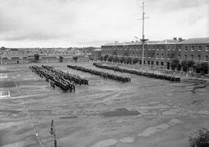
HMS St Vincent was a shore establishment of the Royal Navy, located in Gosport, Hampshire. The name was given to the Forton Barracks site in Gosport in 1927, after the one that been set up aboard the old first rate HMS St Vincent in 1862. The new HMS St Vincent was commissioned on 1 June 1927, originally like its predecessor as a training establishment for boys and juniors.

Gosport and Fareham Inshore Rescue Service
Lifeboat Station in Hampshire, England
Distance: Approx. 1130 meters
Latitude and longitude: 50.77861111,-1.14933333
Gosport Lifeboat Station is a volunteer-operated independent lifeboat station charity located in the village of Alverstoke on the peninsula of Gosport in the English county of Hampshire. Owned and operated by Gosport and Fareham Inshore Rescue Service (GAFIRS), it operates free lifeboat services in the Solent from Portsmouth Harbour to Titchfield Haven, on the approaching shores of Southampton Water. GAFIRS is a charity registered in England and Wales (1159681).

Stokes Bay Lines
Distance: Approx. 679 meters
Latitude and longitude: 50.783443,-1.152397
The Stokes Bay Lines were part of the great Victorian fortification of Portsmouth Harbour under Lord Palmerston. In 1857 Major Jervois had proposed a complex system of moats (ditches), ramparts and batteries to close off the gap between the new fort at Fort Gomer, and the earlier fort at Fort Gilkicker, and Fort Monckton. This defensive moat was to become the ‘Stokes Bay Lines’.

Forton Barracks
Distance: Approx. 1496 meters
Latitude and longitude: 50.8,-1.136
Forton Barracks was a military installation near Gosport in Hampshire, which served first as an Army barracks and then as a divisional headquarters for the Royal Marines. It subsequently served as a Royal Navy training establishment. Today, the site is occupied by St Vincent College.
Fort Gomer Halt railway station
Disused railway station in Gosport, Hampshire
Distance: Approx. 1310 meters
Latitude and longitude: 50.7939,-1.1642
Fort Gomer Halt railway station served the town of Gosport, Hampshire, England from 1894 to 1930 on the Lee-on-the-Solent Railway.

Gosport War Memorial Hospital
NHS hospital in Hampshire, England
Distance: Approx. 492 meters
Latitude and longitude: 50.7931,-1.1481
Gosport War Memorial Hospital is a hospital in Gosport, Hampshire, England, part of the Southern Health NHS Foundation Trust.
Gosport Road and Alverstoke railway station
Disused railway station in Gosport, Hampshire
Distance: Approx. 625 meters
Latitude and longitude: 50.7919,-1.1402
Gosport Road and Alverstoke railway station served the town of Gosport, Hampshire, England, from 1865 to 1915 on the Stokes Bay line.
Stokes Bay railway station
Disused railway station in Gosport, Hampshire
Distance: Approx. 1351 meters
Latitude and longitude: 50.7767,-1.1504
Stokes Bay railway station served the town of Gosport, Hampshire, England, from 1863 to 1915 on the Stokes Bay line.
Weather in this IP's area
overcast clouds
8 Celsius
8 Celsius
7 Celsius
9 Celsius
1026 hPa
70 %
1026 hPa
1025 hPa
10000 meters
0.31 m/s
0.59 m/s
296 degree
100 %
07:12:13
16:24:59