109.71.24.244 - IP Lookup: Free IP Address Lookup, Postal Code Lookup, IP Location Lookup, IP ASN, Public IP
Country:
Region:
City:
Location:
Time Zone:
Postal Code:
IP information under different IP Channel
ip-api
Country
Region
City
ASN
Time Zone
ISP
Blacklist
Proxy
Latitude
Longitude
Postal
Route
Luminati
Country
ASN
Time Zone
Europe/Berlin
ISP
SECURITYSERVICES
Latitude
Longitude
Postal
IPinfo
Country
Region
City
ASN
Time Zone
ISP
Blacklist
Proxy
Latitude
Longitude
Postal
Route
IP2Location
109.71.24.244Country
Region
bayern
City
kasten
Time Zone
Europe/Berlin
ISP
Language
User-Agent
Latitude
Longitude
Postal
db-ip
Country
Region
City
ASN
Time Zone
ISP
Blacklist
Proxy
Latitude
Longitude
Postal
Route
ipdata
Country
Region
City
ASN
Time Zone
ISP
Blacklist
Proxy
Latitude
Longitude
Postal
Route
Popular places and events near this IP address
Miesbach (district)
District in Bavaria, Germany
Distance: Approx. 627 meters
Latitude and longitude: 47.75,11.83
Miesbach (German: [ˈmiːsˌbax] ) is a Landkreis (district) in Bavaria, Germany. It is bounded by (from the west and clockwise) the districts of Bad Tölz-Wolfratshausen, Munich and Rosenheim, and by the Austrian state of Tyrol.

Miesbach
Town in Bavaria, Germany
Distance: Approx. 3101 meters
Latitude and longitude: 47.78333333,11.83333333
Miesbach (German: [ˈmiːsˌbax] ) is a town in Bavaria, Germany, and is the capital of the Miesbach district. The district is at an altitude of 697 metres above sea level. It covers an area of approximately 863.50 km2 of alpine headlands and in 2017 had a population of 11,477.

Schliersee
Municipality in Bavaria, Germany
Distance: Approx. 3592 meters
Latitude and longitude: 47.73333333,11.86666667
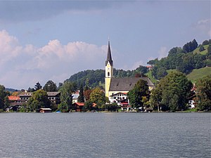
Schliersee is a small town (Markt) and a municipality in the district of Miesbach in Bavaria in Germany. It is named after the nearby Lake Schliersee. It comprises the districts Schliersee (town), Westenhofen, Neuhaus, Fischhausen, Josefsthal and Spitzingsee.

Hausham
Municipality in Bavaria, Germany
Distance: Approx. 1493 meters
Latitude and longitude: 47.75,11.85
Hausham is a municipality in the district of Miesbach in Bavaria in south-eastern Germany.

Schliersee (lake)
Distance: Approx. 4386 meters
Latitude and longitude: 47.72194444,11.8625
Schliersee is a natural lake in Upper Bavaria in the Bavarian Alps. It is located next to the small town of Schliersee in the Miesbach district. The lake has a surface of 2.241 square kilometres (0.865 sq mi) at an elevation of 777 metres (2,549 ft) AMSL, expanding 2.3 kilometres (1.4 mi) by 1.3 kilometres (0.81 mi) maximum.

Baumgartenschneid
Distance: Approx. 5947 meters
Latitude and longitude: 47.70333,11.81472
The Baumgartenschneid is a 1,448 metre high mountain in the Bavarian Prealps above the Tegernsee to the east.

Neureuth (mountain)
Distance: Approx. 5464 meters
Latitude and longitude: 47.73333333,11.76666667
The Neureuth is a 1,261-metre-high (4,137 ft) mountain in the Bavarian Prealps east of Lake Tegernsee in Bavaria, Germany. It is a popular destination for the citizens of Munich. The summit with the much-visited Neureuth Inn can be reached by an easy hike from the town Tegernsee or from the village Gasse (Gmund am Tegernsee).

Dürnbach (Festenbach)
River in Germany
Distance: Approx. 6457 meters
Latitude and longitude: 47.7704,11.7484
Dürnbach is a river of Bavaria, Germany. It is a tributary of the Festenbach.

Festenbach
River in Germany
Distance: Approx. 5003 meters
Latitude and longitude: 47.7764,11.7726
Festenbach is a river of Bavaria, Germany. It flows into the Mangfall near Thalmühl.

Slyrs
Distillery in Germany
Distance: Approx. 7142 meters
Latitude and longitude: 47.7025,11.88555556
Slyrs (German pronunciation: [ˈʃliːɐ̯s]) is a German whisky distillery in Schliersee, a small town in the Oberbayern region of Bavaria. The distillery is controlled by the Stetter family, which also operates a schnapps distillery previously used to distill Slyrs whisky. According to Andrea Stetter, one of Slyrs' managing directors, Slyrs whisky is fundamentally different from Scotch, with "...

Tegernsee station
Railway station in Germany
Distance: Approx. 7235 meters
Latitude and longitude: 47.71416667,11.75722222
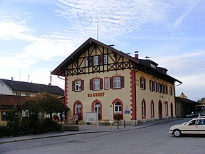
The Tegernsee station (Tegernsee Bf) is the railroad station of the town of Tegernsee in the district of Miesbach, Upper Bavaria. It is the terminus of the railroad line coming from Schaftlach. Tegernsee station was built as part of the extension of the railroad line from Gmund station and was ceremonially opened on May 1, 1902.

Schliersberg
Mountain in Germany
Distance: Approx. 4423 meters
Latitude and longitude: 47.74277778,11.88777778
The Schliersberg (also known as Rhonberg or Rohnberg) is a 1,265-metre-high (4,150 ft) mountain in the Bavarian Prealps above the village Schliersee (Miesbach district, Upper Bavaria) and Lake Schliersee. The wooded summit can be reached within a 1.5 hour hike and passes the hut Schliersbergalm, located 1,055 m above sea level, which can also be reached by a cable car since 1952.
Weather in this IP's area
light snow
-1 Celsius
-4 Celsius
-1 Celsius
-0 Celsius
1026 hPa
95 %
1026 hPa
920 hPa
2078 meters
2.22 m/s
8.24 m/s
255 degree
99 %