109.70.47.30 - IP Lookup: Free IP Address Lookup, Postal Code Lookup, IP Location Lookup, IP ASN, Public IP
Country:
Region:
City:
Location:
Time Zone:
Postal Code:
IP information under different IP Channel
ip-api
Country
Region
City
ASN
Time Zone
ISP
Blacklist
Proxy
Latitude
Longitude
Postal
Route
Luminati
Country
City
peel
ASN
Time Zone
Europe/Isle_of_Man
ISP
Elite Group.im Limited
Latitude
Longitude
Postal
IPinfo
Country
Region
City
ASN
Time Zone
ISP
Blacklist
Proxy
Latitude
Longitude
Postal
Route
IP2Location
109.70.47.30Country
Region
england
City
heywood
Time Zone
Europe/London
ISP
Language
User-Agent
Latitude
Longitude
Postal
db-ip
Country
Region
City
ASN
Time Zone
ISP
Blacklist
Proxy
Latitude
Longitude
Postal
Route
ipdata
Country
Region
City
ASN
Time Zone
ISP
Blacklist
Proxy
Latitude
Longitude
Postal
Route
Popular places and events near this IP address

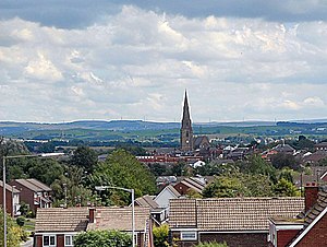
Heywood, Greater Manchester
Town in Greater Manchester, England
Distance: Approx. 268 meters
Latitude and longitude: 53.59,-2.219
Heywood is a town in the Metropolitan Borough of Rochdale, Greater Manchester, England, in the historic county of Lancashire. It had a population of 28,205 at the 2011 Census. The town lies on the south bank of the River Roch, 2 miles (3.2 km) east of Bury, 4 miles (6.4 km) southwest of Rochdale, and 8 miles (12.9 km) north of Manchester.

Heywood railway station
Railway station in England
Distance: Approx. 913 meters
Latitude and longitude: 53.5889,-2.2069
Heywood railway station serves the town of Heywood in Greater Manchester, England. The original station was opened in 1841 (by the Manchester and Leeds Railway). It was resited in 1848 when the line was extended to Bury.

Broadfield railway station
Disused railway station in England
Distance: Approx. 982 meters
Latitude and longitude: 53.58636,-2.23024
Broadfield railway station served the district of Broadfield in Heywood in Greater Manchester, England from 1869 until October 1970, when the station was closed and passenger services between Bolton & Rochdale were withdrawn by British Rail. The line through the station has since been reopened by the heritage East Lancashire Railway, although the station itself remains disused.
Newhouse Academy
Academy in Heywood, Greater Manchester, England
Distance: Approx. 1128 meters
Latitude and longitude: 53.58237,-2.21692
Newhouse Academy is a coeducational secondary school located in Heywood, Greater Manchester, England.

Naden Brook
River in England
Distance: Approx. 1349 meters
Latitude and longitude: 53.60356944,-2.22730556
Naden Brook is a watercourse in northwest England. It rises in the hills above Norden, near the boundary of Lancashire and Greater Manchester. From here it flows south to Heywood, where it merges with the River Roch.

Wrigley Brook
Watercourse in Greater Manchester, England
Distance: Approx. 1058 meters
Latitude and longitude: 53.59840833,-2.23180833
Wrigley Brook is a culverted watercourse in Greater Manchester which flows through Heywood and is a tributary of the River Roch. Originating in the Hareshill area to the South of Heywood, it flows northwards and joins the River Roch at Bottom O' th' Brow.

Hopwood, Greater Manchester
Human settlement in England
Distance: Approx. 1567 meters
Latitude and longitude: 53.582128,-2.203179
Hopwood is a suburb of Heywood, a town within the Metropolitan Borough of Rochdale, in Greater Manchester, England. It is north of the M62 motorway. Hopwood has a primary school and a fire station for the Greater Manchester Fire and Rescue Service.

Millers Brook
River in England
Distance: Approx. 1082 meters
Latitude and longitude: 53.60014167,-2.20949167
Millers Brook is a watercourse in Greater Manchester and tributary of the River Roch. It originates in Heywood and flows through Queens Park to join the River Roch.

Municipal Borough of Heywood
United Kingdom legislation
Distance: Approx. 270 meters
Latitude and longitude: 53.59,-2.22
The Municipal Borough of Heywood was, from 1881 to 1974, a local government district in the administrative county of Lancashire, England, with borough status and coterminate with the town of Heywood.
Tack Lee Brook
Stream in Greater Manchester, England
Distance: Approx. 1394 meters
Latitude and longitude: 53.600975,-2.23476944
Tack Lee Brook is a watercourse in Greater Manchester and a tributary of the River Roch. Birtle Brook is one of its tributaries.
Holy Family Roman Catholic and Church of England College
Voluntary aided school in Greater Manchester, England
Distance: Approx. 693 meters
Latitude and longitude: 53.58646,-2.22253
Holy Family RC & CE College (formerly St Joseph's RC High School) is a coeducational secondary school located in Heywood in the English county of Greater Manchester. It is a voluntary aided school administered by Rochdale Metropolitan Borough Council, the Roman Catholic Diocese of Salford and the Church of England Diocese of Manchester. It was previously known as St Joseph's RC High School serving the Catholic population of the local area, however it became a joint-faith Catholic/Church of England school in 2007 and was renamed Holy Family RC & CE College.
Queen's Park, Rochdale
Public park in Rochdale, England
Distance: Approx. 999 meters
Latitude and longitude: 53.60137,-2.2188
Queen's Park is a public park in Heywood, in the Metropolitan Borough of Rochdale, Greater Manchester, England.
Weather in this IP's area
scattered clouds
8 Celsius
6 Celsius
5 Celsius
9 Celsius
1030 hPa
90 %
1030 hPa
1015 hPa
10000 meters
2.1 m/s
5.14 m/s
221 degree
39 %