Country:
Region:
City:
Latitude and Longitude:
Time Zone:
Postal Code:
IP information under different IP Channel
ip-api
Country
Region
City
ASN
Time Zone
ISP
Blacklist
Proxy
Latitude
Longitude
Postal
Route
Luminati
Country
Region
15
City
quintadoconde
ASN
Time Zone
Europe/Lisbon
ISP
Nos Comunicacoes, S.A.
Latitude
Longitude
Postal
IPinfo
Country
Region
City
ASN
Time Zone
ISP
Blacklist
Proxy
Latitude
Longitude
Postal
Route
db-ip
Country
Region
City
ASN
Time Zone
ISP
Blacklist
Proxy
Latitude
Longitude
Postal
Route
ipdata
Country
Region
City
ASN
Time Zone
ISP
Blacklist
Proxy
Latitude
Longitude
Postal
Route
Popular places and events near this IP address

Setúbal Peninsula
Distance: Approx. 6043 meters
Latitude and longitude: 38.58333333,-9
The Setúbal Peninsula (Portuguese: Península de Setúbal) is a peninsula in the Lisbon Region of Portugal. The peninsula is named after one of its larger cities, Setúbal, and is bordered by three bodies of water, the Atlantic Ocean in the west and southwest, the Tagus Estuary to the north and the Sado Estuary to the southeast. The region can be divided into two different orographic zones: the mountainous southwest, formed by the Arrábida mountain range, cut by valleys and hills, with altitudes between 100 and 500 m (330 and 1,640 ft), and the remaining extensive flat areas, part of the Tagus floodplain.
Azeitão (São Lourenço e São Simão)
Civil parish in Lisbon, Portugal
Distance: Approx. 3864 meters
Latitude and longitude: 38.519,-9.016
Azeitão (São Lourenço e São Simão) is a civil parish in the municipality of Setúbal, Portugal. It was formed in 2013 by the merger of the former parishes São Lourenço and São Simão. The population in 2011 was 18,877, in an area of 69.32 km2.

Super Bock Super Rock
Music festival in Portugal
Distance: Approx. 9203 meters
Latitude and longitude: 38.5139539,-9.1459465
Super Bock Super Rock is a music festival in Portugal that takes place annually since 1995. It is organized by the Portuguese live entertainment company Música no Coração and is named after its main sponsor, the beer brand Super Bock. Over the years, the festival has had various formats, locations and focus on music genres.
Fernão Ferro
Civil parish in Lisbon, Portugal
Distance: Approx. 5467 meters
Latitude and longitude: 38.586,-9.079
Fernão Ferro is a civil parish, in the municipality of Seixal in the district of Setúbal, Portugal. It is part of the Lisbon metropolitan area. The population in 2011 corresponded to 17 059, in an area of 24.13 km².
Aldeia de Paio Pires
Civil parish in Lisbon, Portugal
Distance: Approx. 9614 meters
Latitude and longitude: 38.627,-9.076
Aldeia de Paio Pires is a former civil parish in the municipality (concelho) of Seixal, Lisbon metropolitan area, Portugal. In 2013, the parish merged into the new parish Seixal, Arrentela e Aldeia de Paio Pires. The population in 2011 was 13,258, in an area of 15.96 km².

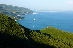
Arrábida Natural Park
Site of community importance in Portugal
Distance: Approx. 8579 meters
Latitude and longitude: 38.48138889,-8.98916667
Arrábida Natural Park (Portuguese: Parque Natural da Arrábida) is a protected area in Portugal. Founded in 1976, the park occupies an area of 176.41 km2 (68.11 sq mi), (123.30 km2 (47.61 sq mi) on land and 53.11 km2 (20.51 sq mi) at sea) covering the southernmost margin of the Setúbal Peninsula. One of the park's unique features is its carbonate geology mountain range, Serra da Arrábida (501 metres (1,644 ft)) which comes into contact with the ocean similarly to some locations in the Mediterranean, contrasting with the usual Portuguese coast (long sand beaches and cliffs) Three of the park's beaches—Galapinhos, Portinho da Arrábida and Figueirinha—are popular among the inhabitants of Lisbon and Setúbal.
Santo António da Charneca
Civil parish in Lisbon, Portugal
Distance: Approx. 9109 meters
Latitude and longitude: 38.624722,-9.033611
Santo António da Charneca is a civil parish in the municipality of Barreiro, Portugal. The population in 2011 was 11,536.

Roman ruins of Creiro
Roman Empire fish-processing factory near Setúbal, Portugal
Distance: Approx. 9247 meters
Latitude and longitude: 38.4815022,-8.9767962
The Roman ruins of Creiro are situated in the Arrábida Natural Park above Creiro Beach in the Setúbal District of Portugal. They are ruins of a fish-salting factory and Roman baths, dating back to the days when the province of Lusitania formed part of the Roman Empire.

Artificial caves of Casal do Pardo
Prehistoric necropolis near Setúbal, Portugal
Distance: Approx. 9735 meters
Latitude and longitude: 38.56416667,-8.93861111
The four Artificial caves of Casal do Pardo (Portuguese: Grutas artificiais do Casal do Pardo), also known as the Caves of Quinta do Anjo, were neolithic tombs. They are situated in Palmela municipality in the Setúbal District, of Portugal, about 25 km (16 mi) south of the capital of Lisbon. These caves were classified as a National Monument of Portugal in 1934.
Weather in this IP's area
scattered clouds
20 Celsius
20 Celsius
19 Celsius
21 Celsius
1018 hPa
77 %
1018 hPa
1013 hPa
10000 meters
0.51 m/s
40 %
07:21:49
17:21:21