Country:
Region:
City:
Latitude and Longitude:
Time Zone:
Postal Code:
IP information under different IP Channel
ip-api
Country
Region
City
ASN
Time Zone
ISP
Blacklist
Proxy
Latitude
Longitude
Postal
Route
Luminati
Country
Region
11
City
odivelas
ASN
Time Zone
Europe/Lisbon
ISP
Nos Comunicacoes, S.A.
Latitude
Longitude
Postal
IPinfo
Country
Region
City
ASN
Time Zone
ISP
Blacklist
Proxy
Latitude
Longitude
Postal
Route
db-ip
Country
Region
City
ASN
Time Zone
ISP
Blacklist
Proxy
Latitude
Longitude
Postal
Route
ipdata
Country
Region
City
ASN
Time Zone
ISP
Blacklist
Proxy
Latitude
Longitude
Postal
Route
Popular places and events near this IP address

Odivelas
Municipality in Lisbon, Portugal
Distance: Approx. 537 meters
Latitude and longitude: 38.79027778,-9.17972222
Odivelas (European Portuguese pronunciation: [ɔðiˈvɛlɐʃ] ) is a city and a municipality in Lisbon metropolitan area, Portugal, in the Lisbon District and the historical and cultural Estremadura Province. The municipality is located 10 km northwest of Lisbon. The present mayor is Hugo Martins, elected by the Socialist Party.
Ramada (Odivelas)
Civil parish in Lisbon, Portugal
Distance: Approx. 1567 meters
Latitude and longitude: 38.804,-9.191
Ramada (Portuguese pronunciation: [ʁɐˈmaðɐ]) is a former civil parish in the municipality of Odivelas, Portugal. In 2013, the parish merged into the new parish Ramada e Caneças. It covers an area of 3.86 km² and had a population of 15,770 as of 2001.
Instituto Nacional de Engenharia, Tecnologia e Inovação
Portuguese research institute
Distance: Approx. 2391 meters
Latitude and longitude: 38.7692954,-9.1815165
The Instituto Nacional de Engenharia, Tecnologia e Inovação (National Institute of Engineering, Technology and Innovation), usually known as INETI for short, was a state-run R&D institution in Lisbon, Portugal, with scientific and technological activities in areas like new systems, processes and products; environmental and sustainable management; geological resources and risks; citizen protection, health and safety; space and defence; laboratory support and testing; etc. In 2007 it was merged into the Laboratório Nacional de Energia e Geologia. The Instituto Nacional de Engenharia, Tecnologia e Inovação (National Institute for Engineering, Technology and Innovation) carries out research, testing and technological development.

Monastery of São Dinis de Odivelas
Building in Lisbon District, Portugal
Distance: Approx. 281 meters
Latitude and longitude: 38.7913451,-9.1828498
The Monastery of Saint Denis (Portuguese: Mosteiro de São Dinis) is located in the city of Odivelas, near Lisbon, in Portugal. The feminine Cistercian convent was founded by King Dinis I and was built during the 14th century in Gothic style. It is the burial place of the king.
Famões
Civil parish in Lisbon, Portugal
Distance: Approx. 2179 meters
Latitude and longitude: 38.79,-9.211
Famões is a former civil parish in the municipality of Odivelas, Portugal. In 2013, the parish merged into the new parish Pontinha e Famões. Administratively, the parish of Famões was de-annexed from the neighboring parish of Odivelas on 25 August 1989, and later elevated to the status of town, on 19 April 2001.
Pontinha (Odivelas)
Civil parish in Lisbon, Portugal
Distance: Approx. 2171 meters
Latitude and longitude: 38.77694444,-9.20388889
Pontinha, with an area of 4.64 km2, is a former civil parish in the municipality of Odivelas, Portugal. In 2013, the parish merged into the new parish Pontinha e Famões. It is on the periphery of the metropolitan area of Lisbon, District of Lisbon, within the NUTS III Region of Lisboa e Vale do Tejo.
Odivelas (parish)
Civil parish in Lisbon, Portugal
Distance: Approx. 515 meters
Latitude and longitude: 38.79,-9.18
Odivelas is a civil parish in the municipality of Odivelas, Portugal. The population in 2011 was 59,546, in an area of 5.04 km².
Ramada e Caneças
Civil parish in Lisbon, Portugal
Distance: Approx. 1567 meters
Latitude and longitude: 38.804,-9.191
Ramada e Caneças is a civil parish in the municipality of Odivelas, Portugal. It was formed in 2013 by the merger of the former parishes Ramada and Caneças. The population in 2011 was 32,581, in an area of 9.66 km2.
Instituto de Odivelas
Distance: Approx. 180 meters
Latitude and longitude: 38.7912702,-9.184071
The Instituto de Odivelas (IO) was a Portuguese military school for young girls, located at Odivelas. It was founded in 1900 and closed in 2015. The last official full name of the school was Instituto de Odivelas (Infante Dom Afonso) (Portuguese for "Institute of Odivelas (Prince Alfonse)").

Senhor Roubado Station
Metro station in Lisbon, Portugal
Distance: Approx. 1396 meters
Latitude and longitude: 38.78555556,-9.17111111
Senhor Roubado station is part of the Yellow Line of the Lisbon Metro.
Ameixoeira Station
Metro station in Lisbon, Portugal
Distance: Approx. 1396 meters
Latitude and longitude: 38.78555556,-9.17111111
Ameixoeira station is part of the Yellow Line of the Lisbon Metro.
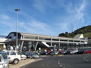
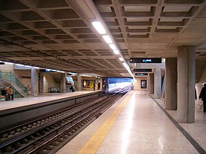
Odivelas Station
Metro station in Lisbon, Portugal
Distance: Approx. 1174 meters
Latitude and longitude: 38.79305556,-9.17277778
Odivelas station is the northern terminus on the Yellow Line of the Lisbon Metro in the Odivelas neighbourhood, north west of central Lisbon.
Weather in this IP's area
few clouds
20 Celsius
20 Celsius
19 Celsius
21 Celsius
1018 hPa
75 %
1018 hPa
1010 hPa
10000 meters
2.57 m/s
20 %
07:22:57
17:21:20

