Country:
 Portugal
Region:
City:
Latitude and Longitude:
Time Zone:
Postal Code:
IP information under different IP Channel
ip-api
Country
Region
City
ASN
Time Zone
ISP
Blacklist
Proxy
Latitude
Longitude
Postal
Route
IPinfo
Country
Region
City
ASN
Time Zone
ISP
Blacklist
Proxy
Latitude
Longitude
Postal
Route
MaxMind
Country
Region
City
ASN
Time Zone
ISP
Blacklist
Proxy
Latitude
Longitude
Postal
Route
Luminati
Country
PTRegion
11
City
lisbon
ASN
Time Zone
Europe/Lisbon
ISP
Nos Comunicacoes, S.A.
Latitude
Longitude
Postal
db-ip
Country
Region
City
ASN
Time Zone
ISP
Blacklist
Proxy
Latitude
Longitude
Postal
Route
ipdata
Country
Region
City
ASN
Time Zone
ISP
Blacklist
Proxy
Latitude
Longitude
Postal
Route
Popular places and events near this IP address
Seixal
Municipality in Lisbon, Portugal
Distance: Approx. 2757 meters
Latitude and longitude: 38.65,-9.1
Seixal (European Portuguese pronunciation: [sɐjˈʃal] ) is a Portuguese city and municipality, located in the district of Setúbal, in the metropolitan area of Lisbon. Its population includes 184,269 inhabitants (2011), in an area of 93.58 square kilometres (36.13 sq mi) that includes six parishes. It is situated across the Tagus River estuary from Lisbon.
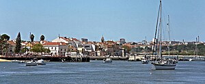
Barreiro, Portugal
Municipality in Lisbon, Portugal
Distance: Approx. 805 meters
Latitude and longitude: 38.66666667,-9.06666667
Barreiro (European Portuguese pronunciation: [bɐˈʁɐjɾu] ) is a city and a municipality in the Setúbal District in Portugal. The population in 2021 was 78,345, in an area of 36.39 km2. Barreiro has a view of the city of Lisbon from Avenida da Praia and a riverside area called Alburrica.
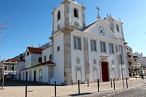
Estádio Dr. Manuel de Mello
Distance: Approx. 333 meters
Latitude and longitude: 38.66315833,-9.0752
Estadio Dr. Manuel de Mello was a multi-use stadium in Barreiro, Portugal. It was used mostly for football matches and was the home stadium of FC Barreirense.
Arrentela
Civil parish in Lisbon, Portugal
Distance: Approx. 4949 meters
Latitude and longitude: 38.627,-9.103
Arrentela is a former civil parish in the municipality (concelho) of Seixal, Lisbon metropolitan area, Portugal. In 2013, the parish merged into the new parish Seixal, Arrentela e Aldeia de Paio Pires. The population in 2011 was 28,886, in an area of 10.17 km².
Aldeia de Paio Pires
Civil parish in Lisbon, Portugal
Distance: Approx. 4353 meters
Latitude and longitude: 38.627,-9.076
Aldeia de Paio Pires is a former civil parish in the municipality (concelho) of Seixal, Lisbon metropolitan area, Portugal. In 2013, the parish merged into the new parish Seixal, Arrentela e Aldeia de Paio Pires. The population in 2011 was 13,258, in an area of 15.96 km².
Seixal (parish)
Civil parish in Lisbon, Portugal
Distance: Approx. 3669 meters
Latitude and longitude: 38.643,-9.106
Seixal is a former civil parish in the municipality (concelho) of Seixal, Lisbon metropolitan area, Portugal. In 2013, the parish merged into the new parish Seixal, Arrentela e Aldeia de Paio Pires. The population in 2011 was 2,776, in an area of 3.73 km2.

Alhos Vedros
Civil parish in Lisbon, Portugal
Distance: Approx. 4824 meters
Latitude and longitude: 38.653,-9.023
Alhos Vedros (pronounced [ˈaʎuʒ ˈvɛðɾuʃ]) is a town and a parish in the municipality of Moita, in Portugal. The population in 2011 was 15,050, in an area of 17.91 km2.
Baixa da Banheira e Vale da Amoreira
Civil parish in Lisbon, Portugal
Distance: Approx. 2770 meters
Latitude and longitude: 38.66,-9.045
Baixa da Banheira e Vale da Amoreira is a civil parish in the municipality of Moita, Portugal. It was formed in 2013 by the merger of the former parishes Baixa da Banheira and Vale da Amoreira. The population in 2011 was 30,949, in an area of 6.42 km2.
Barreiro e Lavradio
Civil parish in Lisbon, Portugal
Distance: Approx. 612 meters
Latitude and longitude: 38.665,-9.069
Barreiro e Lavradio is a civil parish in the municipality of Barreiro, Portugal. It was formed in 2013 by the merger of the former parishes Barreiro and Lavradio. The population in 2011 was 21,877, in an area of 7.74 km2.

Benfica Campus
Distance: Approx. 3167 meters
Latitude and longitude: 38.64055556,-9.09194444
Benfica Campus (formerly Caixa Futebol Campus), also known as centro de estágio e formação do Seixal, is the training ground and youth academy of Portuguese football club Benfica. Having nine pitches (three of synthetic turf), including the main one with 2,644 seats – Benfica B's home ground – the training centre is used by Benfica's first-team, the reserves, and youth levels such as the under-19s. Located in Seixal, Benfica Campus opened on 22 September 2006 and was sponsored by Caixa Geral de Depósitos until September 2019.
Montijo Air Base
Distance: Approx. 5461 meters
Latitude and longitude: 38.70388889,-9.03583333
Montijo Air Base (Portuguese: Base Aérea do Montijo) (ICAO: LPMT) - officially known as Air Base No. 6 (Base Aérea n.º 6) or BA6 - is a military air base located in Montijo, Portugal. The base is home to three transport squadrons and one helicopter search and rescue squadron and provides logistic support to the Portuguese Navy's helicopters based there.
Seixal, Arrentela e Aldeia de Paio Pires
Civil parish in Lisbon, Portugal
Distance: Approx. 3582 meters
Latitude and longitude: 38.64,-9.1
Seixal, Arrentela e Aldeia de Paio Pires is a civil parish in the municipality of Seixal, Portugal. It was formed in 2013 by the merger of the former parishes Seixal, Arrentela and Aldeia de Paio Pires. The population in 2011 was 44,920, in an area of 29.90 km2.
Weather in this IP's area
few clouds
21 Celsius
21 Celsius
20 Celsius
22 Celsius
1019 hPa
77 %
1019 hPa
1019 hPa
10000 meters
6.69 m/s
310 degree
20 %
07:31:23
19:20:50